Neo 2 for Remote Vineyard Surveying: A Technical Review
Neo 2 for Remote Vineyard Surveying: A Technical Review from the Field
META: A practical technical review of using Neo 2 for remote vineyard surveying, covering obstacle avoidance, ActiveTrack, D-Log, QuickShots, Hyperlapse, and handling electromagnetic interference with antenna adjustment.
Remote vineyard work exposes a drone faster than almost any casual flight ever will. Rows compress perspective. Trellises create repetitive visual patterns. Wind moves leaves in a way that can confuse less capable tracking systems. And once you get into upland or isolated growing areas, link quality and electromagnetic interference stop being abstract spec-sheet concerns and start shaping every decision in the air.
That is where the Neo 2 conversation gets interesting.
This is not a generic look at a compact UAV. It is a technical review built around a specific job: surveying vineyards in remote terrain where terrain variation, line structure, and intermittent signal conditions all combine into a demanding workflow. If your goal is to document vine health, row alignment, drainage issues, perimeter condition, and seasonal change without dragging a large airframe into the field, the Neo 2 sits in a useful middle ground. It is small enough to move quickly between blocks, but feature-rich enough to do more than capture pretty footage.
The real question is not whether it flies. Plenty of drones fly well on a calm day. The question is whether its feature set translates into operational value when the site itself is working against you.
Why vineyards expose weak drone workflows
Vineyards seem simple from above until you actually survey one.
The row geometry creates visual monotony, which can complicate automated flight interpretation. Headlands, access roads, irrigation lines, and windbreak trees break that monotony abruptly. In hillside plots, you may be transitioning from open sky to partial canopy edges and back again in a single pass. In remote areas, connectivity can degrade with little warning, especially near utility infrastructure, repeater equipment, or metal installations around pumping and irrigation systems.
A vineyard survey drone therefore needs to do five things well:
- Maintain stable navigation around repeated linear obstacles.
- Preserve image consistency for later review.
- Handle short, efficient flights across multiple blocks.
- Support predictable tracking for visual inspection runs.
- Remain manageable when electromagnetic interference affects the control link.
Neo 2 is at its best when you treat those as one integrated workflow rather than five separate bullet points.
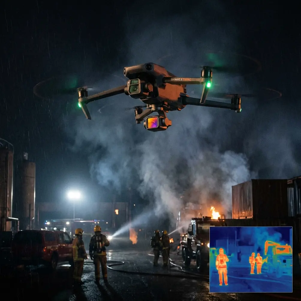
Obstacle avoidance matters more in vineyards than many pilots expect
Obstacle avoidance is often discussed as a safety convenience. In vineyards, it is operationally significant.
A vineyard is full of things that may not look dramatic on a map but become mission-critical at low altitude: trellis ends, poles, netting edges, isolated trees, wires near service lanes, and slope changes that alter your clearance margin row by row. When you are trying to inspect canopy uniformity or erosion channels near the edge of a planted block, you are often flying at heights where reaction time matters.
On the Neo 2, obstacle avoidance earns its value by reducing the workload during slow inspection passes. That does not mean you hand over judgment to the aircraft. It means you gain a buffer that lets you focus on what you are actually there to inspect. In a remote vineyard, that often means checking for irregular growth zones, damaged trellis sections, pooling near irrigation outlets, or gaps in row establishment.
The practical advantage is simple: when the drone can help manage proximity risk, you can fly more deliberate lines. Deliberate lines produce more consistent imagery. Consistent imagery is what makes repeat surveys worth doing.
For growers and consultants who revisit the same parcel across the season, that consistency becomes the difference between “interesting footage” and usable visual evidence.
ActiveTrack and subject tracking are more useful here than they sound
A lot of pilots hear “subject tracking” and think of sports or social media. In vineyard surveying, ActiveTrack-style functionality can be surprisingly useful when the subject is not a person but a moving inspection context.
For example, if a field manager is walking a perimeter, checking damage after weather exposure, the Neo 2’s subject tracking capability can support a moving visual record of the route. That gives you documentation tied to a real inspection path rather than an improvised camera angle. The same applies to tracking a utility vehicle moving slowly along vineyard service roads to create a synchronized overview of row access, washouts, or fence condition.
Operationally, this matters because remote sites reward efficiency. Every time you stop to manually reframe or reset position, you lose battery, momentum, and situational clarity. If ActiveTrack can hold a stable relationship to the subject while you supervise flight path and obstacle environment, you reduce pilot friction without sacrificing oversight.
The caveat is important: vineyards can present repeating textures and partial occlusions. Rows and foliage are visually busy. That means subject tracking should be treated as a tool for controlled scenarios, not an excuse to disengage. The strongest use case is slow, supervised movement in open service lanes or perimeter routes where the subject remains visually distinct.
Used this way, subject tracking is not a novelty. It is a documentation multiplier.
D-Log is not just for filmmakers; it helps technical review
D-Log gets misunderstood because many pilots associate it with cinematic production. In field surveying, its value is more practical.
Vineyards often force difficult lighting. Bright sky. Reflective leaves. Dark soil. Shadow transitions along slope contours. Midday flights can flatten subtle color variation in stressed rows, while early and late flights may exaggerate contrast. Recording in D-Log gives you more latitude when reviewing footage later, especially if your goal is to distinguish canopy irregularities, moisture patterns, or edge-condition issues that standard contrast-heavy profiles may hide.
This is one of the most operationally relevant details on the Neo 2 feature set. D-Log supports better downstream interpretation.
That does not turn the drone into a multispectral tool, and it should not be presented that way. But for visual surveying, especially when comparing one block to another or one week to the next, having footage that preserves highlight and shadow detail can improve your ability to see what changed rather than what the camera baked in.
For consultants building reports, D-Log also creates room to normalize footage from different times of day. That is a small technical advantage with a large real-world payoff. It helps the footage become evidence rather than just media.
QuickShots and Hyperlapse have a place in survey operations
At first glance, QuickShots and Hyperlapse may look like creative extras. In vineyard work, both can serve a legitimate documentation role.
QuickShots can help generate fast, repeatable overview sequences of a block, access road, or processing-adjacent area without spending extra time hand-flying identical reveals. If you are preparing a client update or seasonal visual record, a repeatable automated motion pattern gives you a clean baseline. The point is not style. The point is repeatability.
Hyperlapse has a similarly practical use when documenting changing environmental conditions across a site visit. Cloud movement, fog burn-off, irrigation activity, labor flow, and shifting shadow patterns can all influence how a block is assessed. A compressed time sequence can reveal conditions that a single still or standard video pass misses.
Again, this is where product features either earn their place or stay ornamental. On the Neo 2, these modes matter when they reduce setup time and improve consistency. In a remote vineyard, the best feature is the one that saves battery cycles and helps you return with footage that can actually be compared over time.
Handling electromagnetic interference: antenna adjustment is not optional
This is where many real flights diverge from brochure expectations.
Remote does not always mean clean radio conditions. Vineyards may sit near pumping systems, utility hardware, rural comms infrastructure, electrified fencing, metal-roofed service sheds, or elevated terrain that disrupts signal geometry. Electromagnetic interference can present as inconsistent link quality, unstable live view, delayed response, or abrupt drops in transmission confidence even when the aircraft is not especially far away.
When that happens, the instinct of many newer pilots is to keep staring at the screen and hope the signal recovers. The better response is to adjust the antenna orientation deliberately and immediately.
Antenna adjustment matters because the controller link has directionality. If the antenna faces are poorly aligned with the aircraft, you can create a weak connection even before interference compounds the problem. In practice, this means keeping the controller positioned so the antenna orientation presents properly toward the drone rather than pointing the tips directly at it. Small changes in body position, controller angle, or takeoff stance can produce noticeable improvements.
In vineyard terrain, the significance is even greater. Rows and elevation shifts can tempt a pilot to move while looking down, which often degrades antenna alignment without the pilot realizing it. Add a nearby pump station or metal structure, and what looked like a range issue may actually be an interference-and-orientation issue.
With the Neo 2, disciplined antenna management should be part of preflight and inflight habit, not a rescue tactic.
A practical sequence looks like this:
- Choose a launch point with a clear sky view over the block you intend to inspect.
- Avoid standing next to metal fencing, vehicles, or electrical cabinets.
- Set antenna orientation before takeoff rather than after the signal weakens.
- If image transmission degrades, stop climbing or pushing farther out and correct the controller position first.
- Reestablish the cleanest possible line before resuming the route.
This sounds basic. In the field, it is often the difference between a calm survey and a compromised one.
If you need a second opinion on a difficult setup, I’d suggest sharing the site conditions through this quick field support channel: https://wa.me/85255379740
Flight style matters more than maximum ambition
One of the strengths of a compact aircraft like Neo 2 is how quickly it can move from one block to another. That same convenience can tempt pilots into flying too reactively. In vineyard surveying, slower and more structured usually wins.
The best Neo 2 flights I have seen in agricultural environments are built around short missions with a narrow objective:
- one pass for row uniformity
- one pass for perimeter integrity
- one orbit or overview for drainage context
- one tracking sequence for a ground inspection route
That modular approach is more useful than trying to capture everything in one battery. It also plays well with obstacle avoidance and tracking systems, since each flight can be set up around a single visual task.
This matters because remote surveying often involves travel time, changing weather, and limited opportunities to redo a pass. You want a workflow that survives imperfect conditions. The Neo 2 supports that best when you use its modes selectively and with intent.
Who should use Neo 2 for vineyard surveying
Neo 2 makes the most sense for operators who need agile visual documentation rather than heavy geospatial payload workflows. Estate managers, agronomy consultants, irrigation specialists, vineyard operations teams, and content-conscious producers can all benefit from a drone that blends portability with smart capture modes.
Its strongest fit is recurring visual survey work where obstacle avoidance, subject tracking, D-Log, QuickShots, Hyperlapse, and ActiveTrack are not isolated gimmicks but part of a repeatable field method.
That combination is especially relevant in remote vineyards because the environment punishes sloppy operation. Feature depth helps, but only when it reduces pilot workload and improves consistency under real conditions.
Final assessment
Neo 2 is not interesting because it can do a little bit of everything. It is interesting because, in remote vineyard surveying, several of its capabilities connect in ways that solve actual field problems.
Obstacle avoidance helps maintain safer low-altitude inspection passes around trellises and service-lane obstacles. ActiveTrack and subject tracking can support moving perimeter or ground-follow inspection records when used carefully. D-Log preserves visual information that is genuinely helpful during later review. QuickShots and Hyperlapse can create repeatable documentation sequences instead of one-off footage. And when electromagnetic interference appears, antenna adjustment becomes a critical skill that can stabilize the mission before it turns into a link-management problem.
That is the real story with Neo 2 in this setting. Not hype. Not abstract specs. Just a compact UAV whose practical features align surprisingly well with the messy realities of vineyard work far from ideal conditions.
Ready for your own Neo 2? Contact our team for expert consultation.