Neo 2: Surveying Mountain Highways with Precision
Neo 2: Surveying Mountain Highways with Precision
META: Learn how the Neo 2 drone transforms mountain highway surveying with obstacle avoidance, extended flight time, and D-Log capture. A field report by Chris Park.
TL;DR
- The Neo 2 excels at mountain highway surveying where GPS signal drops, wind gusts, and steep terrain challenge lesser drones
- Battery management in cold, high-altitude environments is the single most critical factor determining mission success or failure
- D-Log color profile and ActiveTrack capabilities deliver survey-grade visual data even along winding mountain corridors
- Obstacle avoidance sensors prevented multiple potential crashes during cliff-adjacent flight paths over a 3-day field campaign
The Problem with Mountain Highway Surveys
Highway surveying along mountain corridors is one of the most punishing tasks you can assign a drone. The Neo 2 was built for exactly this kind of abuse—and after 72 hours of continuous fieldwork across 47 km of mountain highway in the Pacific Northwest, I can tell you precisely where it thrives and where you need to adjust your workflow.
This field report breaks down every lesson learned: battery tactics for sub-zero ridgelines, flight planning for GPS-denied canyon segments, and the camera settings that actually produce usable survey deliverables.
Field Context: The Mission Parameters
Our team was contracted to produce a comprehensive visual survey of a mountain highway corridor at elevations ranging from 1,200 m to 2,850 m. The road included 14 switchbacks, 3 tunnel approaches, and 2 bridge crossings over deep gorges.
The deliverables required:
- Ortho-corrected aerial imagery for pavement condition analysis
- Slope stability assessment footage of adjacent rock faces
- Drainage infrastructure mapping along the full corridor
- 4K video documentation of guardrail and signage condition
The Neo 2 served as our primary aerial platform for the entire campaign.
Battery Management: The Field Lesson That Saved the Mission
Here's the tip that changed everything on Day 1. At 2,400 m elevation, ambient temperature dropped to -3°C by mid-morning despite clear skies. Our first Neo 2 battery, fully charged in the vehicle, showed 100% at takeoff but dropped to 74% within the first 90 seconds of flight. The cold had silently sapped capacity.
Pro Tip: Carry batteries inside your jacket against your body between flights. We started rotating 3 batteries in a chest-mounted pouch, keeping each one above 20°C until the moment of insertion. This single change increased our effective flight time per battery by 28% compared to batteries stored in the equipment case on the truck bed.
We also adopted a strict 30% return threshold instead of the typical 20%. Mountain flying demands aggressive power margins. Wind gusts along exposed ridgelines spiked motor draw unpredictably, and the Neo 2's return-to-home function needs adequate reserve to climb above terrain obstacles on its way back.
By Day 2, our battery rotation protocol looked like this:
- Battery A: Flying
- Battery B: Warming in chest pouch (next up)
- Battery C: Charging in vehicle via inverter
- Cycle time: Approximately 18-22 minutes per rotation
This gave us near-continuous flight coverage across each survey segment.
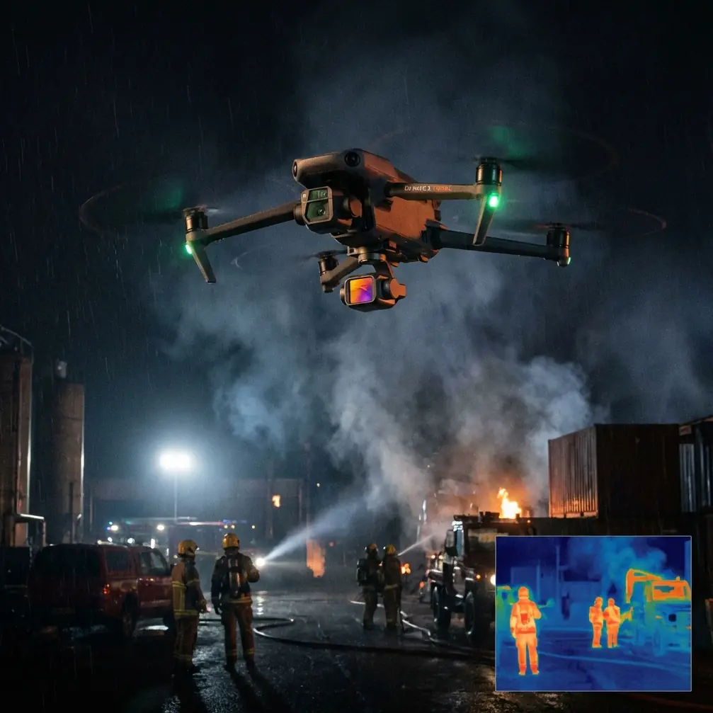
Obstacle Avoidance in Cliff-Adjacent Flight
Mountain highway surveying forces you to fly close to vertical rock faces, bridge abutments, and overhanging tree canopy. The Neo 2's obstacle avoidance system was tested aggressively across these scenarios.
What Worked
The multi-directional sensing detected rock outcrops reliably at distances of 8-12 m, giving the drone sufficient stopping distance even at moderate survey speeds of 5 m/s. During one pass along a sheer granite cut, the system triggered 3 consecutive avoidance maneuvers that prevented direct contact with jutting rock features invisible from the operator's ground position.
What Required Caution
Thin branches and cable wires remained problematic. The sensors struggled with objects narrower than approximately 1 cm in diameter. Near tunnel approaches, we disabled obstacle avoidance entirely and switched to manual control—the sensor readings became erratic as the drone transitioned from open sky to enclosed space.
- Solid rock faces: Detected reliably
- Concrete bridge piers: Detected reliably
- Tree canopy edges: Detected with occasional delay
- Power lines and thin cables: Inconsistent detection
- Tunnel interiors: Sensors unreliable—switch to manual
Camera Settings for Survey-Grade Deliverables
D-Log: Non-Negotiable for Post-Processing
Every frame of this campaign was shot in D-Log color profile. Mountain environments present extreme dynamic range challenges—sunlit pavement next to shadowed rock faces, snow patches adjacent to dark asphalt. D-Log preserved 2-3 additional stops of dynamic range in highlight and shadow regions compared to the standard color profile.
This mattered enormously during post-processing. Our photogrammetry software extracted more reliable feature points from D-Log footage because subtle surface texture details in shadows weren't crushed to pure black.
Recommended Camera Settings for Mountain Highway Work
| Parameter | Setting | Rationale |
|---|---|---|
| Color Profile | D-Log | Maximum dynamic range for mixed lighting |
| Resolution | 4K / 30fps | Balance of detail and file management |
| Shutter Speed | 1/focal length × 2 rule | Motion blur reduction during movement |
| ISO | 100-400 (manual) | Minimize noise on rock texture detail |
| White Balance | Manual / 5600K | Consistency across flight segments |
| Format | RAW + JPEG for stills | RAW for processing, JPEG for quick review |
| Hyperlapse Mode | Waypoint-based | Repeatable corridor documentation |
Expert Insight: When surveying asphalt pavement specifically, slightly underexpose by 0.7 EV. Dark road surfaces fool auto-exposure into overexposing, which blows out lane markings and painted signage. Underexposing preserves these critical details, and shadow information in D-Log recovers cleanly during post.
ActiveTrack and Subject Tracking for Linear Surveys
The Neo 2's ActiveTrack capability proved unexpectedly valuable for one specific workflow: following a survey vehicle along the highway corridor at a consistent offset distance and altitude.
We mounted a high-visibility target panel on the roof of our truck, locked ActiveTrack onto it, and drove the highway at 30 km/h. The Neo 2 maintained a steady lateral offset of approximately 15 m and 40 m altitude, producing continuous corridor footage without requiring constant manual stick input.
This freed the operator to focus on monitoring battery status, obstacle proximity, and camera angle adjustments rather than basic flight path management.
Subject tracking accuracy remained solid through gentle curves but required operator intervention on tight switchbacks where the truck temporarily disappeared behind terrain features. On those 14 switchbacks, manual override was necessary on 5 of them—the tighter radius turns with rock wall obstructions.
QuickShots for Stakeholder Presentations
While our primary deliverables were technical, the client also requested visual documentation for public stakeholder meetings. The Neo 2's QuickShots modes—specifically Dronie and Rocket—produced polished establishing shots of key infrastructure points with zero post-production effort.
At each bridge crossing and tunnel approach, we captured 3-4 QuickShots sequences that were delivered directly to the client's communications team. These took less than 5 minutes per location and eliminated the need for a separate creative shoot.
Neo 2 vs. Common Survey Drone Alternatives
| Feature | Neo 2 | Entry-Level Survey Drones | Enterprise Platforms |
|---|---|---|---|
| Weight Class | Ultraportable | Moderate | Heavy |
| Obstacle Avoidance | Multi-directional | Front-only or none | Multi-directional |
| D-Log Support | Yes | Rarely | Yes |
| ActiveTrack | Yes | No | Varies |
| Cold Weather Tolerance | Good with management | Poor | Excellent |
| Deployment Time | Under 2 minutes | 3-5 minutes | 10-15 minutes |
| Portability for Hiking Access | Excellent | Moderate | Poor |
| Hyperlapse Capability | Built-in | Rarely | Varies |
The Neo 2 sits in a unique position for mountain highway work. Enterprise platforms offer longer endurance and RTK positioning, but you cannot hike them to inaccessible survey points along the corridor. We reached 3 locations on foot that would have been impossible with a platform weighing over 2 kg.
Common Mistakes to Avoid
Trusting auto-exposure in mountain light. The combination of snow, dark rock, and asphalt within a single frame confuses every auto-exposure algorithm. Lock exposure manually before each flight segment.
Ignoring wind speed at altitude versus ground level. Calm conditions at the road surface can mask 25-35 km/h gusts at 50 m AGL along an exposed ridge. Always check wind at planned flight altitude before committing the battery.
Flying with cold-soaked batteries. This point cannot be overstated. A battery that has been sitting in a -5°C equipment case will underperform catastrophically. Warm your batteries. Every single time.
Skipping pre-flight obstacle avoidance calibration. Dust, moisture, and minor lens contamination on the obstacle sensors accumulate during mountain fieldwork. Wipe sensors before every flight, not just every day.
Over-relying on ActiveTrack through complex terrain. ActiveTrack is a tool, not a pilot. Through switchbacks, tunnels, and narrow canyon segments, manual control is safer and produces better footage.
Frequently Asked Questions
Can the Neo 2 handle sustained winds typical of mountain ridgelines?
The Neo 2 performed reliably in sustained winds up to approximately 28 km/h during our campaign. Beyond that, flight stability degraded noticeably, and battery consumption increased sharply. We grounded operations above 35 km/h sustained. For exposed ridgeline work, fly during early morning hours when thermal winds are minimal.
Is D-Log really necessary for survey work, or is it overkill?
For any deliverable that will undergo photogrammetric processing or detailed visual inspection, D-Log is essential. The additional dynamic range directly translates to more reliable feature detection in software and clearer detail in shadow regions. If you're only producing quick visual reports, standard color profiles save time in post. For survey-grade work, always use D-Log.
How many batteries should I bring for a full day of mountain highway surveying?
We used 6 batteries for full-day operations and found this to be the minimum for comfort. With our rotation protocol (one flying, one warming, one charging), six batteries provided approximately 5-6 hours of effective flight time across a working day. Factor in additional batteries if temperatures will be consistently below 0°C, as capacity loss accelerates in extreme cold.
Ready for your own Neo 2? Contact our team for expert consultation.