Neo 2 for High-Altitude Wildlife Scouting
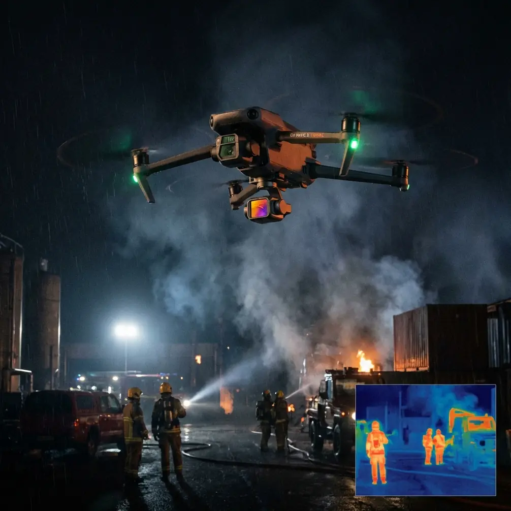
Neo 2 for High-Altitude Wildlife Scouting: What Actually Matters in the Mapping Workflow
META: Expert technical review of Neo 2 for high-altitude wildlife scouting, with practical flight altitude guidance and a deeper look at 3D reconstruction, subject tracking, obstacle awareness, and downstream modeling workflows.
High-altitude wildlife scouting sounds simple until you try to turn a flight into something usable. A few clean clips are easy. Reliable situational awareness is not. The real challenge is collecting imagery that helps you understand terrain, animal movement corridors, and access constraints without creating a messy downstream workflow.
That is where Neo 2 becomes interesting.
Most drone reviews stop at flight feel, camera modes, or a list of intelligent features. For wildlife scouting in elevated terrain, that misses the point. The aircraft is only one part of the chain. The value comes from what happens after the mission: whether your imagery can move cleanly into a serious reconstruction and planning environment, whether your chosen flight altitude preserves enough detail for interpretation, and whether the platform’s automation helps you observe without repeatedly repositioning in thin-air conditions.
This is a technical review built around that operational reality.
The first decision is not camera mode. It is flight altitude.
When scouting wildlife at high altitude, the optimal flight height is rarely “as low as possible.” That instinct often works against you. In mountainous habitat, lower passes can compress your field of view, force more aggressive stick inputs, and increase the odds of terrain conflicts near ridgelines, trees, or uneven rock faces. They can also disturb animals more than a slightly higher, more stable observation pattern.
For Neo 2, the smarter starting point is a moderate observational altitude that gives you three things at once:
- enough scene coverage to read movement patterns across slopes and gullies,
- enough separation from terrain for obstacle avoidance to remain useful,
- enough image overlap if you plan to reconstruct the area later.
In practice, that means treating altitude as a data-collection variable, not just a safety buffer.
If your goal is wildlife scouting rather than cinematic proximity, climb until the scene begins to read as habitat rather than isolated subjects. At that height, subject tracking and ActiveTrack-style follow behavior become less about dramatic footage and more about maintaining visual continuity as an animal line or herd crosses broken terrain. You are not chasing. You are documenting movement in context.
That distinction matters.
Neo 2’s feature set makes more sense when you think like a surveyor, not a hobby pilot
The common marketing language around obstacle avoidance, QuickShots, Hyperlapse, D-Log, and subject tracking tends to frame them as convenience features. In high-altitude wildlife work, they are better understood as tools that influence data quality.
Obstacle avoidance is not just crash prevention
In upland environments, obstacle avoidance earns its keep less from avoiding obvious large objects and more from reducing pilot workload near irregular topography. Rock outcrops, sparse tree clusters, and sudden slope transitions can create moments where manual line management becomes distracting. If Neo 2 can shoulder part of that awareness burden, the pilot can spend more attention on behavior, spacing, and image continuity.
That is especially useful when you are maintaining a parallel observation line over a ridge shoulder. A platform that can help preserve a safer buffer lets you hold a steadier track, which tends to improve overlap and consistency in the captured imagery.
Steadier imagery matters downstream, because reconstruction software is unforgiving when your capture pattern becomes erratic.
Subject tracking has a legitimate conservation workflow use
Wildlife scouting often requires repeated visual reacquisition. Animals disappear into scrub, emerge on snow breaks, or split around terrain features. Subject tracking is valuable here, not because it replaces pilot judgment, but because it reduces the frequency of abrupt framing corrections.
A stable track across a hillside gives you stronger contextual footage for later review. It also helps when comparing movement behavior with terrain models. If you later generate a 3D scene, being able to relate observed paths to ridges, drainage cuts, or vegetation edges is far more useful than having a set of disconnected close-up clips.
QuickShots and Hyperlapse are not gimmicks if used selectively
For wildlife scouting, QuickShots are rarely the primary mode. But a controlled automated path can be useful for brief terrain context captures before or after the main observation segment. The point is not style. It is repeatability.
Hyperlapse can also serve a practical role if you are documenting changing environmental conditions such as cloud movement over grazing ground or long-range activity near a migration route. Used carefully, it can reveal pattern shifts that are easy to miss in real time.
D-Log has value beyond “grading flexibility”
D-Log matters because mountain light is harsh and inconsistent. Snow patches, pale rock, dark timber, and cloud shadow can all exist in the same frame. A flatter capture profile helps preserve highlight and shadow information that may later assist interpretation.
If you are trying to distinguish animals against broken terrain, or understand how they are using sheltered versus exposed ground, retaining tonal detail is not just an editor’s concern. It can support analysis.
Why the post-flight software chain should influence how you fly Neo 2
This is where the reference material becomes genuinely useful.
One of the strongest points in the source is the contrast between software ecosystems. Bentley is described as deeply focused on engineering and construction, with MicroStation serving as a unified platform that handles both 2D and 3D well. The key operational detail is not branding. It is the idea of one platform and one data architecture, rather than fragmenting work between incompatible formats.
That has direct relevance for Neo 2 users doing serious wildlife scouting in difficult terrain.
If your mission goes beyond visual spotting and into habitat documentation, route planning, land management coordination, or environmental reporting, your imagery may need to enter a broader geospatial and engineering workflow. In that setting, Bentley’s integrated environment matters because reconstruction output is more useful when it can move into a stable 2D/3D framework without format friction.
The source also notes that Bentley reportedly integrated more than 300 software products around MicroStation. Whether you use only a small slice of that universe is beside the point. The operational significance is that the ecosystem was built to absorb specialized tools rather than leave users juggling disconnected applications.
For a Neo 2 operator, that changes capture priorities. You should not fly only for what looks good on-screen. You should fly for what reconstructs well and transfers cleanly.
ContextCapture and oblique wildlife terrain documentation
Another important detail from the reference is the explanation of how the StreetFactory subsystem from INFOTERRA’s Pixel Factory processes oblique imagery: geometric processing, multi-view matching, triangulation, extraction of texture features from typical objects, and visualization to produce a 3D model.
That sequence is highly relevant to high-altitude wildlife scouting because oblique imagery often tells you more than straight-down views in mountainous terrain.
A nadir-style top-down pass can document broad land cover. Oblique imagery, by contrast, helps reveal slope faces, ledges, tree lines, erosion cuts, and sheltered benches where wildlife may bed down or move under cover. When software performs multi-view matching and triangulation on that kind of imagery, the result is not just a prettier model. It can become a far better terrain interpretation tool.
For Neo 2 pilots, the lesson is straightforward: include deliberate oblique passes when the site allows it. A clean set of angled observations around a ridge basin or valley shoulder can dramatically improve model usefulness later.
This is also where a stable altitude strategy pays off. If your oblique passes vary wildly in distance and angle because you are improvising too close to terrain, software has a harder job. If you maintain consistent spacing, the reconstruction process becomes more reliable.
What PhotoScan teaches us about control, accuracy, and when “good enough” is not enough
The reference also calls out PhotoScan, now widely known in professional photogrammetry circles for image-based reconstruction, and includes one especially practical number: with control points, it can produce a true orthomosaic with accuracy reaching 5 cm.
That figure should reset expectations for Neo 2 users.
If your wildlife scouting mission eventually feeds into habitat mapping, boundary interpretation, or repeatable environmental monitoring, image capture discipline matters. Software can do impressive work from arbitrary photos, and the source specifically notes that PhotoScan does not require initial values or camera calibration to get started. That flexibility is a gift in the field. It means not every capture has to look like a textbook survey mission to become useful.
But the same source also makes clear that control points are what elevate a model into a real coordinate framework. In other words, “I can build a 3D scene from these images” is not the same as “I can trust this scene for accurate spatial decisions.”
For high-altitude wildlife scouting, that creates a two-tier workflow:
Rapid reconnaissance with Neo 2
Use the aircraft for efficient visual scouting, broad terrain reading, and behavioral observation.Structured capture for mapping-grade output
When an area proves important, return with a more systematic flight pattern and, where appropriate, control points for better geospatial reliability.
That separation keeps expectations realistic. Neo 2 can be excellent for the first tier and still contribute strongly to the second, provided the pilot captures overlap, angle diversity, and stable image sequences.
A practical altitude strategy for Neo 2 in wildlife country
Here is the approach I would use.
Start high enough to understand terrain logic
Your first pass should prioritize topographic comprehension. From a higher and safer observational level, identify ridgelines, travel corridors, exposed feeding zones, and covered approach routes. This broad read helps prevent random low-level wandering later.
Drop only when lower altitude adds interpretive value
Come down selectively when you need to confirm species presence, count individuals more reliably, or inspect how animals are using a specific slope break or vegetation patch. Lower altitude should answer a question, not satisfy curiosity.
Build one oblique loop for reconstruction
If the location appears operationally significant, fly a measured oblique arc or loop while maintaining steady spacing. This gives reconstruction software the multi-angle material it needs to build a useful terrain model.
Use tracking sparingly and deliberately
ActiveTrack or similar subject tracking is most valuable once you have already established a safe offset and a clear escape path. In steep terrain, the right use case is continuity of observation, not aggressive following.
Reserve QuickShots for context, not drama
A short automated orbit or pull-away can be valuable as a terrain reference segment. Keep it controlled and brief.
Capture in D-Log when light is difficult
If contrast is high, preserve tonal range first and decide later how to render the footage.
The hidden advantage of unified downstream formats
One of the overlooked source details is the discussion of file consistency in Bentley’s world, where 2D and 3D workflows stay centered on the same environment rather than breaking into separate format silos.
For teams involved in conservation planning, habitat restoration, access-route review, or ecological reporting, that consistency is not academic. It affects handoff speed, annotation, revision tracking, and whether aerial data actually gets used by decision-makers outside the drone team.
A Neo 2 flight that produces attractive footage but never enters the planning workflow has limited value. A Neo 2 flight that supports a terrain model, orthographic products, and engineering-friendly integration can become part of a serious land-use record.
That is the bigger story here. The aircraft is the front end. The real usefulness comes from matching field capture to the software architecture waiting on the back end.
When to ask for workflow advice before you fly
If you are planning wildlife scouting in high terrain and expect the imagery to feed into mapping, habitat documentation, or 3D environmental review, it is worth sorting the workflow before the mission day. Questions about overlap, oblique coverage, export compatibility, and modeling targets are much easier to solve in advance. If you need a practical pre-flight workflow discussion, you can message here for field-oriented guidance.
Final take on Neo 2 for this scenario
Neo 2 makes the most sense in high-altitude wildlife scouting when you stop treating it as a flying camera and start treating it as the capture node in a geospatial workflow.
Its obstacle awareness reduces pilot strain around irregular terrain. Subject tracking can preserve observation continuity. D-Log helps in punishing mountain light. QuickShots and Hyperlapse have niche but real documentation uses. None of that is the whole story.
The more consequential point comes from the reference material: good airborne collection becomes far more valuable when it can flow into mature reconstruction platforms and unified 2D/3D environments. The mention of Bentley’s integrated MicroStation ecosystem, the reported scale of its software integration with more than 300 tools, the role of ContextCapture in oblique-model generation, and PhotoScan’s ability to reach 5 cm accuracy with control points all point to the same lesson.
Flight technique should be designed backward from the output you need.
For wildlife scouting in high-altitude terrain, the optimal Neo 2 altitude is the one that preserves habitat context, minimizes disturbance, supports safe obstacle separation, and captures imagery consistent enough to reconstruct later. That usually means beginning higher than instinct suggests, then descending only when lower altitude adds real analytical value.
That is how you turn a scouting flight into something worth keeping.
Ready for your own Neo 2? Contact our team for expert consultation.