Neo 2 for Urban Power Line Scouting: A Technical Review
Neo 2 for Urban Power Line Scouting: A Technical Review from the Field
META: A technical review of Neo 2 for urban power line scouting, covering obstacle avoidance, ActiveTrack, D-Log workflows, EMI handling, antenna adjustment, and practical flight planning.
Urban power line scouting sits in an awkward space for small drones. The job looks simple until you actually do it. Tight streets. Reflective glass. Patchy GNSS. Repeating steel structures. Trees grown into easements. Intersections full of traffic signals, utility poles, and telecom clutter. Add electromagnetic interference around energized lines and substations, and a lightweight aircraft either earns its keep or exposes its limits immediately.
That is the right lens for judging the Neo 2.
This is not a broad beginner’s overview. It is a technical review built around one scenario: scouting power lines in an urban environment, where the aircraft has to stay controlled near interference sources, recover clean footage for later review, and keep enough automation to reduce pilot workload without creating false confidence.
Why the Neo 2 format makes sense for this job
For urban utility scouting, the first operational question is rarely image quality alone. It is deployment speed. A crew may need to launch from a sidewalk corner, a parking bay, or the edge of a service road, then reposition multiple times over a short route. In that kind of stop-start workflow, a compact platform has an advantage if it can still hold its line around obstacles and maintain a dependable control link.
That is where the Neo 2 concept becomes useful. Its value is not that it replaces larger inspection aircraft. It does not. The value is that it can cover pre-inspection reconnaissance quickly: identifying vegetation encroachment, checking pole-top access conditions, spotting damaged insulators from a safe stand-off when possible, and documenting corridor context before a heavier inspection package is sent in.
The practical gain is time. A small drone that can be launched in seconds changes how often crews are willing to scout a section before committing trucks and personnel.
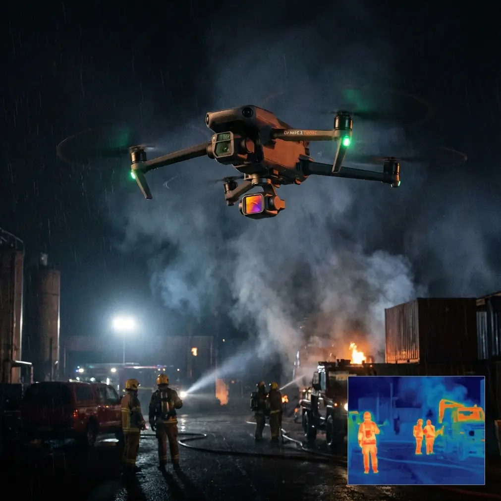
The hidden challenge: electromagnetic interference near urban lines
Anyone scouting power infrastructure in a city learns this fast: interference is rarely dramatic. It is usually subtle, and that makes it more dangerous. You may not see a total loss of control. Instead, you notice slight hesitation in response, unstable heading behavior, brief signal degradation, or video downlink noise right when you are trying to hold a clean angle on a conductor crossing.
Electromagnetic interference matters because it can stack with all the other urban problems already in play. Buildings can block or reflect signal. Utility hardware can confuse situational awareness. Traffic and pedestrians create pressure to finish the shot quickly. If the pilot starts chasing the aircraft instead of flying deliberately, the margin disappears.
With the Neo 2, antenna adjustment becomes a real operating skill, not a box-ticking detail. In urban power line scouting, I would treat antenna orientation as part of the pre-maneuver routine. If the aircraft is moving down a street canyon or alongside a line corridor, keep the controller antennas aligned to preserve the strongest possible link geometry rather than waiting until the feed degrades. Small corrections early are better than large corrections late.
That sounds basic, but it has operational significance. Near interference sources, maintaining a cleaner controller-to-aircraft relationship can prevent the pilot from misreading EMI as a flight control issue. It also reduces the temptation to climb unnecessarily just to “get signal back,” which is often the wrong move in dense urban areas where vertical space may put the aircraft closer to wires, poles, or façade obstacles.
Obstacle avoidance is useful here, but only if you understand what it is not
Obstacle avoidance is one of the most misunderstood features in utility-related flying. In a city, it helps. No question. It can reduce workload while threading through visual clutter and can save a rushed pilot from a bad line on approach or retreat.
But power line scouting is exactly where pilots need discipline. Wires are thin, low-contrast objects. Urban backgrounds are messy. Sensor-based systems may perform well against building edges, walls, parked vehicles, and tree masses while still leaving little margin around narrower structures. So the operational value of obstacle avoidance on the Neo 2 is not “the drone sees everything.” The value is that it helps manage the larger environment while the pilot deliberately maintains stand-off distance from the line set itself.
That distinction matters in the field. If you use obstacle sensing to avoid lamp posts, branches, and walls while treating energized conductors as manual-flying exclusion zones, you get a safer workflow. If you assume automation will protect the aircraft from every wire crossing, you are setting up the wrong habit.
For urban utility scouting, the most effective use of obstacle avoidance is during lateral repositioning between observation points, especially when backing away from a pole line with trees behind the aircraft or edging sideways near street furniture. It reduces the cognitive load of the “non-inspection” parts of the flight.
ActiveTrack and subject tracking: valuable, but only in controlled slices
The inclusion of ActiveTrack and general subject tracking tools often gets framed around creators following bikes or runners. For utility scouting, that misses the point. The better use is controlled repeatability.
In an urban line corridor, there are moments when a pilot wants the aircraft to maintain a consistent relation to a feature while the operator studies the live view. Subject tracking can help hold the aircraft’s framing on a pole structure, access route, or vegetation boundary while the pilot monitors spacing and route progression. That can be useful during route familiarization, especially before sending a larger inspection platform into the area.
Still, this is not a mode to run casually around active power infrastructure. The operational significance lies in short, planned segments where the surroundings are already understood and clear of unpredictable obstacles. Used that way, ActiveTrack becomes a workload management tool. Used indiscriminately, it can add risk because urban power corridors are full of visual interruptions and geometry changes.
My rule would be simple: use tracking to stabilize observational tasks in open or semi-open slices of the corridor, not to “automate” line following in clutter.
QuickShots and Hyperlapse actually have utility value here
At first glance, QuickShots and Hyperlapse sound more like creator tools than utility tools. In practice, both can support scouting documentation if handled properly.
QuickShots are useful when a crew needs fast context capture around a structure or block segment. A short automated reveal around a pole cluster or service junction can document how the line sits relative to roads, buildings, trees, and access points. That context can help planners assess truck approach, crew staging, and visual constraints before a maintenance visit.
Hyperlapse has a narrower but still real role. In urban scouting, it can show corridor behavior over time: vehicle density around an access point, changing pedestrian movement, or shifting shadow patterns that may affect visibility for a later inspection window. This is not about cinematic output. It is about compressing environmental change into something operationally readable.
The caution is obvious. Automated movement features should only be used where the flight path has already been validated and where stand-off from wires and structures is generous. Their usefulness comes after route familiarity, not before it.
D-Log is not just for aesthetics
If the Neo 2 supports D-Log capture in your workflow, use it when the mission includes post-flight review by multiple stakeholders. Urban utility scenes are brutal on standard profiles. Bright sky behind dark conductors. Reflective building surfaces next to shaded alleys. Concrete, foliage, glass, and metal in the same frame. Standard contrast can bury detail where you need it most.
D-Log matters because it holds more grading flexibility for footage review. That can help recover shadow detail around attachment points, highlight structure against bright backgrounds, and produce more consistent documentation across flights done at different times of day. For engineering support, vegetation planning, or contractor briefings, that consistency is more useful than many pilots realize.
The operational significance is straightforward: if your scouting mission is meant to inform later action, not just live decision-making, the extra latitude in post can improve what the rest of the team actually sees. Just plan the workflow in advance. Flat footage without a review pipeline wastes time.
Handling the aircraft near EMI: what I would actually do
The most relevant skill in this scenario is not a fancy camera move. It is restraint.
If I were using the Neo 2 to scout urban power lines, my process near potential electromagnetic interference would look like this:
1. Establish a clean baseline away from the line
Before moving into the corridor, confirm stable control response, video downlink, and heading behavior in a low-risk area. That gives you a reference. If instability appears later, you know it is environmental rather than a general aircraft issue.
2. Approach from a geometry that preserves signal
Do not drift into a weak controller orientation and then troubleshoot in place. Face the aircraft with deliberate antenna alignment, keeping the controller aimed for the strongest likely link. In dense urban areas, even small body movements by the pilot can matter when the route is hemmed in by buildings and hardware.
3. Keep stand-off distance conservative
A scout mission does not need the aircraft tucked in close to every conductor. The point is to identify conditions, not force inspection-level proximity from a platform not intended for that role. Greater distance gives obstacle systems more room to help and gives the pilot more time to interpret odd behavior.
4. Watch for subtle symptoms
Signal bars are not the whole story. Small heading twitch, delayed yaw response, intermittent image breakup, or unexpected drift can all be cues to stop advancing. Urban EMI rarely announces itself politely.
5. Reposition instead of pushing through
If the feed or control feel changes, back out and try a new angle. Sometimes a slight lateral move or a change in street-side position restores a cleaner path than climbing or pressing forward.
That last point is where many flights are won or lost. Good urban utility pilots do not “fight” the environment. They reframe it.
Where the Neo 2 fits in a utility fleet
For power line work, the Neo 2 fits best as a scouting and documentation aircraft, not as a one-size-fits-all inspection solution. That sounds limiting, but it is actually a strength. Fleets work better when each aircraft has a clear lane.
Use the Neo 2 when you need to:
- check urban corridor accessibility
- document vegetation proximity
- capture pre-inspection visual context
- validate launch and recovery locations
- identify obvious structural concerns from a safe stand-off
- record route conditions for crews or contractors
That gives field teams a low-friction tool for the first layer of situational awareness. Then, if a site demands zoom optics, thermal payloads, or heavier wind tolerance, the mission escalates to a larger aircraft with the right sensor package and risk envelope.
This is the mature way to think about the platform. Not “Can it do everything?” but “Does it reduce friction in the part of the job where speed and repeatability matter most?”
Final assessment
The Neo 2 makes sense for urban power line scouting when the operator respects the environment it is entering. Its strongest qualities in this context are portability, low setup burden, and automation features that can trim pilot workload when used selectively. Obstacle avoidance helps with the city around the lines. ActiveTrack can stabilize short observational tasks. QuickShots and Hyperlapse can support contextual documentation. D-Log can improve downstream review quality.
The critical skill, though, is not hidden in a spec sheet. It is how the pilot manages electromagnetic interference through conservative stand-off, route choice, and timely antenna adjustment. That is where a lightweight aircraft becomes dependable instead of merely convenient.
If you are building a practical workflow for this kind of mission and want to compare setup ideas with someone who understands utility scouting, you can message the team directly here.
Ready for your own Neo 2? Contact our team for expert consultation.