Neo 2 Field Report: Scouting Urban Highways Without Losing
Neo 2 Field Report: Scouting Urban Highways Without Losing the Story
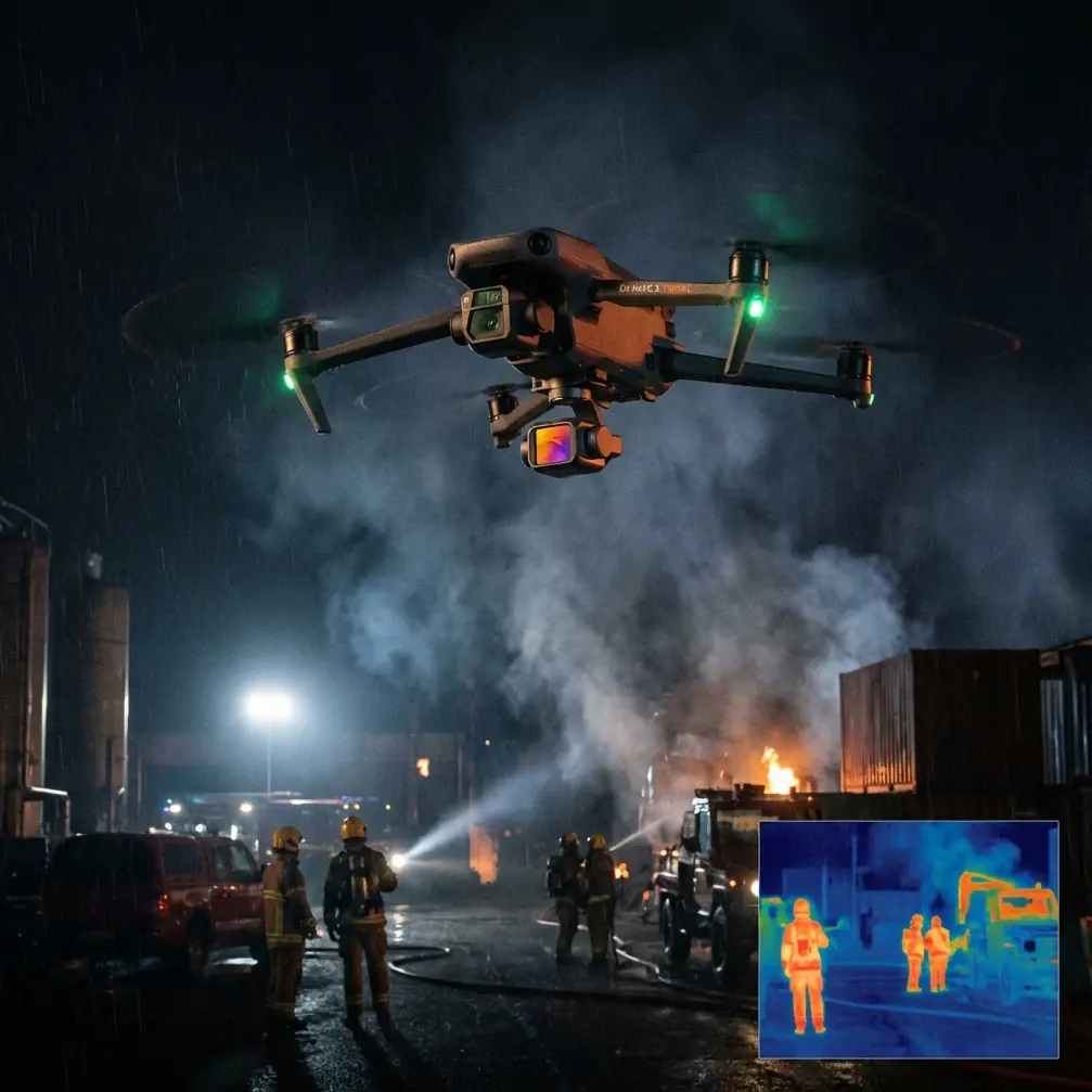
META: A field-tested look at how Neo 2 handles urban highway scouting, with practical insight on obstacle avoidance, subject tracking, QuickShots, Hyperlapse, D-Log, and ActiveTrack.
Urban highway scouting sounds simple until you actually do it.
A road corridor is not an open field. It is a moving maze of overpasses, sign gantries, light poles, concrete walls, merge lanes, service roads, and unpredictable airflow. Add traffic density, reflective surfaces, and the need to maintain visual context, and the drone stops being a gadget and becomes a decision-making tool. That is the lens I used for this Neo 2 field session: not as a spec sheet exercise, but as a practical test of how well it supports real observation work in a city highway environment.
I approached this report the way I would evaluate any aircraft for corridor reconnaissance. Can it keep orientation when the visual scene is crowded? Can it maintain a clean track on a moving subject without getting confused by surrounding vehicles? Can it transition from documentation to cinematic overview without breaking workflow? And maybe most revealing of all, can it stay composed when something unplanned enters the frame?
That last question got answered sooner than expected.
Just after sunrise, while I was tracking traffic flow near an elevated interchange, a red-tailed hawk swept low across the service lane and cut toward a cluster of lamp standards beside the outer barrier. It was brief, maybe a few seconds, but it was exactly the kind of moment that exposes whether a drone’s sensing and control logic are helping the pilot or adding workload. The Neo 2’s obstacle awareness did what it needed to do in that compressed window: it held a stable line as the scene tightened, avoided a clumsy drift toward the roadside structures, and gave me enough confidence to keep the aircraft predictable rather than overcorrecting. That matters operationally. In urban scouting, the best safety system is often the one that reduces pilot panic before it needs to rescue a bad input.
This is where obstacle avoidance stops being a marketing phrase and starts earning its keep. On a highway route, the threats are not always large buildings. Often they are narrow vertical objects with weak visual separation from the background: poles, directional signage supports, utility runs, temporary construction elements. A drone that handles broad open-air flight beautifully can still become awkward in these cluttered margins. The Neo 2 feels most useful when it helps preserve smooth control near roadside infrastructure without turning every maneuver into a hesitant crawl. For scouting work, that balance is everything. Too aggressive a safety envelope interrupts the shot and slows inspection logic. Too little assistance and the pilot carries unnecessary cognitive load.
The other major test was subject tracking. Urban highways are full of visual impostors. If you assign the drone to follow one vehicle, you are asking its tracking system to distinguish that subject from dozens of similar shapes moving at roughly similar speeds, often with occlusions from bridges and lane changes. In this environment, ActiveTrack is only valuable if it behaves with discipline. The Neo 2 proved most effective when I used it not as an excuse to stop piloting, but as a way to offload repetitive framing tasks while I supervised route safety and scene composition.
That distinction matters. Subject tracking on a highway is less about spectacle and more about continuity. If you are documenting congestion patterns, merge conflicts, or lane utilization, the drone must maintain context around the subject rather than tunnel vision. The stronger use case is not “follow that car because it looks cool.” It is “maintain that vehicle as an anchor while preserving enough environment to interpret what the roadway is doing around it.” The Neo 2’s tracking tools are useful precisely because they support that layered read of the scene.
I found that especially helpful when monitoring vehicles moving under alternating light conditions created by overpasses and tall commercial buildings. Those transitions can disrupt visual consistency and make footage harder to interpret later. A stable tracking pass gives analysts and clients something far more valuable than a flashy clip: usable spatial evidence. You can read lane positioning. You can see choke points form. You can compare vehicle flow before and after a ramp merge. In corridor work, that is the real product.
QuickShots surprised me here, though not in the way casual users might expect. I do not reach for automated shot modes on professional scouting flights unless they solve a problem. On Neo 2, they can. A short, repeatable automated move is useful when you want to establish the relationship between frontage roads, sound barriers, feeder lanes, and the main carriageway without manually re-flying the same arc several times. In an urban highway setting, consistency has operational value. If you are revisiting a corridor over multiple sessions, standardized movement makes footage easier to compare. QuickShots, used selectively, can create repeatable visual baselines.
Hyperlapse is another feature that gets misunderstood. People think of it as style first. In corridor observation, it can become a pattern-reveal tool. Highway behavior changes with time more than with distance. Queue formation, lane bias, shoulder use, delivery van clustering near exits, even pedestrian spillover near transit-linked access roads all emerge over intervals. A well-planned Hyperlapse sequence condenses those changes into something planners, construction managers, or content teams can interpret quickly. Instead of explaining that congestion migrated from the outer lane to the center lanes over 20 minutes, you can show it clearly in one compact piece of media. That is not decoration. That is compression of evidence.
Color workflow also matters more than many operators admit. If your mission is urban scouting, you are constantly dealing with hard dynamic range. Bright sky. Dark underpasses. Reflective windshields. Concrete that shifts from warm to cold depending on time of day and surrounding structures. D-Log earns attention in this environment because it preserves room to grade those contrasts later. That is not just about making footage pretty. It is about preserving interpretability. When shadows beneath a flyover crush too aggressively, you lose visibility into lane markings, barrier edges, and vehicle separation. When highlights clip off reflective surfaces, the whole scene can become visually fatiguing. A flatter capture profile gives the editor or analyst more latitude to recover a truthful image.
This is one of the reasons I see Neo 2 as most credible when used by operators who understand the difference between recording and seeing. Many drones can record a highway. Fewer let you come back with footage that withstands scrutiny when conditions get messy. D-Log does not fix bad piloting or poor exposure discipline, but it expands your margin for producing footage that remains useful after the flight.
There is also a subtle advantage in how Neo 2 supports mixed-purpose missions. On this highway session, I was not doing a single-task sortie. I needed broad environmental coverage, moving-subject follow work, infrastructure-aware flight, and a few polished sequences that could function in a presentation without separate reshoots. That blend is common in real operations. A city transport consultant may want visual documentation. A project manager may want progression context. A communications team may want a concise aerial segment that translates for non-technical stakeholders. The drone that succeeds is the one that does not force you to choose one lane too early.
That flexibility showed up in workflow. I could move from a controlled tracking pass to a wider establishing move, then to a compressed time-based sequence, without the aircraft feeling like it was designed for one narrow content type. For a corridor scout, that means fewer compromises at the edge of the mission brief. You are not always guessing which capability to sacrifice when the site gets complicated.
There is another point worth stating clearly: urban highway scouting is not just about what the drone sees ahead. It is about how efficiently the pilot can read everything else. Signal timing around intersections that feed the corridor. Lane behavior near on-ramps. Temporary roadworks. Pedestrian or cyclist intrusion near service roads. Emergency shoulder access. Neo 2’s value is strongest when its automation features reduce mechanical repetition and free the operator to think at the systems level.
That is what happened during the hawk encounter too. The dramatic part of the story is easy to tell: bird appears, drone remains controlled, mission continues. The more useful lesson is why that moment mattered. Wildlife in urban corridors is not rare. Raptors use thermal lift around built environments, and small birds often move unpredictably between green strips, drainage channels, and roadside plantings. When a drone’s sensing and control behavior remain calm in that kind of interruption, the pilot retains bandwidth for the right priority decisions: spacing, trajectory, airspace awareness, and recovery options. That is a serious operational benefit.
For teams planning recurring corridor work, I would frame Neo 2 around five practical strengths.
First, obstacle avoidance has real value near highway furniture and elevated structures because those are the places where manual overcorrection often creates risk. Second, ActiveTrack and subject tracking can preserve continuity on moving vehicles when used as supervised tools rather than autonomous shortcuts. Third, QuickShots can support repeatable documentation, not just cinematic flourishes. Fourth, Hyperlapse helps reveal traffic behavior over time in a format that busy stakeholders can absorb quickly. Fifth, D-Log gives urban footage the tonal flexibility it needs when the route runs through brutal lighting contrast.
None of this removes the need for judgment. A highway corridor is still a high-consequence environment. Pilots need site awareness, legal compliance, disciplined spacing, and a clear purpose for every movement. But when those fundamentals are in place, Neo 2 feels well suited to the specific problem of urban scouting because its features line up with actual field demands instead of abstract wish lists.
If you are building a workflow around this kind of mission, my advice is simple. Use obstacle sensing to preserve control margin, not to invite risk. Use tracking to hold narrative continuity, not to surrender supervision. Use QuickShots to standardize comparison angles. Use Hyperlapse when the story is temporal, not just spatial. Shoot D-Log when lighting conditions are likely to punish a narrower capture pipeline. And if you need a second set of eyes on a corridor planning setup, I’ve found that a quick message through our flight planning channel is often faster than sorting assumptions in the field.
The Neo 2 does not earn its place on an urban highway by being flashy. It earns it by staying useful when the scene is dense, fast, reflective, and occasionally alive in ways you did not script. That is a better standard anyway. Out on the corridor, nobody cares how smooth the product page sounded. They care whether the aircraft helped you come back with footage you can trust.
Ready for your own Neo 2? Contact our team for expert consultation.