Neo 2 for Wildlife Monitoring in Complex Terrain
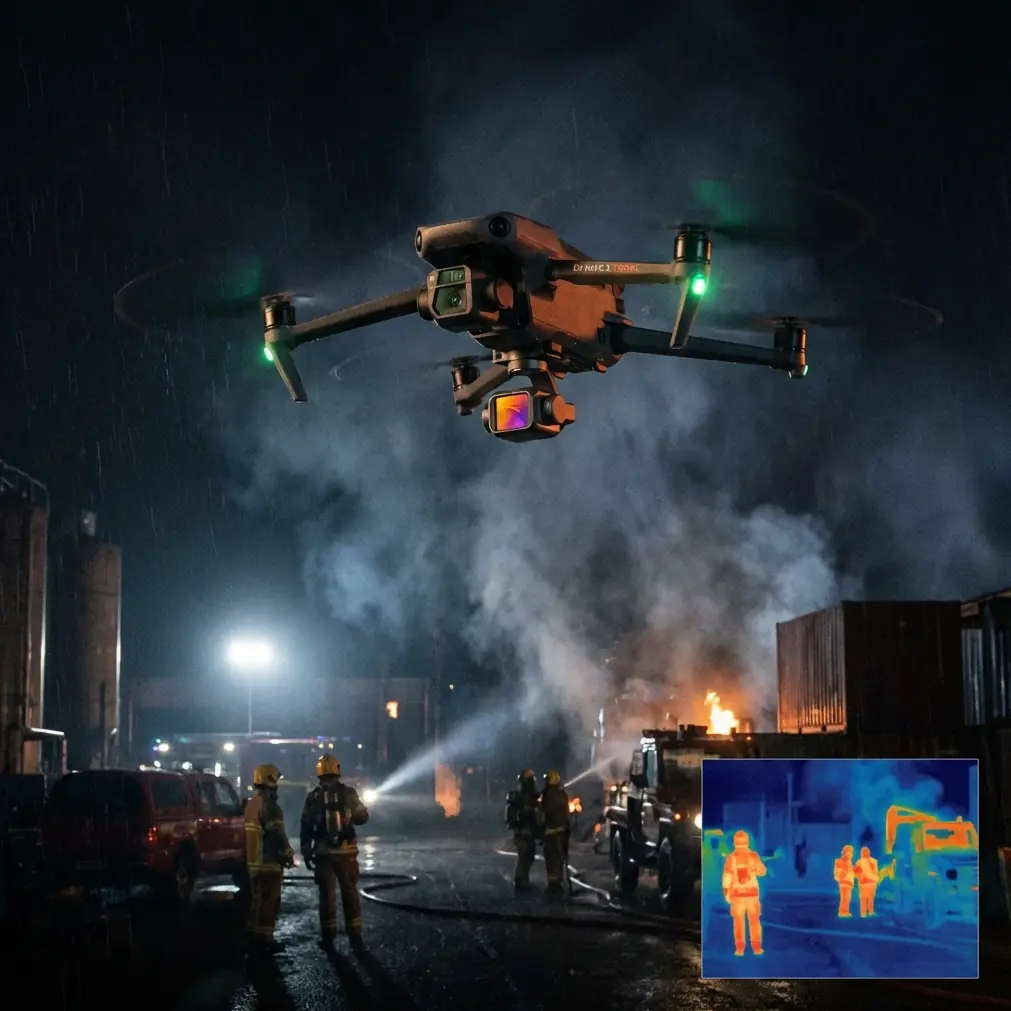
Neo 2 for Wildlife Monitoring in Complex Terrain: What Actually Matters in the Field
META: Expert guide to using Neo 2 for wildlife monitoring in forests, canyons, and uneven terrain, with practical advice on obstacle avoidance, tracking, D-Log, QuickShots, Hyperlapse, and antenna positioning for reliable control.
Wildlife monitoring sounds straightforward until the landscape starts fighting your aircraft.
A ridgeline blocks signal. Tree cover breaks visual contrast. A moving animal disappears behind brush just as the drone tries to hold framing. In open terrain, almost any compact UAV can look competent. In complex terrain, the real test begins: control stability, obstacle handling, tracking reliability, and the pilot’s ability to preserve link quality while reacting to fast-changing geometry.
That is where the Neo 2 becomes interesting.
Not because it solves every field problem automatically. It does not. But for operators working around gullies, mixed canopy, rocky slopes, marsh edges, or broken forest corridors, the Neo 2 sits in a useful category: small enough to deploy quickly, smart enough to reduce pilot workload, and capable enough to collect footage and observation data without turning every sortie into a manual wrestling match.
If your specific mission is monitoring wildlife in difficult terrain, the value of the Neo 2 is not one headline feature. It is the way several systems interact under pressure: obstacle avoidance, subject tracking, QuickShots, Hyperlapse, D-Log capture, and ActiveTrack behavior. Used well, those tools let you stay farther from sensitive animals, reduce repeated passes, and come home with footage that is actually usable.
The Real Problem in Wildlife Monitoring
Most failed wildlife drone flights are not dramatic crashes. They are quiet failures.
The drone remains airborne, but the shot is compromised. The operator loses the animal in the frame. Branches or terrain force a clumsy reposition. Compression and lighting issues make later analysis less reliable. Or the aircraft has to fly closer than intended because the pilot does not trust tracking or link stability at standoff distance.
For conservation teams, field biologists, land managers, and responsible content creators, that matters. A drone that forces repeated approaches can increase disturbance. One that struggles with terrain masking can reduce confidence exactly when an animal changes direction or disappears into edge cover. In practical terms, each missed pass costs battery, time, and often the best behavioral window.
The Neo 2’s strength in this scenario is that it can support a lower-disturbance operating style when the pilot understands its limits.
Obstacle avoidance helps preserve a margin when terrain rises unexpectedly or when lateral movement near vegetation becomes necessary. Subject tracking and ActiveTrack reduce the need for constant micro-corrections. D-Log gives more latitude when you are filming under broken canopy light, where bright sky gaps and dark ground detail often exist in the same frame. QuickShots and Hyperlapse are not just cinematic extras either. In monitoring work, they can be repurposed into repeatable movement patterns for visual context, habitat overview, and temporal change documentation.
That mix is operationally significant because wildlife work rarely offers ideal conditions. One minute you are over a meadow edge; the next you are dealing with shadow, slope, and partial occlusion.
Why Obstacle Avoidance Matters More Here Than in Open Air
In flat open space, obstacle avoidance is mostly insurance.
In complex terrain, it becomes part of mission planning.
When monitoring wildlife along ravines, creek channels, forest boundaries, or rocky escarpments, the aircraft is constantly exposed to hidden geometry. A branch line that looks obvious from the ground may disappear against a dark background in the live feed. Terrain can rise faster than expected during a forward track. If you are maintaining a respectful distance from an animal, you may not have the option to simply fly closer and higher for a cleaner angle.
This is where Neo 2’s obstacle avoidance has practical value: it buys decision time.
That extra margin can prevent a rushed stick input when the subject changes direction near cover. It can also make low-altitude lateral repositioning more controlled when you are trying to maintain visual continuity without pushing the aircraft into brush or rock.
Still, wildlife operators should not treat obstacle sensing as permission to fly aggressively through clutter. Thin branches, reeds, and irregular vegetation can remain problematic for any compact platform. The better way to use Neo 2 is as a system that supports conservative flying, not one that replaces it.
A strong field habit is to establish an escape vector before engaging any automated tracking behavior. If the animal moves toward dense canopy or a narrow cut in the terrain, you should already know whether your safest response is a vertical climb, a backward slide, or a hold-and-observe pause.
ActiveTrack and Subject Tracking: Useful, But Only If You Use Them Like a Biologist
ActiveTrack and subject tracking often get discussed as convenience features. In wildlife monitoring, they are more serious than that.
A reliable tracking system can reduce pilot workload at exactly the moment when environmental awareness matters most. Instead of dedicating all your attention to keeping the animal centered, you can devote more cognitive bandwidth to terrain, signal status, wind drift, sun angle, and the animal’s behavioral cues.
That is the upside.
The limitation is equally important. Wild animals do not move like athletes on a clear field. They stop abruptly, turn under cover, blend into surroundings, and trigger false confidence in automated systems. In broken terrain, tracking reliability depends heavily on separation, contrast, and line of sight. If the animal passes beneath brush or around a rock shelf, the smartest move may be to stop chasing the perfect moving shot and switch to a wider observational frame.
Operationally, this means Neo 2’s tracking tools are best used in segments rather than continuously. Let the aircraft help you during exposed movement across open patches, game trails, shorelines, or ridgeline traverses. Once the subject approaches clutter, transition back to a pilot-led position that preserves safety and context.
Used this way, tracking is not just about aesthetics. It reduces unnecessary corrections, which in turn lowers the chance of overflying the animal or making repeated noisy passes.
D-Log Is Not a “Creator Feature” in This Use Case
D-Log often gets framed as a tool for editors. For wildlife monitoring in complex terrain, it can be a field data advantage.
The reason is simple: mixed lighting destroys detail. A deer moving from shadow into a sunlit break, a bird crossing bright water with dark bank vegetation behind it, or a mammal partially obscured by brush under a bright sky can push standard footage hard. If you are trying to review coat pattern, movement behavior, group spacing, or habitat interaction later, preserving tonal information matters.
D-Log gives you more room to recover highlight and shadow detail during post-processing. That does not turn the Neo 2 into a scientific multispectral platform, but it can improve the interpretability of ordinary visual footage. For habitat documentation and behavior review, that can be the difference between “usable” and “too contrasty to trust.”
The catch is workflow. If your team needs immediate field sharing without grading, a standard profile may still be more practical. But for missions where later review matters, D-Log is worth the extra handling.
A useful approach is to reserve D-Log for dawn, dusk, broken canopy, and high-contrast topography, then shift to a simpler profile when light is even and time-sensitive delivery matters more than grading latitude.
QuickShots and Hyperlapse Have a Place in Monitoring
Many operators ignore QuickShots and Hyperlapse in wildlife work because they sound too polished for serious field use. That is a mistake.
QuickShots can help create consistent habitat-context clips that show the relationship between the animal and its environment. A controlled reveal around a ridge edge, a pullback from a wetland margin, or a measured orbit from a safe distance can document terrain context better than a manually improvised pass. The key is restraint. Use these patterns to capture structure and spacing, not to dramatize the scene.
Hyperlapse has a different kind of value. If your goal includes observing movement corridors, waterhole activity, herd spacing shifts, or changing light on a nesting area from a respectful distance, compressing time can reveal patterns that are easy to miss in real time. Even when not used for publication, it can help communicate site dynamics to field teams and stakeholders.
That matters because complex terrain often hides movement logic. A static viewpoint over 20 or 30 minutes may show where animals prefer to cross, pause, shelter, or avoid. Hyperlapse can make those patterns legible.
Antenna Positioning Advice for Maximum Range
This is the practical detail too many pilots skip until they lose confidence in the link.
In complex terrain, signal quality is shaped less by advertised range and more by geometry. Hills, rock faces, dense trees, and even your own body position can degrade the control link before the aircraft is anywhere near its theoretical limit. If you are monitoring wildlife in valleys, forest cuts, or behind ridges, antenna positioning becomes a real operational skill.
The first principle: point the broad face of the antenna pattern toward the aircraft, not the tip directly at it. Many pilots instinctively “aim” antennas like flashlights. That is often wrong. For most controller antennas, the strongest usable orientation comes from aligning the flat side or broad surface toward the drone.
The second principle: keep the controller high and clear. If the drone is flying low beyond brush, your body can become part of the obstruction. Raising the controller slightly and turning your torso so your chest is not blocking the path can improve consistency.
The third principle: adjust as the aircraft changes elevation relative to you. A drone crossing a slope line or dropping into a drainage channel can move from strong link to terrain-masked signal quickly. Do not lock your hands into one position. Re-orient the antennas as the aircraft moves.
The fourth principle: your launch point often matters more than your aircraft settings. If possible, start from a knoll, open edge, or elevated clearing that preserves line of sight into the area of interest. A 10-meter improvement in launch position can be more valuable than trying to squeeze more distance out of a poor location.
The fifth principle: avoid standing directly beneath canopy if the mission requires range. Even when the aircraft has a partial view of the sky, the control link back to you may suffer if your own controller is shielded by foliage.
If you want a second opinion on link setup for a specific habitat, I’d use this direct field support channel: message the team here.
How I’d Fly the Neo 2 for This Scenario
For wildlife monitoring in broken terrain, I would not launch with the goal of “getting close.” I would launch with the goal of getting stable information.
Start with a high-context pass from a safe offset. Use manual control first to understand wind, terrain rise, and likely interference points. Once the subject is identified and behavior looks settled, use ActiveTrack or subject tracking only where movement corridors are relatively open.
If the animal approaches clutter, pause the automation early. Climbing a little and widening the frame is often better than forcing a tighter pursuit. Where habitat context matters, add a restrained QuickShot-style reveal or retreat movement. If the lighting is harsh or variable, record in D-Log so the footage remains more useful later. If the goal is temporal observation rather than dynamic pursuit, set up a stable hover at respectful distance and use Hyperlapse to reveal movement patterns over time.
Throughout the flight, keep checking one thing beyond the image: your control geometry. In difficult terrain, the aircraft can still look fine in the feed right before the link starts to weaken. Antenna orientation, body position, and launch-point selection are part of piloting, not accessories to it.
The Bottom Line on Neo 2 in Complex Terrain
The Neo 2 makes the most sense for wildlife monitoring when the operator values controlled observation over spectacle.
Its obstacle avoidance is meaningful because terrain and vegetation create real collision pressure. Its tracking features matter because they lower pilot workload during short windows of exposed movement. D-Log matters because wildlife footage in mixed light often needs more tonal recovery than people expect. QuickShots and Hyperlapse matter because they can document context and temporal behavior when used with discipline rather than flair.
None of that removes the need for judgment. You still need to read animal behavior, protect standoff distance, and resist using automation where manual patience is the safer choice.
But in the hands of a careful operator, the Neo 2 is not just a small drone with smart features. It becomes a practical monitoring tool for places where terrain, cover, and signal geometry punish sloppy flying fast.
Ready for your own Neo 2? Contact our team for expert consultation.