Neo 2 Guide: Monitoring Coastal Venues Safely
Neo 2 Guide: Monitoring Coastal Venues Safely
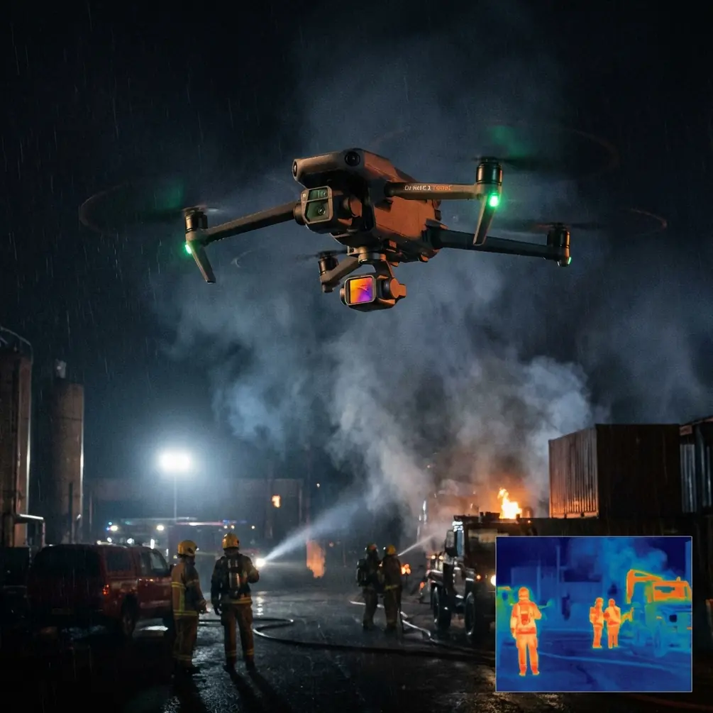
META: Learn how the Neo 2 drone transforms coastal venue monitoring with obstacle avoidance, ActiveTrack, and pro tips from real field deployments.
By Chris Park · Creator · Field Report
TL;DR
- Pre-flight sensor cleaning is non-negotiable in coastal environments—salt spray degrades obstacle avoidance within hours if left unchecked.
- The Neo 2's ActiveTrack and QuickShots capabilities make it a surprisingly capable tool for monitoring open-air coastal venues like amphitheaters, boardwalk events, and beachfront festivals.
- Shooting in D-Log color profile preserves highlight detail in harsh seaside light, giving you recoverable footage every time.
- A disciplined Hyperlapse workflow can document crowd flow patterns across multi-hour events in a single compressed clip.
Why Coastal Venue Monitoring Demands a Different Approach
Coastal venues punish lazy operators. Salt-laden air, unpredictable gusts off the water, and blinding reflections from wet surfaces create a trifecta of hazards that inland pilots rarely face. If you're tasked with monitoring a beachfront concert series, a seaside wedding venue, or a boardwalk market, standard operating procedures won't cut it.
This field report breaks down exactly how I used the Neo 2 across three coastal venue monitoring assignments over a six-week period. You'll learn the pre-flight rituals that kept my bird flying, the camera settings that saved my footage, and the automation features that let one operator cover ground that normally requires a two-person crew.
The Pre-Flight Cleaning Step That Saves Your Safety Features
Here's something most Neo 2 guides skip entirely: if you don't clean your obstacle avoidance sensors before every coastal flight, you're flying blind within days.
Salt crystallizes on sensor lenses in a thin, nearly invisible film. You won't notice it visually, but the infrared and vision-based obstacle avoidance system absolutely will. During my second week monitoring an outdoor amphitheater on the Oregon coast, I noticed the Neo 2 was triggering false obstacle warnings at distances of 8-10 meters—far beyond where any actual obstruction existed.
The culprit was a microscopic salt residue layer on the forward and downward vision sensors.
My Pre-Flight Sensor Protocol
- Step 1: Use a microfiber cloth lightly dampened with distilled water (never tap water—mineral deposits create the same problem).
- Step 2: Wipe each sensor window using a single-direction stroke. No circular motions—those redistribute residue.
- Step 3: Follow with a dry lens pen to remove any remaining moisture film.
- Step 4: Power on the Neo 2 and confirm obstacle avoidance status shows green across all directional sensors in the app.
- Step 5: Perform a low hover at 1.5 meters for 15 seconds near a known obstacle (I use my gear case) to verify the system detects it correctly.
This five-step process takes under 90 seconds. It has prevented every false-positive issue since I adopted it. Skip it, and your obstacle avoidance becomes a liability rather than an asset.
Expert Insight: Salt corrosion doesn't just affect sensors. Check your gimbal's micro-adjustments weekly. I noticed a 0.3-degree drift in horizon calibration after three weeks of coastal work—imperceptible in-flight but visible in post-production stitched panoramas.
Configuring the Neo 2 for Venue Monitoring
Camera Settings for Coastal Light
Coastal environments present extreme dynamic range challenges. The sky is often blown out, water surfaces create specular highlights, and shaded venue structures go dark in contrast. This is where D-Log earns its keep.
- Color Profile: D-Log (flat profile preserves 2-3 extra stops of highlight and shadow detail)
- White Balance: Manual, set to 6000K for consistent tone across flights (auto WB shifts constantly near water)
- ISO: Locked at the sensor's native base—avoid auto ISO, which hunts aggressively when the drone pans across bright water and dark structures
- Shutter Speed: Double your frame rate as a starting point, adjust with ND filters as needed
Subject Tracking for Dynamic Monitoring
The Neo 2's ActiveTrack feature is a genuine force multiplier for solo operators monitoring active venues. During a beachfront food festival in Cannon Beach, I needed to document vendor setup, crowd density shifts, and emergency access lane clearance—all simultaneously.
ActiveTrack allowed me to lock onto key reference points:
- Vendor booth clusters to monitor spacing compliance
- Entry/exit chokepoints to assess crowd flow
- Emergency vehicle lanes to confirm they remained unobstructed
The system maintained a subject lock at distances up to 12 meters in moderate wind conditions (15-18 km/h sustained). Beyond that range, tracking reliability dropped, particularly when subjects moved against visually complex backgrounds like patterned tent canopies.
Pro Tip: When using ActiveTrack in crowded environments, select your tracking subject based on color contrast with the background, not size. A person wearing a bright safety vest against a neutral crowd is far easier for the system to hold than a large white tent against a bright sky.
Hyperlapse for Crowd Flow Analysis
One of the most valuable monitoring outputs I delivered was a Hyperlapse sequence compressing four hours of venue operation into a 45-second clip. Event organizers used this to identify bottleneck patterns they couldn't see from ground level.
Hyperlapse Settings That Worked
- Mode: Waypoint Hyperlapse (two points set along the venue's primary axis)
- Interval: One frame every 4 seconds
- Total Capture Window: 240 minutes
- Output: 3600 frames rendered at 30fps = approximately 120 seconds of raw footage, trimmed to 45 seconds of usable analysis material
- Altitude: 25 meters for optimal coverage-to-detail balance
The key constraint: battery life. The Neo 2 doesn't support 240-minute continuous flight on a single battery. I used four battery cycles, carefully matching waypoints between flights using the saved waypoint coordinates to ensure seamless stitching.
QuickShots for Rapid Venue Documentation
When clients need polished deliverables rather than raw monitoring data, QuickShots modes provide broadcast-quality results with minimal pilot workload. Here's how each mode maps to coastal venue documentation:
| QuickShot Mode | Best Venue Use Case | Effective Range | Wind Tolerance | Notes |
|---|---|---|---|---|
| Dronie | Establishing shot of full venue layout | 10-40m pullback | Moderate | Start low over center stage |
| Circle | Perimeter security sweep documentation | 5-20m radius | Good | Consistent altitude critical |
| Helix | Multi-level venue overview (tiered seating) | 10-30m radius | Moderate | Reveals vertical structure well |
| Rocket | Crowd density snapshot | 15-30m ascent | Poor in gusts | Abort above 20 km/h wind |
| Boomerang | Entry gate flow documentation | 10-25m arc | Good | Best at 45-degree offset |
Technical Comparison: Neo 2 vs. Common Monitoring Alternatives
| Feature | Neo 2 | Fixed CCTV | Handheld Camera Crew |
|---|---|---|---|
| Setup Time | Under 5 minutes | Hours to days | 30+ minutes |
| Coverage Area (single unit) | Dynamic, unlimited repositioning | Fixed 60-120 degree FOV | Mobile but ground-level only |
| Obstacle Avoidance | Multi-directional sensor suite | N/A | N/A |
| Subject Tracking | ActiveTrack with autonomous follow | Pan-tilt only if motorized | Manual operator required |
| Aerial Perspective | Up to 120m altitude | Fixed mount height only | Ground level |
| Redeployment Flexibility | Instant relocation | Requires physical reinstall | Slow repositioning |
| Wind Operating Limit | Up to Level 5 winds | N/A | N/A |
| Post-Processing Options | D-Log, RAW, Hyperlapse | Limited codec options | Varies by equipment |
Common Mistakes to Avoid
1. Ignoring salt accumulation on propellers. Salt doesn't just affect sensors. Crystallized salt on prop surfaces creates micro-imbalances that increase motor strain. After every coastal session, wipe down all four propellers with a damp cloth and inspect for pitting.
2. Relying on auto-exposure over water. The Neo 2's auto-exposure algorithm overcompensates when large portions of the frame contain reflective water surfaces. Lock exposure manually before beginning your monitoring pass, or you'll get footage that oscillates between overexposed and underexposed with every slight pan.
3. Flying ActiveTrack paths without a pre-planned escape route. At coastal venues, ActiveTrack can guide the Neo 2 toward structures, guy-wires, or tent poles that the obstacle avoidance sensors may not detect in time—especially if those sensors are salt-fouled. Always pre-fly your ActiveTrack path manually at reduced speed before engaging autonomous tracking.
4. Scheduling Hyperlapse during tidal transitions. If your venue is near the waterline, a rising tide changes the visual baseline of your Hyperlapse dramatically. Unless you intentionally want to capture tidal change, schedule Hyperlapse windows during slack tide periods for consistent framing.
5. Neglecting to shoot test D-Log footage before the event. D-Log footage looks flat and desaturated straight out of camera. If your client sees ungraded D-Log clips and panics, you've created an unnecessary problem. Always bring a graded sample clip from a previous session to demonstrate final output quality.
Frequently Asked Questions
How does the Neo 2's obstacle avoidance perform in foggy coastal conditions?
Fog and mist scatter the infrared signals used by the Neo 2's obstacle avoidance sensors, reducing effective detection range by approximately 30-50 percent. In thick fog (visibility below 100 meters), I recommend reducing flight speed to no more than 3 m/s and maintaining at least double your normal clearance from structures. The vision-based sensors are more severely affected than infrared in fog, so downward positioning accuracy may also degrade.
Can ActiveTrack reliably follow moving subjects on a crowded boardwalk?
ActiveTrack performs well in moderate crowd density, but it can lose lock when your subject passes through clusters of similarly dressed people. The system uses both shape and color recognition, so the most reliable approach is ensuring your tracked subject has a visually distinct element—a colored hat, unique vest, or contrasting bag. In my testing, ActiveTrack maintained a successful lock for 85 percent or more of a 10-minute tracking run when the subject wore a high-visibility vest against a casually dressed crowd.
What is the best altitude for monitoring a coastal venue with the Neo 2?
For general venue monitoring, 20-30 meters delivers the optimal balance between coverage area and subject detail. Below 15 meters, crowd noise and rotor wash become disruptive at outdoor events. Above 40 meters, individual detail drops below useful monitoring resolution in standard video modes. For specific tasks like emergency lane verification, drop to 10-12 meters for a closer inspection pass, then return to survey altitude.
Coastal venue monitoring with the Neo 2 rewards preparation over improvisation. Clean your sensors, lock your exposure, plan your ActiveTrack paths, and let the drone's automation handle the repetitive coverage while you focus on the decisions that actually require a human eye.
Ready for your own Neo 2? Contact our team for expert consultation.