Neo 2 in Extreme-Temperature Forest Monitoring
Neo 2 in Extreme-Temperature Forest Monitoring: A Field Workflow Borrowed From Land Mapping
META: A practical case-study style look at using Neo 2 for forest monitoring in extreme temperatures, with lessons drawn from UAV land-rights mapping workflows, orthomosaic capture, flight-line planning, and pre-flight sensor cleaning.
Forest monitoring gets messy long before the drone leaves the ground.
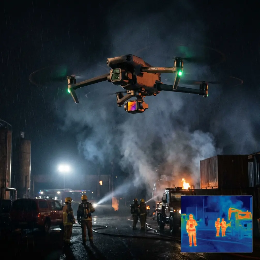
In deep cold, frost forms where you do not want it. In heat, dust and pollen cling to every forward-facing surface. In both cases, crews tend to focus on battery temperature and wind while overlooking the smaller failure points that quietly wreck data quality: dirty vision sensors, smeared lenses, and rushed flight planning. For a platform like Neo 2, especially when operators are leaning on obstacle avoidance, ActiveTrack, QuickShots, or automated capture modes in tree-dense environments, that oversight matters more than most people admit.
A useful way to think about Neo 2 in this setting is not as a toy-sized camera drone trying to survive rough conditions, but as a compact field instrument. And one of the clearest civilian workflow models for that mindset comes from an unlikely place: a rural land-rights confirmation solution published by Tianjin Tengyun Zhihang, a subsidiary of Hi-Target. The original material was about drone-based land rights work, not forests. Still, its sequence is highly relevant to anyone using Neo 2 to monitor woodland edges, regeneration plots, fire-scar recovery, access routes, or seasonal canopy change in punishing weather.
The reference process is remarkably disciplined. It starts with site reconnaissance and flight-route planning. Then it moves to aerial image collection using a fixed-wing iFly U3 equipped with a Sony A7r, capturing both high-resolution imagery and POS data. After that comes control-point layout and coordinate collection, aerial triangulation, production of high-resolution orthophotos, creation of detailed vector base maps, field parcel confirmation, and final archiving. That is an eight-step chain, and its value is not limited to land administration. It offers a strong blueprint for making Neo 2 useful in forest monitoring where repeatability matters more than cinematic spontaneity.
Why a land-rights mapping workflow fits forest monitoring
Forests in extreme temperatures are operationally unforgiving. You may have only a narrow weather window. Light changes quickly under cloud breaks. Snow cover can flatten visual contrast. Summer haze can reduce image clarity just enough to weaken tracking and visual positioning. If you are monitoring a stand boundary, checking storm damage, reviewing disease spread along access roads, or building a visual baseline for repeated site visits, your real challenge is not only getting footage. It is getting footage that can be compared, trusted, and reused.
That is where the land-confirmation workflow earns its relevance.
The source document places reconnaissance and route planning first, before any capture. In forest work, that translates directly. With Neo 2, route planning is not just about efficiency. It is a safety and data-consistency tool. In winter, you want to identify wind funnels created by ridgelines, open clearings that can serve as recovery zones, and sections of canopy with weak texture that may reduce the quality of autonomous visual features. In summer, you need to account for thermal shimmer over clearings, airborne debris, and the tendency of dense foliage to create sudden contrast shifts that can affect subject tracking and obstacle sensing.
That first step also informs whether the mission should prioritize manual passes, waypoint-like repeat passes if available in the workflow stack you use, or shorter segmented flights to preserve control in extreme conditions. The point is simple: a drone does not solve a poorly framed field problem. The survey does.
The pre-flight cleaning step that becomes a safety feature
Here is the field habit I wish more forest teams adopted before launching Neo 2 in heat or cold: clean the sensing surfaces before every mission leg, not just the camera lens.
That includes the main lens, but also the surfaces used by obstacle avoidance and visual positioning. In a forest, those systems are not luxuries. They are your margin when flying near branches, saplings, trunks, and uneven terrain. A light film of condensation, smoke residue, pollen, or dust can quietly reduce the confidence of the aircraft’s scene interpretation. In an open field you might get away with it. Under canopy edges, you may not.
The source material emphasizes a chain that depends on clean, high-resolution image acquisition and later software processing. That principle scales down perfectly to Neo 2. If your source frames are compromised, no amount of downstream editing, D-Log grading, or timeline trimming will restore missing detail. More critically, if forward or downward vision systems are partially obscured, your obstacle avoidance behavior may become less dependable precisely when branches and terrain are closest.
For extreme-temperature work, I recommend crews build cleaning into the checklist immediately after acclimatization. Do not wipe a freezing lens with whatever cloth is in your pocket. Let the aircraft stabilize, inspect for condensation, remove debris carefully, and verify that all vision sensors are clear. It sounds small. In practice, it directly affects both flight safety and the reliability of automated functions like ActiveTrack.
From iFly U3 and Sony A7r to Neo 2: what changes, what does not
The reference workflow uses a fixed-wing iFly U3 carrying a Sony A7r, then processes the imagery in Pix4Dmapper to generate a high-resolution orthophoto. Neo 2 is obviously not a fixed-wing survey aircraft, and nobody serious should pretend it is. The difference in payload, endurance, and survey architecture is real.
But the transferable lesson is not hardware parity. It is data discipline.
The iFly U3 setup in the source was used to gather high-resolution imagery plus POS data, then feed that into aerial triangulation and orthophoto production. For forest monitoring with Neo 2, the practical equivalent is to capture short, repeatable flight segments with deliberate overlap and stable altitude choices so that your outputs can be compared over time. You may not always be building a formal DOM from every mission, but the concept of a high-resolution orthographic record remains valuable. When you revisit a forest edge after snowmelt, drought stress, insect pressure, or stormfall, even a modestly structured image set is far more useful than disconnected clips grabbed from random headings.
This is where many teams misuse small drones. They rely on QuickShots because they are fast, or on subject tracking because it reduces pilot workload, but they fail to collect the boring reference passes that make longitudinal monitoring possible. QuickShots and Hyperlapse have their place. Hyperlapse can document movement along a corridor or show change around a tower access route through woodland in a visually efficient way. QuickShots can communicate terrain context to nontechnical stakeholders. Yet neither should replace the core evidence-gathering pass.
The land-rights document gets this right by separating capture from interpretation. First you obtain the imagery properly. Then you process it. Then you use it to confirm conditions in the field. That order matters.
Orthophoto thinking is useful even when you are not producing formal deliverables
One of the strongest details in the reference set is its explanation of DOM, or digital orthophoto mapping. The document describes orthophotos as a modern digital mapping product that can update line-map data, improve timeliness, accelerate topographic updates, and serve directly as a GIS background layer. That is not abstract mapping language. It is an operational argument for why image geometry matters.
For forest monitoring with Neo 2, orthophoto thinking changes how you fly.
Instead of treating every mission as content capture, you fly to preserve spatial truth. That means more nadir and near-nadir imaging over target areas, more attention to overlap, and less temptation to chase dramatic oblique angles unless they support a specific inspection question. If your team later needs to compare skid trail expansion, drainage changes, encroachment near a forest parcel, or post-event canopy gaps, a map-like image base is often more valuable than spectacular footage.
This is especially relevant if your monitoring work connects to land use, boundary interpretation, habitat restoration, or reporting into a GIS workflow. The source notes that orthophotos can function as direct background layers in geographic information systems. That detail matters operationally because it bridges field capture and decision-making. A Neo 2 mission that produces visually clean, spatially coherent imagery can support not only pilot observations but also office-based review, annotations, and repeat planning.
Large-scale mapping logic, scaled down for woodland teams
The source also references large-scale topographic map production in the 1:500 to 1:5000 range, with applications in planning, land management, industrial design, and engineering. On paper, that sounds distant from a compact drone in a forest. It is not.
What that range really signals is the value of detail. In practical terms, it means seeing enough to make decisions about boundaries, features, and surface conditions. Forest operations often need exactly that level of practical detail around roads, culverts, creek crossings, nursery plots, or planting blocks. Neo 2 is well suited to rapid localized documentation when crews apply mapping logic rather than casual flying habits.
A smart field team might use Neo 2 to do three things in one site visit:
- Capture a consistent overview pass of the monitoring area.
- Use ActiveTrack selectively for moving field staff along a marked path, so office reviewers can see route condition and canopy density in context.
- Record short D-Log clips of specific problem areas where tonal flexibility will help later interpretation, especially in high-contrast snow-shadow or bright summer canopy situations.
That is not overcomplication. It is role separation. The overview pass builds the record. The tracked segment adds human-scale context. The D-Log clips preserve detail where lighting is difficult.
A case-study mindset for extreme-temperature forests
Imagine a team revisiting a forest tract after a stretch of severe cold followed by thaw. Their task is not cadastral certification, but monitoring drainage disruption, windthrow pockets, and access-route condition near parcel edges. They arrive early. Before launch, they walk the tract boundary and identify a safe launch zone clear of overhead limbs. They note where the canopy opens and where visual contrast may be poor over snow.
Then they do the least glamorous thing on the checklist: they clean Neo 2’s camera and obstacle-sensing surfaces carefully, checking for haze from temperature transition. That one act supports both imagery quality and flight safety.
The first flight is not cinematic. It is structured. They maintain repeatable headings and altitudes over the priority zone to create an image sequence that can be compared with prior visits. The second flight uses controlled oblique angles to inspect wind-damaged edges and drainage lines. Only after that do they run a short contextual segment for stakeholders, perhaps using a measured automated move or a Hyperlapse to show route continuity through the site.
Back in the office, the team is not guessing what changed. They have a coherent image set. If needed, they can align observations against previous captures, annotate them against a base layer, and feed the results into planning.
That entire logic chain is visible in the reference material, even though the original use case was rural land-rights work. Reconnaissance. Planned acquisition. Organized data handling. Processed imagery. Field confirmation. Archive. Neo 2 benefits from exactly the same discipline.
Where to be careful with automation
Forest monitoring can tempt operators into overtrusting intelligent features. Neo 2’s subject tracking and automated modes can save time, but wooded environments punish assumptions. Branches, thin twigs, trunks with low contrast, and cluttered backgrounds can all degrade the margin for error. Extreme temperatures add another variable, because condensation, glare, or dust can reduce sensor confidence.
That is why the pre-flight cleaning step belongs in the same sentence as obstacle avoidance. It is not maintenance theater. It is part of how you preserve system awareness.
Automation works best after the operator has already completed the reconnaissance mindset described in the source workflow. Know the area first. Plan the route. Understand the terrain. Then use the feature. Not the other way around.
The bigger lesson from the source material
The most valuable thing in the reference documents is not a piece of hardware. It is a sequence.
The source describes an eight-step process beginning with field reconnaissance and ending with organized archival of final outputs. It also specifies a capture stack built around iFly U3, a Sony A7r, POS data, and Pix4Dmapper-generated orthophotos. Those details matter because they show that reliable UAV work is procedural before it is visual. For Neo 2 operators working in extreme-temperature forests, that same discipline is the difference between “we flew the site” and “we generated usable evidence.”
If you treat Neo 2 as a compact sensor platform and borrow the strongest habits from formal mapping practice, it becomes much more than a convenience drone. It becomes a repeatable monitoring tool.
If you want to compare field workflows for woodland monitoring, this direct line is often the fastest way to discuss real deployment details: message our UAV team on WhatsApp.
And if you only take one operational idea from this case study, make it this: before every cold or hot forest mission, clean the lens and the obstacle-sensing surfaces, then fly the boring pass first. The dramatic shots can wait. Good records should not.
Ready for your own Neo 2? Contact our team for expert consultation.