Neo 2 for Coastline Monitoring: A Field Case Study
Neo 2 for Coastline Monitoring: A Field Case Study in Stable Sensing, Low-Altitude Control, and Cleaner Data
META: A practical case study on using Neo 2 for coastline monitoring, with expert analysis of vibration control, fused altitude sensing, GPS and optical flow positioning, and why these details matter in real coastal operations.
Coastline monitoring sounds straightforward until you actually fly the mission.
Salt haze softens contrast. Wind changes by the minute. Wet sand, rock edges, foam lines, and tidal pools all create a scene that looks visually simple but is hard on a drone’s control system. For a platform like Neo 2, the difference between usable survey footage and noisy, inconsistent data often comes down to one thing: how well the aircraft handles sensor uncertainty while staying stable near the ground.
That is the real story here.
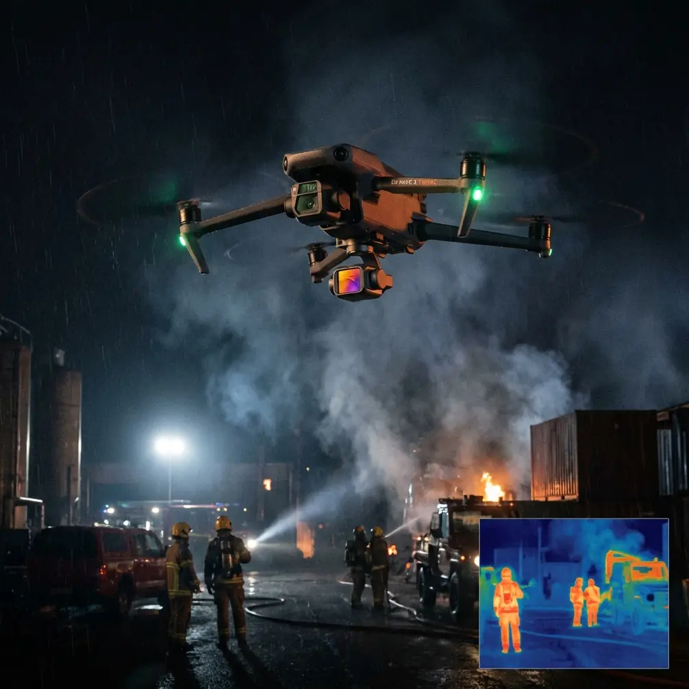
A useful technical reference from a hexacopter design paper highlights a problem many marketing pages skip over: on rotorcraft, the motors and propellers become a major vibration source, and that vibration directly contaminates attitude sensors, especially the gyroscope and accelerometer. In static conditions, the gyroscope, accelerometer, and magnetometer may all show relatively low noise. Once the rotors spin up, the environment changes. For a coastal monitoring team flying Neo 2 along dunes, seawalls, estuaries, or intertidal zones, that matters more than almost any flashy flight mode.
Why? Because every higher-level feature depends on clean lower-level sensing.
If Neo 2 is being used to track shoreline retreat, document erosion after a storm, or repeat the same transect at low altitude, the aircraft has to maintain attitude with confidence. A drift in attitude estimate does not just affect “feel.” It changes framing, degrades repeatability, and can make automated capture features less reliable when the drone is working close to terrain or over moving water.
The Coastal Mission Profile: Why Stability Beats Hype
Let’s look at a realistic operation.
A coastal engineering consultant needs weekly visual documentation of a beach section and nearby rock revetment. The goal is not cinematic content for its own sake. The team wants consistent low-altitude imagery that can reveal changes in sand berm shape, debris accumulation, and signs of washout near access paths. Some sections are flown offshore for oblique views. Others are captured inland at very low level where GPS can be less clean near structures, vegetation, or steep embankments.
This is exactly where Neo 2 has to outperform simpler drones that may advertise smart tracking or quick automated shots but do not hold position and attitude as cleanly in mixed sensing conditions.
The reference material describes a control architecture with three linked layers: attitude control, position control, and altitude control. That sounds academic until you map it to a coastline workflow.
- The attitude loop takes target attitude angles and outputs control actions that directly affect motor speed.
- The position loop uses GPS and optical flow to determine position and speed, then converts that into target velocity and eventually target attitude.
- The altitude loop fuses GPS, ultrasonic ranging, accelerometer data, and barometric data to generate a more trustworthy height estimate.
That layered logic is exactly what a practical shoreline mission needs. Not because the operator cares about equations in the field, but because coastal environments constantly stress every one of those assumptions.
Vibration Is Not a Small Detail
The most operationally important detail from the source is the emphasis on sensor vibration isolation and filtering.
On a rotor drone, motors and propellers create a strong vibration source. The paper specifically points out that this can push noise levels much higher for the gyroscope and accelerometer. In a coastline scenario, that has several consequences.
First, unstable attitude sensing can produce small but persistent framing errors. If you are documenting a dune face every week from the same offset, tiny angular inconsistencies can make before-and-after comparisons less reliable. The footage may still look fine casually, yet the dataset becomes weaker for actual interpretation.
Second, vibration noise can interfere with low-altitude automation. Neo 2 features such as ActiveTrack, subject tracking, QuickShots, or Hyperlapse only work well when the aircraft’s core stabilization remains predictable. Along a shoreline, the “subject” may be a surveyor on foot, an inspection route along a sea wall, or a moving boat inside a calm harbor. Competitor drones often look similar in spec sheets, but if their low-level filtering is less mature, tracking behavior starts to wobble where wind, glare, and constant micro-corrections stack up.
Third, poor vibration handling can propagate into altitude estimation, because the accelerometer is a key part of vertical state awareness. The reference notes that accelerometer output can become noisy due to body vibration, yet it still offers high dynamic response and sensitivity. That tradeoff is crucial. In practical terms, Neo 2 should not rely on accelerometer data in isolation. It should exploit it where it is strongest: filling in fast changes between slower sensor updates.
That is not a glamorous feature, but it is a meaningful one.
Why the “10Hz” Detail Matters More Than It Looks
One of the most revealing facts in the source is the mention of low-frequency ultrasonic data at 10Hz. The paper explains that accelerometer data, despite its noise, can be used to interpolate between these slower measurements so the system retains high dynamic output characteristics.
For a coastline operator, this is gold.
Imagine Neo 2 flying a low pass over a beach access stairway, then transitioning toward open sand at a modest height. Ultrasonic sensing may provide excellent short-range distance precision, but it updates relatively slowly and only works well within limited range. If the drone depended only on that 10Hz measurement, altitude response could feel stepwise or delayed during subtle changes in terrain or over uneven surfaces.
By using a higher-dynamic accelerometer to bridge those gaps, the aircraft can respond more fluidly. The practical result is steadier height behavior during low-level work. That improves image consistency, reduces abrupt throttle behavior, and helps maintain cleaner footage for shoreline comparison.
This is also where Neo 2 can excel against drones that lean heavily on a single sensor mode. Coastal monitoring rarely gives you one perfect measurement source. Sand reflects differently than rock. Sea spray affects optical clarity. Wind gusts alter pressure. The best-performing aircraft is usually the one that fuses imperfect inputs intelligently rather than betting everything on one “hero” sensor.
GPS Outside, Optical Flow Down Low
Another source detail with direct operational value: GPS is used mainly for outdoor position control, while optical flow is used mainly indoors or for outdoor low-altitude flight.
That split makes immediate sense for coastline work.
Most shoreline mapping flights begin outdoors in open sky, where GPS provides the broad positional frame. But not every useful mission is high and wide. Some of the most valuable monitoring happens low and close: along retaining walls, over boardwalk edges, near tidal inlets, or around coastal facilities where precise local holding matters more than broad navigation.
At low altitude, optical flow can become especially useful because it observes movement relative to the surface below. If Neo 2 is following a repeat path over a textured beach or compact rock platform, that local sensing can support smoother control than GPS alone. Competitors often advertise obstacle avoidance and tracking as headline features, but in real shoreline operations, low-altitude positional discipline is often the bigger differentiator.
This also influences how features such as QuickShots or ActiveTrack should be used professionally. For recreational users, those modes are often about style. For a coastal monitoring team, they can become repeatable capture tools—if the aircraft’s local position control is solid. A tracking pass following an inspector on a dune line is only useful if the drone does not wander laterally in gusts or bob in altitude over variable ground texture.
Height Control Over Water and Sand Is a Sensor Fusion Problem
Coastlines expose the weakness of single-source altitude estimation.
The reference describes a fused height solution built from GPS, ultrasonic ranging, accelerometer, and barometer data. Each has a different role:
- Ultrasonic sensing offers excellent short-range distance precision.
- Barometric sensing provides strong relative height information but can drift and react to temperature changes or gusts.
- GPS offers limited height precision, but its absolute reference remains valuable.
- The accelerometer reacts quickly, though it is noisy under vibration.
That balance is exactly what matters over mixed coastal terrain.
Over a sheltered dune path, ultrasonic may be highly useful. Over open beach with changing surface reflectivity and wave wash nearby, barometric and inertial behavior become more relevant. When temperature shifts and sea breeze gusts start affecting pressure readings, GPS can help prevent long-term vertical bias from creeping too far. No single input is enough. The fused result is what gives the operator confidence.
This matters not just for safe handling but for data quality. If Neo 2 is capturing D-Log footage for later tonal matching across multiple site visits, stable height and attitude help preserve consistency in composition and exposure decisions. Hyperlapse sequences along a coast also benefit from predictable vertical control; otherwise the final motion path feels uneven and less usable for change visualization.
A Practical Neo 2 Workflow for Coastal Teams
In the field, the strongest Neo 2 workflow is rarely the most complex one.
Start with a broad GPS-based pass for context. This creates the site overview: dune toe, shoreline edge, hard structures, and access routes. Then move into lower-altitude legs where optical flow can support finer local control. For short-range height-critical segments—say, tracking erosion at the base of a sea wall—treat the mission as a fused-sensor exercise, not a manual “eyeball it” flight.
Obstacle avoidance also earns its keep here, not as a buzzword, but as a practical layer when working near signposts, railings, rocky outcrops, or coastal vegetation. Subject tracking and ActiveTrack can be useful if a surveyor or site manager needs to walk the area while narrating observations. The key is to deploy those modes on top of stable core sensing, not instead of it.
This is where Neo 2 can pull ahead of less balanced platforms. Some competitors are tuned to impress in ideal conditions. Coastlines are rarely ideal. The better aircraft is the one that remains composed when the wind shifts, the ground texture changes, and different sensors take turns being the most trustworthy source of truth.
If your team is planning a shoreline monitoring setup and wants to talk through sensor behavior, low-altitude route design, or repeatable capture strategy, you can message a coastal drone workflow specialist here.
What the Reference Really Tells Us About Neo 2
The deepest lesson from the source material is simple: good drone performance starts long before the camera records anything.
Attitude estimation built from gyroscope, accelerometer, and magnetometer data only works well when vibration is managed. Position control becomes more dependable when GPS and optical flow are assigned roles that fit their strengths. Altitude control improves when short-range precision, absolute reference, relative pressure sensing, and fast inertial response are fused instead of treated as rivals.
For coastline monitoring, those are not engineering footnotes. They are the operating foundation.
A drone flying over beaches and sea-adjacent infrastructure has to deal with gusts, spray, uneven visual texture, and frequent low-altitude transitions. Neo 2’s value in that setting is not just that it offers modern tools like QuickShots, Hyperlapse, D-Log, obstacle avoidance, and ActiveTrack. It is that those tools become more useful when the aircraft beneath them is controlling attitude, position, and height in a disciplined way.
That is also why the source’s technical details remain so relevant. The mention of rotor-induced vibration affecting gyroscopes and accelerometers is a direct reminder that stabilization is never free. The note about accelerometer-assisted interpolation of 10Hz ultrasonic data reveals how a drone can feel smooth and responsive even when one key sensor updates relatively slowly. And the separation between GPS for outdoor positioning and optical flow for indoor or low-altitude control maps neatly to the exact demands of shoreline work.
For teams monitoring coastlines, that combination is what turns Neo 2 from a flying camera into a repeatable observation tool.
Ready for your own Neo 2? Contact our team for expert consultation.