Neo 2 for Remote Coastline Monitoring: Practical Flight
Neo 2 for Remote Coastline Monitoring: Practical Flight Habits That Protect Data and Aircraft
META: A practical Neo 2 tutorial for remote coastline monitoring, covering pre-flight cleaning, obstacle avoidance, ActiveTrack, QuickShots, Hyperlapse, D-Log, and safer mission planning in harsh marine conditions.
Remote coastline work looks simple until you actually do it.
On paper, it is just a drone, a beach, and a flight path. In the field, salt mist coats sensors, wind shifts around cliffs, wet sand confuses depth perception, and long empty stretches make it tempting to trust automation more than you should. If you are using a Neo 2 for shoreline observation, habitat checks, erosion documentation, or infrastructure review in isolated coastal zones, the quality of your results depends less on flashy flight modes and more on disciplined setup.
This tutorial is built around that reality.
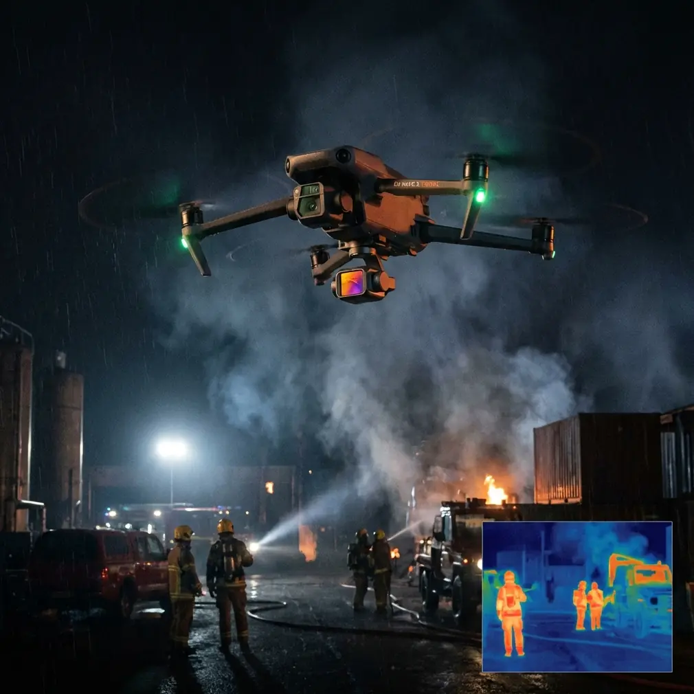
The Neo 2 is attractive for remote coastal monitoring because it combines lightweight portability with modern automation features such as obstacle avoidance, subject tracking, QuickShots, Hyperlapse capture, D-Log, and ActiveTrack. Those tools can help a solo operator document a lot of shoreline fast. They can also create false confidence if you skip the basic habits that keep sensors accurate and footage usable.
The most overlooked habit is also one of the simplest: clean the aircraft before every flight, especially the vision and obstacle sensing surfaces.
Start with the pre-flight cleaning step most pilots rush past
Coastal air is hostile to drones. Salt particles, fine sand, humidity, and spray do not need to be visible to create problems. A light film over forward or downward sensors can reduce the reliability of obstacle avoidance and positioning behavior. On a rocky coastline or around driftwood, fencing, signs, and uneven terrain, that matters immediately.
Before powering up the Neo 2, inspect and gently clean:
- Obstacle sensing windows
- Downward vision sensors
- Camera lens
- Gimbal housing edges
- Battery contacts
- Motor vents and arm joints
Use a clean microfiber cloth first. If the residue is stubborn, a lens-safe cleaning method is the right move, but avoid turning a quick wipe into a wet cleaning session in the field. The goal is not cosmetic perfection. The goal is restoring the sensor clarity that automated safety functions depend on.
Operationally, this is a bigger deal than many pilots realize. Obstacle avoidance is only as good as the sensor data feeding it. ActiveTrack and subject tracking also benefit from a clean lens and stable visual input, especially when your subject is moving against a high-glare background like surf or reflective wet sand. A few seconds of cleaning can be the difference between smooth autonomous behavior and a flight that feels erratic for reasons that are hard to diagnose on site.
If you are deploying at multiple coastal points in one day, repeat this check between flights. Salt accumulates fast.
Define the mission before picking the mode
Remote shoreline work usually falls into one of four civilian monitoring patterns:
Linear shoreline documentation
Useful for erosion comparison, vegetation edge monitoring, or storm impact review.Fixed-point repeat observation
Best for comparing the same bluff, seawall, path, estuary edge, or outfall over time.Moving subject observation
Typical for following field staff, small boats in permitted civilian work zones, or maintenance teams.Visual storytelling for stakeholders
Needed when local authorities, researchers, resort operators, or conservation groups need a readable visual summary rather than raw inspection imagery.
The Neo 2’s feature set supports all four, but each requires different discipline.
If you just launch and improvise, you will probably come back with plenty of footage and not enough usable evidence.
For coastline baselining, keep the aircraft behavior boring
The best monitoring flights are often the least cinematic.
When your goal is comparison over time, use conservative speed, consistent altitude, and repeatable framing. Resist the urge to weave, orbit, and dip unless the mission specifically calls for it. A shoreline record only becomes valuable if you can compare one flight to the next without visual chaos getting in the way.
For repeat documentation:
- Launch from the same safe location when possible
- Fly a similar line each visit
- Keep camera angle consistent
- Avoid abrupt yaw inputs
- Note tide state, wind direction, and sun position
This is where D-Log becomes useful. Not because it sounds advanced, but because coastal lighting is brutal. White foam, dark rock, reflective water, and hazy sky can exist in the same frame. D-Log gives you more flexibility when balancing highlights and shadows later, which is especially helpful if the footage may support environmental review or infrastructure reporting. If one flight is captured under flat morning light and the next under harsh midday reflection, a flatter profile can help normalize your output in post.
That does not mean every operator should default to heavy grading. It means your recording choice should support comparison, not just immediate social-ready color.
Obstacle avoidance near cliffs and dune edges: useful, not magical
Obstacle avoidance is one of the Neo 2’s most practical features for coastal work, but marine terrain exposes its limits.
Cliff edges create shifting backgrounds. Sparse branches, wire fencing, and narrow signposts are not always presented cleanly to a small drone’s sensing system. Bright sky behind rock faces can also reduce contrast. Add sea wind and the aircraft may drift while your attention is on framing.
So yes, use obstacle avoidance. Just do not fly like it absolves you from route planning.
A better workflow is:
- Walk the launch area first
- Identify vertical hazards like poles, dead trees, railings, and cable runs
- Keep extra lateral distance from cliff walls
- Climb before translating when leaving a constrained area
- Avoid relying on automated side clearance near irregular rock formations
This matters because remote coastlines are often deceptive. Open space over water makes pilots feel safe, but the transition zone between land and sea is where most surprises live. The Neo 2 can help reduce mistakes, yet the aircraft performs best when the pilot has already chosen a clean corridor.
ActiveTrack and subject tracking are strongest when the subject is predictable
If your monitoring task involves a moving person or vehicle, ActiveTrack and subject tracking can reduce workload. That is useful when one operator needs to document a surveyor walking a beach line, a maintenance worker checking coastal barriers, or a field team moving between inspection points.
But coastal backgrounds are complicated. Breaking waves, reflective surfaces, beachgoers, birds, and shifting shadows can all compete visually.
To improve tracking reliability:
- Start tracking with strong separation between subject and background
- Avoid crossing directly over highly reflective water during lock-on
- Keep subject size in frame moderate and stable
- Give the system a clear initial view before adding speed or directional changes
The operational significance here is straightforward: tracking tools are not just convenience features. On a remote shoreline, they allow a small crew to gather more consistent observational footage without constantly dividing attention between piloting and framing. That can reduce fatigue and improve repeatability over a long field day.
Still, if your subject is moving close to cliffs, under overhangs, or near loose obstacles, manual control should take priority.
QuickShots are not just for style if you use them with intent
QuickShots tend to be dismissed as novelty functions, but they can serve a real purpose during coastline monitoring.
A well-chosen automated reveal can provide context that ordinary linear passes miss. For example, a brief pullback or elevated establishing movement can show how a damaged access path relates to a seawall, or how dune erosion connects to nearby vegetation loss. That kind of overview is valuable for people reviewing the footage later who were not present on site.
The key is restraint.
Use QuickShots to create one or two contextual clips per location, not to replace your documentation workflow. If every shot is automated and dramatic, your dataset becomes harder to use for actual monitoring. If one QuickShot complements a structured survey pass, it can make the final report clearer.
Hyperlapse has a niche role in shoreline change and site activity
Hyperlapse is another feature that sounds creative-first but has practical field value when used carefully.
For civilian coastline projects, Hyperlapse can help show:
- Tidal movement across a fixed area
- Visitor flow near a coastal access point
- Cloud shadow changes affecting visibility
- Activity around a maintenance or restoration site
It is not a substitute for mapping or formal survey methods. It is a communication layer. When stakeholders need to understand how a place changes over a few hours, a Hyperlapse can explain site dynamics far faster than static images.
Just make sure the aircraft is positioned conservatively, with strong clearance and stable environmental conditions. Coastal wind can turn a long capture into a battery-wasting struggle if you choose a marginal hover position.
The camera setup should match the decision you need to support
This is where many drone missions quietly fail. The pilot captures “good footage” but not the right footage.
Ask one question before takeoff: what decision will this flight help someone make?
If the answer is “assess erosion progression,” prioritize consistent angle and repeatability.
If the answer is “show the condition of a remote shoreline path after weather damage,” use wider context plus medium-detail passes.
If the answer is “help a conservation group communicate habitat pressure,” combine stable observation footage with a few broader establishing clips.
This is also where D-Log earns its place again. In mixed coastal light, preserving image flexibility can mean the difference between visible texture in a sandbank and a blown-out patch of brightness. Even if you are not doing heavy color work, preserving tonal headroom helps when footage will be reviewed later for details you did not notice in the field.
Build a safer launch and recovery routine for isolated sites
Remote coastlines rarely offer ideal takeoff zones. You may have damp ground, loose sand, scrub vegetation, or uneven rock. That makes launch and recovery discipline much more important than at a paved site.
A practical routine:
- Choose a stable patch away from blowing sand.
- Face the aircraft into the cleaner departure corridor.
- Recheck sensor surfaces and lens.
- Confirm enough vertical clearance for immediate climb-out.
- Watch for birds before takeoff.
- After landing, inspect for salt, sand, and moisture before packing.
That final step matters. Packing a drone with salt residue still on the body is how minor contamination becomes a recurring reliability problem across future flights.
What a smart coastline mission with Neo 2 actually looks like
A strong remote monitoring session often follows this sequence:
- Clean and inspect the Neo 2 before power-up
- Record environmental notes: wind, tide, visibility, sun angle
- Capture one broad establishing shot
- Fly a repeatable shoreline line for baseline footage
- Use obstacle avoidance conservatively near terrain transitions
- Add one or two context clips with QuickShots if helpful
- Use ActiveTrack only where subject movement is predictable and space is clean
- Consider a Hyperlapse if site change over time is relevant
- Land, inspect, clean, and log any anomalies
Nothing about that sequence is flashy. That is why it works.
A final field note from experience
Remote shoreline flying punishes haste. The drone may be compact, the interface may feel friendly, and the smart modes may seem capable enough to carry the workload. But in coastal environments, small lapses stack up fast: one dirty sensor, one careless launch point, one overconfident tracking attempt near an irregular cliff edge.
The Neo 2 is at its best when you treat its intelligent functions as force multipliers, not substitutes for judgment.
If you want to compare workflows for your own coastline operations or discuss practical deployment setups, you can message Chris Park directly here.
The best habit to take from this guide is still the simplest one: clean the aircraft before every flight. It protects obstacle avoidance, supports more reliable subject tracking, improves image quality, and gives every other feature on the Neo 2 a fair chance to do its job.
That is not glamorous. It is just what serious field work looks like.
Ready for your own Neo 2? Contact our team for expert consultation.