Monitoring Coastlines in Extreme Temperatures With Neo 2
Monitoring Coastlines in Extreme Temperatures With Neo 2: What Actually Matters in the Field
META: A practical expert guide to using Neo 2 for coastline monitoring in extreme temperatures, with real-world advice on obstacle avoidance, ActiveTrack, D-Log, QuickShots, and mid-flight weather changes.
Coastline monitoring sounds straightforward until you are standing on a cold bluff with salt spray on your lenses, gusts shifting every few minutes, and a tide line that needs to be documented before the light goes flat. This is where a small drone either becomes a serious field tool or a liability.
For operators considering Neo 2 for shoreline work, the real question is not whether it can fly. Most modern drones can get airborne and capture attractive footage in easy conditions. The better question is whether it can stay useful when the environment stops cooperating. Coastlines are messy. Wind rebounds off rocks and buildings. Light changes fast. Wet sand, white foam, dark water, and reflective surfaces can confuse exposure and tracking. Temperature swings add another layer, especially when a flight starts in stable air and ends in something much less predictable.
That is the context where Neo 2 earns attention. Not because of one flashy feature, but because several flight and imaging tools work together in ways that matter for inspection, observation, and repeatable monitoring.
The actual problem: coastlines are unstable working environments
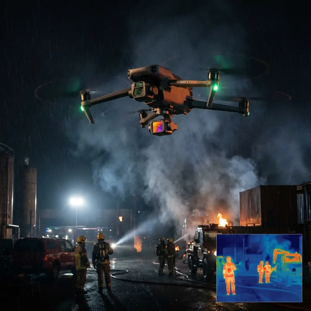
A shoreline is never one thing for very long. The same stretch of coast can present flat light, glare, crosswind, haze, and airborne moisture within a single battery cycle. In colder conditions, battery performance and responsiveness become more important. In hotter conditions, thermal stress and heat shimmer can complicate imaging and route discipline. Add cliffs, driftwood, access paths, sea walls, boats, and moving people, and the mission quickly stops looking like a recreational flight.
For environmental teams, property managers, search support volunteers, and content crews documenting erosion or storm impact, the challenge is usually a mix of three operational demands:
- Hold a stable route over uneven terrain and moving air.
- Maintain subject awareness near obstacles and clutter.
- Capture footage that can still be graded, reviewed, and compared later.
Neo 2 stands out when you approach it as a monitoring platform rather than a toy. Features like obstacle avoidance, subject tracking, ActiveTrack, D-Log, QuickShots, and Hyperlapse are often marketed as convenience tools. On the coast, they become workflow tools. That distinction matters.
Why obstacle avoidance matters more on the coast than in open fields
Obstacle avoidance is easy to dismiss until the environment becomes visually chaotic. On a beach or seawall route, the drone may pass near railings, rock outcrops, lamp posts, moored vessels, or wind-bent trees. Unlike a controlled inland field, the coastline creates irregular approach angles and hidden hazards, especially when the operator is repositioning to keep a breaking surf line or inspection target in frame.
Operationally, obstacle avoidance reduces the mental burden during low-altitude path adjustments. That does not replace pilot judgment. It does make it easier to fly precise routes while keeping more attention on mission purpose. If you are documenting coastal erosion, for example, you are often trying to keep a consistent lateral distance from a bluff edge or revetment. A small correction made under pressure can turn into a close pass near an unexpected protrusion. Obstacle sensing buys time. On the shoreline, time is the difference between clean data and a rushed recovery.
It also becomes more relevant when weather shifts mid-flight.
I have seen this play out in a familiar way. The mission starts with a stable onshore breeze and clean visibility. Ten minutes later, a colder band of air pushes in off the water, the wind angle changes, and the drone begins making more frequent micro-corrections than it was during the outbound leg. This is the moment when an aircraft’s supporting systems need to be predictable. Neo 2’s obstacle avoidance is not just there for beginners. In a coastal scenario, it acts like a safety buffer while the pilot recalibrates route, altitude, and return line under changing conditions.
Mid-flight weather changes are where discipline and automation meet
The user scenario here is extreme temperatures, but temperature stress rarely arrives alone. It usually brings secondary effects: wind shift, atmospheric haze, spray, or changing contrast across land and water. That is why mid-flight weather changes deserve more attention than spec-sheet bragging.
When conditions deteriorate halfway through a monitoring pass, the best response is usually not dramatic. It is methodical. Shorten the route. Increase standoff distance. Simplify the camera move. Preserve enough battery margin to avoid a rushed return. Neo 2 supports this style of flying because its intelligent flight aids can absorb some of the workload without taking control away from the operator.
ActiveTrack and subject tracking are a good example. Many people think of these as content features for athletes or moving vehicles. Along the coast, they can be useful for consistent observation of a moving patrol vehicle, a survey walker, or a boat operating parallel to shore. The operational value is repeatability. If weather starts changing and manual framing becomes harder, tracking tools help maintain composition while the pilot prioritizes safe positioning.
That matters more than it sounds. In practical coastal work, every extra manual adjustment increases workload at exactly the moment environmental conditions are becoming less forgiving.
D-Log is not a luxury for shoreline footage
If your goal is only social media clips, standard color can be enough. If your goal is meaningful monitoring, D-Log deserves attention.
Coastal scenes are high-contrast by nature. White foam, dark rock, reflective water, and bright cloud breaks can all exist in one frame. That creates exposure problems fast, especially when the weather changes during flight. D-Log gives more flexibility in handling highlights and shadows later, which is critical if you need footage that remains readable rather than merely attractive.
This is one of the most practical distinctions for professionals. A flat profile is not about style. It is about preserving information. If a cloud bank suddenly dims the shoreline while the sea still reflects harsh brightness, footage captured with more post-processing latitude can be normalized more effectively across the sequence. That helps when comparing the same section of coast over time.
For erosion monitoring, storm aftermath reviews, or habitat observation, consistency matters. A nice-looking clip is useful. A gradeable clip that preserves detail in both surf and cliff face is better.
QuickShots and Hyperlapse are not just creative extras
On paper, QuickShots and Hyperlapse look like features for polished content production. In the field, they can also support clearer documentation.
QuickShots help when you need repeatable, structured reveal movements around a feature such as a breakwater, jetty, lighthouse access path, or damaged shoreline section. The value is not novelty. It is the ability to produce a smooth, predictable visual reference that can be compared across multiple site visits. When different operators return to the same area, repeatable automated patterns can improve visual consistency.
Hyperlapse is especially useful for coastline work because shorelines are temporal systems. Tides rise, shadows move, weather fronts arrive, and human activity changes the scene. A compressed time view can show how a stretch of coast behaves over an hour without requiring continuous manual operation. For marsh edges, harbor entrances, flood-prone paths, or wave impact on retaining structures, a well-planned Hyperlapse can reveal patterns that a standard clip hides.
Used carelessly, these modes are gimmicks. Used with purpose, they become observational tools.
Subject tracking is only useful if you understand its limits
Neo 2’s subject tracking can be genuinely helpful in coastal missions, but only when used with clear expectations. Tracking works best as an assistant, not as a substitute for route planning.
On a beach with scattered people, dogs, birds, surfcraft, and reflective water, visual complexity can challenge any automated system. The smart move is to use tracking in sections where the subject is distinct and the background is manageable. A shoreline inspector in a high-visibility jacket walking a clear access path is one thing. A small kayak blending into whitewater near rocks is another.
That said, when the target is suitable, tracking reduces framing drift and frees up attention for altitude, wind, and obstacle spacing. This is especially valuable when cold conditions affect dexterity. Anyone who has flown in biting wind knows that fine stick inputs can become less comfortable over time. Automation that reduces unnecessary input load has real operational value.
A field scenario: when the weather flipped halfway through
Picture a late afternoon inspection run along a rocky section of coast. The air is cold enough to keep everyone moving, but visibility is initially good. The plan is simple: document a vulnerable sea wall, capture the surf line at mid-tide, and get a few higher-angle passes showing access erosion near the path above the bluff.
Neo 2 launches cleanly. The first leg is manual, low and parallel to the sea wall. Obstacle avoidance helps while the drone moves near uneven rock formations and poles along the top edge. The operator switches to D-Log because the sunlight is bouncing unpredictably between water and stone. Exposure stays conservative to protect highlights in the foam.
Then the weather changes.
A darker cloud layer moves in much faster than expected. The wind turns awkward, no longer cleanly onshore, and begins pushing from the side. The water loses sparkle and becomes a darker, flatter mass. At the same time, the bluff path becomes the brighter part of the frame. This is where casual flying falls apart. The original route no longer makes sense.
Instead of trying to force the full mission, the operator shortens the pattern, uses ActiveTrack briefly on a surveyor walking the upper path, and captures a stable comparative pass that ties the sea wall damage to the access route above it. The drone’s automated support reduces workload while the pilot focuses on spacing, wind correction, and battery reserve. A short Hyperlapse from a safer standoff position records the incoming weather front and wave pattern change over the next several minutes.
The result is not dramatic footage for its own sake. It is better evidence. The mission adapts because the aircraft’s tools support adaptation.
How to get more from Neo 2 on a cold or hot coastal day
Extreme temperatures expose sloppy workflow. Neo 2 performs better when the operator respects the environment and uses the aircraft’s strengths deliberately.
Start with route simplicity. Do not overbuild your first mission. Coastline work rewards clean, repeatable flight lines far more than ambitious cinematic wandering. If you need multiple outputs, prioritize the monitoring pass first and the creative pass second.
Use obstacle avoidance as a guardrail, not an invitation to fly recklessly near structures. Keep margin. Saltwater environments punish overconfidence.
Choose D-Log when scene contrast is high or changing. It gives you a better chance of maintaining useful visual information across a flight where the light refuses to stay consistent.
Reserve ActiveTrack and subject tracking for segments where they genuinely reduce workload. They are most valuable when they help you preserve composition during a weather shift or while coordinating with a moving team member on the ground.
Use QuickShots and Hyperlapse with a monitoring objective in mind. If a mode helps standardize repeat visits or reveal timing changes in the environment, it belongs in the toolkit.
Most importantly, be ready to change the mission halfway through. That is not failure. That is competent field operation.
Why Neo 2 makes sense for this specific use case
For coastline monitoring in extreme temperatures, the appeal of Neo 2 is not raw spectacle. It is that several practical features align with the realities of the job.
Obstacle avoidance supports low-altitude route discipline near irregular shoreline hazards. ActiveTrack and subject tracking help stabilize observation of moving people or vehicles when manual workload rises. D-Log improves footage usability when sea, sky, and land all fight for exposure at once. QuickShots and Hyperlapse can support repeatable documentation rather than just polished presentation.
That combination is what makes the platform interesting for this scenario. Coastline monitoring demands adaptability more than perfection. The aircraft needs to remain useful when the environment changes mid-flight, because it usually will.
If you are building a Neo 2 workflow for shoreline missions and want to compare route ideas or camera settings, you can message us here and continue the conversation in a practical, field-focused way.
The best coastal drone operations are rarely the most dramatic. They are the ones that come back with usable data, stable footage, and enough consistency to make the next flight even better. Neo 2 fits that philosophy when it is flown with intention.
Ready for your own Neo 2? Contact our team for expert consultation.