Neo 2 Best Practices for Wildlife Mapping in Extreme Tempera
Neo 2 Best Practices for Wildlife Mapping in Extreme Temperatures
META: A field-tested Neo 2 tutorial for wildlife mapping in harsh temperatures, with practical guidance on tracking, flight planning, communication resilience, and why temporary aerial networking matters in remote surveys.
I’ve had wildlife mapping days that fell apart before the first clean data pass.
Not because the aircraft couldn’t fly. Not because the camera wasn’t good enough. The real failure point was coordination. In remote terrain, especially in punishing heat or bitter cold, the weakest link is often communication between field teams, observers, and the aircraft workflow itself. You can have a capable drone in the air and still lose the mission on the ground.
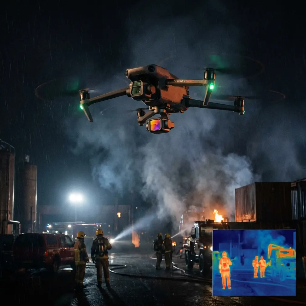
That is why one detail from the recent China Unicom display at the 9th Digital China Summit stands out far beyond exhibition hype: the showcased low-altitude ad hoc networking system was designed to operate without relying on ground base stations. Once carried aloft by a drone, it can quickly form a temporary airborne communication network. On paper, that sounds like telecom infrastructure. In practice, for wildlife mapping crews working in extreme temperatures, it points to a much bigger operational shift.
If you’re flying Neo 2 for wildlife survey work, especially where conditions are unstable and terrain is sparse, this idea matters. A lot.
This guide is built around that reality: how to use Neo 2 more effectively when heat, cold, distance, and fragile field coordination all collide.
The old problem with wildlife mapping in harsh weather
Wildlife mapping is rarely just about getting images. It’s a chain of tasks that only works if every link holds.
You need a launch area that is safe and workable. You need visual awareness of animal movement. You need stable flight behavior around terrain and vegetation. You need repeatable clips or image runs that can be compared later. And you need a reliable way for people on the ground to share sightings, corrections, and route changes as conditions shift.
Extreme temperature makes every one of those harder.
In heat, people fatigue faster, visibility can shimmer, and field crews spread out to cover water points, migration corridors, or nesting zones. In cold environments, batteries and people both become less predictable, and movements tend to be compressed into short, high-value windows. In both cases, remote wildlife areas often have weak or inconsistent coverage.
That’s where the summit demonstration becomes relevant. A low-altitude self-organizing network that does not depend on ground base stations changes the planning model. Instead of assuming your communications collapse where infrastructure ends, the drone itself can help establish a temporary network overhead. The operational significance is simple: teams can coordinate in places where normal ground support is thin or absent.
For a Neo 2 operator, that doesn’t mean the aircraft suddenly becomes a telecom platform by default. It means your workflow should be designed with airborne coordination in mind, because the wider ecosystem is clearly moving that way. If your mapping practice still assumes perfect ground connectivity, it is behind the real field problem.
Why Neo 2 suits this kind of mission
Neo 2 makes sense for wildlife mapping not because it does one dramatic thing, but because it reduces workload in the small moments that usually create mistakes.
When temperatures are extreme, operator bandwidth shrinks. You don’t want to spend that bandwidth wrestling with framing, overcorrecting for moving subjects, or manually rebuilding every shot sequence. This is where features like obstacle avoidance, subject tracking, ActiveTrack, QuickShots, Hyperlapse, and D-Log become more than checklist items.
They become energy management tools.
Obstacle avoidance matters because wildlife environments are messy. Tree lines, rock outcrops, brush, uneven slopes, and narrow corridors all add pressure when you’re flying near dawn, dusk, or under changing thermal conditions. Subject tracking and ActiveTrack matter because animals rarely move in the neat patterns your mission planner imagined. If you can maintain cleaner follow logic on moving targets, your observation passes become more useful and less reactive.
QuickShots and Hyperlapse are not just creative extras either. In wildlife mapping, they can support repeatable visual context. A Hyperlapse sequence over a known corridor can reveal movement patterns around watering areas, edge habitats, or temporary seasonal trails. QuickShots can help establish location context around a survey point before the team moves on.
And D-Log matters if you are documenting subtle tonal differences in vegetation, terrain, or animal visibility under ugly light. Extreme weather rarely gives you ideal contrast. D-Log gives you more room to preserve information you may want later when reviewing habitat use or comparing repeated flights.
The communication layer most pilots overlook
Here’s the mistake I used to make: I treated the drone as the mission, not as one part of the mission network.
That mindset works on simple recreational flights. It breaks down during wildlife mapping.
If one spotter sees herd movement outside your planned sector, if another team member detects heat shimmer reducing visibility on one ridge, or if a safe recovery zone becomes unusable because animal activity shifts, the aircraft is not the only variable. The team’s ability to react matters just as much.
This is why the China Unicom demonstration is more than a tech exhibit detail. The fact that the system can rapidly establish a temporary communication network in the air means low-altitude operations are being designed around agility, not static infrastructure. The phrase “rapid networking support for low-altitude scenarios” has direct field significance. Wildlife mapping in remote zones is a textbook low-altitude scenario. Conditions change quickly. Teams reposition constantly. Ground communications may be unreliable or absent.
If your work involves NGO habitat surveys, ecological baseline documentation, or seasonal population observations in harsh climates, start thinking in layers:
- Aircraft capability
- Sensor and imaging consistency
- Ground team coordination
- Communication continuity when infrastructure is missing
Neo 2 can handle the first two well. The third and fourth are where planning maturity separates smooth operations from wasted field days.
If you want to talk through field-ready workflows for this kind of setup, this direct field coordination channel is a practical place to start.
A practical Neo 2 workflow for wildlife mapping in extreme temperatures
Let’s keep this grounded. Below is the workflow I’d use when the job is mapping wildlife activity, not chasing cinematic footage.
1. Define the survey objective before launch
Don’t begin with flight modes. Begin with the ecological question.
Are you counting visible individuals in a corridor? Documenting habitat use? Tracking repeated movement through a bottleneck? Mapping nesting or grazing boundaries? Each objective changes how you should use Neo 2.
If the goal is movement documentation, subject tracking and ActiveTrack may be central. If the goal is location context over time, Hyperlapse may become more useful than close pursuit. If the goal is habitat comparison under difficult light, prioritize D-Log capture for post-analysis flexibility.
Extreme temperature shortens your margin for improvisation. Know the job first.
2. Fly during the most stable observation window
In harsh heat, the best image is often the one you captured earlier than planned. In severe cold, the best flight is often the shortest one done with precision.
Wildlife activity also tends to cluster around specific windows. Build your Neo 2 mission around animal behavior, not around human convenience. That sounds obvious, but crews still waste good conditions on setup drift and overcomplicated launch routines.
Keep the first sortie simple. Establish area context. Identify movement lines. Confirm whether the original route still makes sense. Then use follow-up flights for detail.
3. Use obstacle avoidance as a conservation tool, not just a pilot aid
A lot of pilots think of obstacle avoidance in terms of protecting the drone. In wildlife mapping, it also protects the mission from disturbance.
A sudden correction near trees or terrain can alter animal behavior. Cleaner path management reduces abrupt movement and lowers the chance of noisy repositioning after pilot misjudgment. In dense habitat edges, obstacle avoidance can help keep the aircraft more predictable, which is exactly what you want when documenting natural movement rather than influencing it.
4. Use tracking features selectively
Subject tracking and ActiveTrack can be excellent, but wildlife work is not social media follow-mode flying.
Use them when:
- the species movement is linear enough to interpret responsibly
- the surrounding terrain is readable
- the goal is documenting route behavior rather than provoking close interaction
Avoid relying on them when:
- vegetation clutter can confuse tracking
- multiple animals overlap visually
- preserving distance is more important than maintaining a locked follow
The point is to reduce operator overload, not surrender judgment.
5. Capture context, not just subjects
One of the most common errors in wildlife mapping is collecting attractive clips that are weak as records.
Use QuickShots sparingly but deliberately to build geographic context around den sites, feeding areas, water sources, and transition zones. Use Hyperlapse to show environmental rhythm and route change over time. These are not just aesthetic tools. They help explain how the observed animal activity fits the landscape.
This becomes even more valuable in extreme temperatures, where wildlife patterns may be tightly linked to shade, exposure, snow cover, surface moisture, or access routes that only become obvious when you zoom out.
6. Record in D-Log when conditions are visually harsh
Heat haze, flat winter light, bright snow, dusty surfaces, and mixed shadows can all compress useful image information. D-Log gives you better latitude when reviewing footage later for subtle environmental interpretation.
That matters if your wildlife mapping project includes:
- repeated seasonal comparisons
- habitat condition review
- stakeholder reporting where visual evidence must hold up under scrutiny
If the mission has any analytical value beyond same-day viewing, give yourself room in post.
How temporary aerial networking could change this workflow
Let’s come back to the most significant reference detail: a drone-borne system that can quickly establish a temporary communication network in the air, without depending on ground base stations.
For wildlife mapping teams, that creates several practical advantages.
Better coordination across dispersed observers
In remote surveys, one team may monitor ridge movement, another may cover a wetland edge, and the pilot may be positioned where launch and recovery are safest rather than where visibility is best. A temporary aerial network can help those people act like one team instead of three disconnected pockets.
Faster response to real-time movement
Animals do not honor your grid plan. If a herd, flock, or individual shifts outside the intended sector, communication delay means missed data. Rapid low-altitude networking support can reduce the lag between observation and aircraft repositioning.
Less dependence on local infrastructure
This is the big one. If the system does not rely on ground base stations, then your mapping workflow becomes more viable in underconnected landscapes. That matters in mountain reserves, steppe zones, desert margins, wetlands, and other places where wildlife surveys are often most needed.
Stronger resilience during short field windows
Extreme temperature often compresses workable time. You might only have a narrow period when crew endurance, battery performance, visibility, and animal activity all align. If communications fail during that window, the mission can collapse fast. Temporary airborne networking is valuable because it supports the entire operation during the exact moments when the work has to happen quickly.
The mindset shift Neo 2 users should make
If you fly Neo 2 for wildlife mapping, don’t think only about smarter aircraft features. Think about smarter mission architecture.
Yes, obstacle avoidance reduces pilot stress. Yes, ActiveTrack and subject tracking can make moving subjects easier to document. Yes, QuickShots, Hyperlapse, and D-Log can improve the usefulness of your visual record.
But the bigger lesson from the summit reference is that low-altitude operations are being reimagined as connected systems. The aircraft is no longer just a camera in the sky. Increasingly, it is part of how field teams maintain continuity when terrain and infrastructure work against them.
That matters more in extreme temperatures than in almost any other civilian scenario. When conditions are punishing, simplicity wins. Coordination wins. Fast adaptation wins.
Neo 2 becomes most valuable when you use its automation and imaging features to conserve human attention for the things the drone cannot decide on its own: wildlife ethics, survey timing, observer communication, and route changes based on actual field behavior.
That’s the difference between flying a capable drone and running a reliable wildlife mapping operation.
Ready for your own Neo 2? Contact our team for expert consultation.