Neo 2 Mapping Tips for Dusty Venues: A Practical Field
Neo 2 Mapping Tips for Dusty Venues: A Practical Field Workflow That Actually Holds Up
META: Learn how to use Neo 2 for mapping dusty venues with smarter flight planning, obstacle awareness, ActiveTrack support, D-Log capture, and reliable post-processing habits.
Dust changes everything.
A venue that looks simple on a site plan can become difficult once you are standing in it with a drone. Open lots throw glare back into the lens. Dry ground creates visual monotony that can confuse framing. Fine dust can soften contrast, reduce clarity, and turn a routine mapping pass into a cleanup job in post. If you are using Neo 2 to map dusty venues, the aircraft’s intelligence matters less as a headline feature and more as a field tool you can lean on when conditions are imperfect.
This is where Neo 2 starts to separate itself from a lot of small drones that look similar on a spec sheet. Not because one single feature solves the problem, but because the package is well suited to a real-world venue workflow: obstacle avoidance for low-altitude confidence, ActiveTrack and subject tracking for dynamic site walkthroughs, QuickShots and Hyperlapse for context capture, and D-Log when you need your final deliverables to survive harsh light and airborne haze.
If your job is to document event grounds, equestrian facilities, construction-adjacent venues, festival sites, outdoor sports spaces, or any large property with loose surface material, here is how to get cleaner maps and more useful client deliverables from Neo 2.
Start by defining what “mapping” means for the venue
A lot of operators use the word mapping when they actually mean three different outputs:
- Top-down spatial coverage for planning or measurement
- Context imagery for operations teams, venue managers, or marketing staff
- Progress documentation to compare site conditions over time
Neo 2 can contribute to all three, but the flight style should change depending on the goal. A basic overhead grid is only part of the story. Dusty venues often need supplemental oblique passes because dry surfaces can flatten detail from straight above. Tire marks, access lanes, drainage edges, temporary fencing, and ground wear patterns often read more clearly at an angle.
That operational distinction matters. If you fly every mission like a pure orthomosaic capture, you may get adequate coverage but poor interpretability. Neo 2’s compact format and intelligent modes make it easier to layer different capture types in one visit without turning the job into a full-day production.
Why dusty venues are harder than they look
Dust affects both flight execution and image usefulness.
On the flight side, dusty sites often have:
- low-contrast surfaces
- repetitive textures
- scattered obstacles like truss, temporary barricades, poles, tents, utility boxes, and cable runs
- variable wind close to the ground, especially in open venues
On the imaging side, dust often produces:
- reduced micro-contrast
- milky highlights in strong sun
- muted separation between traffic routes and surrounding ground
- less distinct edges for stitched maps
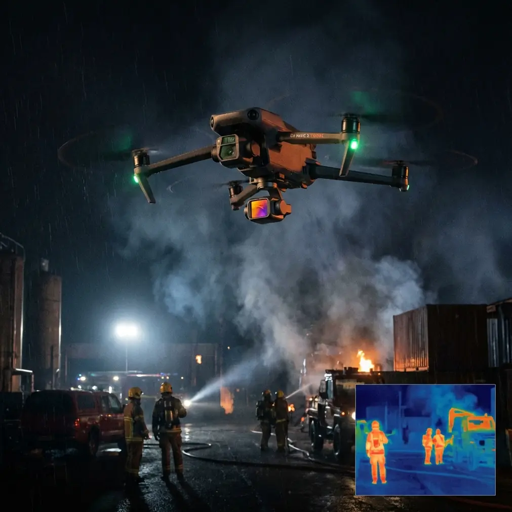
This is one reason obstacle avoidance is not just a safety feature in this environment. It directly supports data quality. When you are running low and slow near temporary structures to capture detailed perimeter context, confidence in the aircraft’s ability to identify hazards lets you maintain a more precise flight line instead of overcorrecting manually. That usually leads to more consistent overlap and cleaner supporting imagery.
Competitors often advertise small size and ease of use, but many compact drones become far less useful once you get into venues with mixed obstacles and loose-surface glare. Neo 2’s balance of maneuverability and intelligent sensing gives it an edge for operators who need more than a casual overhead shot.
Build a two-layer capture plan
For dusty venues, I recommend a two-layer workflow.
Layer 1: Structured mapping pass
Use your primary overhead route to establish the base record of the site. Keep altitude consistent and prioritize overlap. If the venue includes parking zones, service lanes, entry gates, vendor pads, or equipment staging areas, do not frame only the “main attraction” area. Dusty sites often reveal operational patterns at the edges, and those peripheral details become valuable later.
Layer 2: Interpretive context pass
After your structured pass, use Neo 2 for lower-angle contextual clips and stills. This is where QuickShots and controlled automated moves can help—not as flashy extras, but as repeatable visual references. A short orbit around a grandstand, entrance corridor, or utility cluster can clarify the relationship between structures and open areas much faster than a flat top-down image alone.
Hyperlapse can also be useful in venue work when you need to show movement patterns across the site over time, such as setup progression or changing traffic density. Used carefully, it adds operational context that a static map cannot provide.
The key is restraint. These modes are most useful when they explain the site, not when they distract from it.
Use ActiveTrack and subject tracking for ground-truthing
One of the smartest ways to make your map more useful is to pair it with a guided ground narrative.
This is where ActiveTrack and subject tracking become operationally significant. Instead of relying only on aerial stills, you can have a site manager, operations lead, or facilities supervisor walk a route while Neo 2 tracks the movement and records the actual logic of the venue: where trucks enter, where attendees queue, where dust accumulates, where barriers shift, where temporary utilities create pinch points.
That tracked walkthrough becomes a bridge between geometry and reality.
A stitched venue image can show where things are. A tracked movement sequence can show how the site works.
This is a subtle advantage over competing aircraft that may offer decent imaging but a less polished tracking experience in constrained or changing environments. For venue mapping, that difference is not cosmetic. It saves time in debriefs because your client no longer has to interpret every still image in isolation.
If you are planning a field workflow around this kind of deliverable, it helps to talk through route design and shot order with an experienced operator first; a quick message via WhatsApp for venue mapping questions can save a lot of trial and error on dusty sites.
D-Log matters more in dust than many pilots expect
A lot of new operators skip D-Log because they associate it with cinematic work. That is a mistake in venue documentation, especially in harsh outdoor conditions.
Dusty venues often combine bright sky, pale ground, reflective structures, and low-contrast midtones. Standard color profiles can clip highlights early or bake in a look that leaves very little room to recover subtle site detail later. D-Log gives you more flexibility to restore separation in those washed-out areas.
Operationally, this matters for three reasons:
1. Better surface interpretation
Dry surfaces often blend together in standard footage. With a flatter capture profile, you have a better chance of teasing apart access roads, compacted paths, staging pads, and disturbed soil in post.
2. More usable comparison sets
If you are documenting a venue over multiple visits, D-Log can help normalize footage captured under different sunlight conditions. Consistency is hard enough outdoors. A flexible source file gives you a better foundation.
3. Cleaner stakeholder deliverables
Clients often ask for simple outputs, but simple does not mean crude. A well-graded venue overview is easier to read, more professional in appearance, and more likely to support actual planning decisions.
If the final use is orthomosaic processing only, keep your capture settings consistent and practical. But if the mission includes any narrative deliverables, inspection-style site review, or side-by-side progress reporting, D-Log is worth using.
Obstacle avoidance is most valuable before and after the main pass
Many pilots think of obstacle avoidance primarily during active movement through clutter. In venue mapping, I find its biggest value often comes in the transitions.
Dusty venues are full of awkward moments:
- climbing out from a narrow launch area
- repositioning around poles or fencing
- dropping lower to document a temporary structure
- backing off from a stage edge or lighting rig
- shifting from open lot coverage to detailed perimeter imagery
These are the moments where fatigue and routine cause mistakes.
Neo 2’s obstacle awareness helps reduce that pressure, which in turn lets you focus on framing and overlap instead of constantly managing every micro-adjustment under stress. Compared with less capable compact drones, that can make the aircraft feel less like a flying camera and more like a dependable survey companion.
That difference is especially noticeable on repeated flights across the same venue. Consistency is easier when the aircraft helps stabilize your workflow.
A practical dusty-venue checklist for Neo 2 operators
Here is the field routine I would use.
Before takeoff
Pick a launch point away from loose debris and vehicle movement. Dust kicked up during takeoff is not just a cleanliness issue; it can affect visibility and your confidence in the first moments of flight.
Walk the perimeter first. Identify:
- temporary vertical obstacles
- cable spans
- scaffold and truss
- signage frames
- moving vehicles
- heat shimmer zones over bare ground
Confirm the sun angle. Early and late light can increase texture readability on dusty ground, while midday often flattens everything.
During the mapping pass
Fly a disciplined route. Keep speed moderate. In dust-heavy environments, operators often rush because the site looks visually simple. The opposite approach works better. Give the camera enough time to capture sharp, consistent frames.
Avoid dramatic altitude changes during your main map sequence unless the terrain requires it. Uniformity helps both stitching and interpretation.
During context capture
Use oblique angles to clarify entrances, pathways, service routes, and venue edges. This is where QuickShots can be selectively useful if they produce repeatable geometry around key structures.
If you are documenting how the venue is used, run an ActiveTrack sequence with a manager or coordinator walking the operational path. Keep that route intentional rather than casual.
After landing
Inspect the aircraft carefully. Dust accumulates gradually, and a drone that still flies fine can already be carrying enough contamination to affect long-term reliability if neglected.
Review your files before leaving the site. Dust and glare problems are easier to correct with one extra pass than with a return visit.
The smartest competitive advantage is workflow efficiency
There are drones with larger airframes, drones with stronger enterprise branding, and drones with more intimidating spec sheets. But for many dusty venue jobs, the best tool is the one that can produce a reliable map, gather context imagery, track a site walk, and handle tricky low-altitude transitions without forcing you into a bulky deployment.
That is where Neo 2 excels.
Not because it dominates every category in isolation, but because the feature mix fits the assignment unusually well. Obstacle avoidance supports safer and steadier close work. ActiveTrack and subject tracking make site walkthroughs more informative. QuickShots and Hyperlapse help capture repeatable context when used with discipline. D-Log gives you room to recover visibility in difficult light and dust.
Those are not novelty features. On a dusty venue, they directly affect whether your output becomes a useful planning asset or just another folder of aerial files.
Final thoughts for venue operators
If your reader’s goal is mapping dusty venues, the real question is not whether Neo 2 can fly there. It is whether you can build a capture method that respects what dust does to visibility, contrast, and decision-making.
Use the map pass to record the site.
Use the context pass to explain it.
Use tracking to connect the aerial view to the human workflow on the ground.
Use D-Log when the environment is fighting your image quality.
And let obstacle avoidance support precision rather than replace judgment.
That is how Neo 2 becomes more than a lightweight drone in a difficult venue. It becomes a field instrument that helps you leave with cleaner data and fewer gaps.
Ready for your own Neo 2? Contact our team for expert consultation.