Neo 2 for Urban Solar Inspection: A Practical Workflow
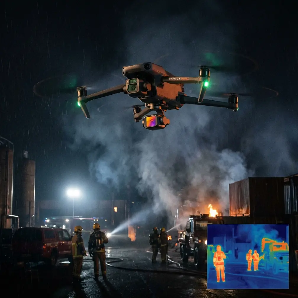
Neo 2 for Urban Solar Inspection: A Practical Workflow Borrowed From Water-Resources Survey Logic
META: Learn a practical Neo 2 workflow for urban solar inspection using lessons from UAV water-resource surveying, including GPS route planning, fast image capture, mapping value, and safer access to hard-to-reach sites.
I still remember a rooftop solar inspection that should have taken an hour and ended up consuming most of a day.
The site was in a dense urban block. Access was awkward. A few panel strings sat near parapet edges, cable runs disappeared behind mechanical equipment, and the maintenance team had only partial notes on recent drainage work. We spent too much time walking, stopping, photographing, backtracking, and trying to rebuild the site condition from scattered images. The panels were the assignment, but the real problem was information flow. We lacked a fast, repeatable way to capture the whole environment and turn it into something decision-ready.
That is why the most useful way to think about Neo 2 for urban solar inspection is not as a camera-first gadget. It is as a field tool for rapid site intelligence.
Oddly enough, one of the clearest frameworks for this comes from a UAV water-conservancy solution. The source material focuses on hydraulic engineering, reservoir zones, river corridors, and water-resource patrols, yet the operating logic transfers neatly to urban solar work: bring the drone to site by vehicle, fly a planned route using GPS coordinates, capture imagery fast, process it into usable maps or inspection visuals, and let ground staff make decisions immediately from a clearer picture. That workflow matters because solar inspections in cities often suffer from the same operational pain points the water sector document describes: manual surveying takes too long, difficult areas are hard to reach, and traditional aerial methods are too inflexible or too slow to support repeat inspections.
Why the water-sector model fits urban solar work
The source document describes a common problem in water infrastructure: traditional manual topographic surveying has long project cycles, high labor demands, and struggles to meet design timelines. It also notes that on-foot and boat-based patrols are costly, slow, and sometimes unsuitable for harsh or inaccessible terrain. Replace “riverbank” with “commercial rooftop,” and you get a familiar solar inspection scenario.
Urban solar arrays create their own access friction:
- rooftops with restricted pathways
- canopies over parking areas
- equipment yards cluttered with ducts and HVAC units
- drainage zones that affect panel soiling and runoff
- repeat inspections after maintenance, weather, or retrofits
What helped me rethink these jobs was one number from the source material: UAV mapping achieved more than 6 times the efficiency of RTK plus total-station terrain mapping in that water-engineering context. Solar inspection is not the same discipline, but the lesson is operationally significant. Once a drone-based capture workflow replaces fragmented manual observation, the gain is not just speed in the air. It is speed in planning, review, communication, and follow-up.
Neo 2 becomes useful when you set it up to reduce those friction points.
Start with the site as a map, not as a photo shoot
The water-resource workflow in the reference begins before takeoff. The team travels to the inspection area, prepares GPS coordinate points, and then runs an automated flight to collect imagery efficiently. That sequence is simple, but it is the difference between random footage and structured inspection data.
For urban solar inspection, I use the same mindset.
Before arriving, define the inspection objective in layers:
Layout confirmation
Are you verifying panel placement, row spacing, access lanes, inverter positions, or roof obstructions?Condition check
Are you looking for cracked modules, heavy soiling, shading changes, pooling water, cable routing concerns, or edge-clearance issues?Context capture
Are nearby buildings, rooftop additions, antenna mounts, or drainage modifications affecting the array?Repeatability
Will this job need comparison with future flights after cleaning, repair, or seasonal performance changes?
This is where Neo 2 can shine in compact urban jobs. A small drone that can be deployed quickly is often more valuable than a larger platform that is theoretically more powerful but less practical on a roof with limited launch space. In city inspections, the setup burden matters almost as much as flight performance.
A practical Neo 2 inspection workflow
1. Build a GPS-led plan before launch
The water-industry reference specifically points to flying according to pre-written GPS coordinates. That matters because urban solar inspection is easy to do badly when the pilot improvises everything on site.
For Neo 2, create a route that answers the actual inspection questions:
- a high overview pass to establish full array context
- a lower oblique pass for panel surface visibility
- targeted side angles around obstacles
- one perimeter pass to document roof edges, walkways, drainage lines, and adjacent structures
If your site has multiple roof levels, break the mission into sectors rather than trying to cover everything in a single flowing flight. In cities, airspace constraints, signal conditions, and rooftop clutter can complicate continuous operations. Sector-based flying keeps the image set cleaner and easier to review later.
2. Use obstacle awareness as a planning tool, not a rescue tool
Urban solar sites punish sloppy flying. Antennas, conduits, railings, skylights, and rooftop mechanical units create a three-dimensional maze. This is where obstacle avoidance earns its value. Not because you want to rely on it recklessly, but because it helps preserve safe spacing and smoother route execution when space is tight.
In practice, obstacle sensing supports consistency. A cleaner, steadier path delivers more usable imagery for panel-row review and broader roof-context analysis. On repeat visits, that consistency also improves comparison between flights.
3. Capture broad context first, then details
The source document emphasizes generating a topographic or patrol map from aerial imagery, then allowing ground personnel to grasp site conditions quickly. In solar inspection, the equivalent is not always a formal engineering topo product. Sometimes it is a visual base layer that lets operations, maintenance, and asset teams all look at the same site reality.
This is why your first pass should be broad and systematic.
I usually start with an elevated sweep that shows:
- total array footprint
- inverter and combiner locations
- rooftop access points
- nearby structures that may cast shade
- visible drainage pathways
- maintenance hazards and movement routes
Only after that do I move to closer passes for surface condition review. If you begin too tight, you lose the ability to place defects in context. And context often explains the defect. A dirty row near a drainage line, for example, tells a different story from a dirty row in an otherwise clean field.
4. Let tracking features help on repeat paths
Subject tracking and ActiveTrack are often discussed in creative shooting, but there is a practical inspection angle too. On urban sites, they can help maintain stable framing when you are following a maintenance path, a row line, or a moving point of reference during coordinated inspections with on-site staff.
That does not mean handing control over blindly. It means using tracking to reduce micro-adjustment workload so you can pay more attention to spacing, reflections, and inspection targets. On roofs with narrow working envelopes, less stick noise often means better footage and fewer missed details.
5. Use image style settings with inspection in mind
This is where many photographer-operators drift into the wrong priorities. Nice color is not the same as useful documentation.
If Neo 2 offers D-Log in your workflow, use it thoughtfully when lighting contrast is high and you need better post-production flexibility across bright panel reflections and darker rooftop hardware. A flatter profile can preserve more grading room for reports, especially when the site includes both reflective glass and shaded service areas.
But not every inspection needs a grading-heavy workflow. For quick operational reviews, straightforward, clean footage may be more efficient. The point is to match capture settings to the inspection deliverable, not to chase cinematic aesthetics.
6. Reserve QuickShots and Hyperlapse for communication, not diagnosis
QuickShots and Hyperlapse are often framed as lifestyle features. In industrial documentation, they have a narrower but still real role.
I would not use them as primary defect-detection tools. I would use them to communicate scale, access complexity, or project progression to stakeholders who do not live on rooftops. A controlled orbit can show how tightly packed an urban array sits among neighboring buildings. A Hyperlapse sequence from repeated visits can illustrate installation progress, cleaning cycles, or rooftop modification over time.
These are communication assets, not substitutes for disciplined inspection passes.
Why rapid processing matters more than people admit
One of the strongest ideas in the source material is that captured images are processed in software to generate survey or patrol outputs, and then ground staff can understand the resource condition immediately. That final step is the entire value chain. Flying alone solves nothing.
For solar inspection, the deliverable might be:
- an annotated orthographic overview
- a roof-condition visual report
- comparison imagery before and after maintenance
- a panel-row reference set for service teams
- a planning layer for future electrical or cleaning access
The significance is practical. When a drone mission produces a usable visual product soon after capture, the maintenance team no longer relies on memory and scattered phone photos. They can see where drainage intersects with array sections, where access is constrained, and how rooftop additions might affect shade or service routes.
That is the part many buyers misunderstand. The drone is not just reducing ladder time. It is compressing the interval between field observation and operational decision.
Hard-to-reach areas are where Neo 2 earns its place
The water-conservancy source repeatedly points to environments that are difficult to access and unsuitable for slow manual inspection. Urban solar has its own versions of that problem:
- perimeter rows near drop edges
- canopies above active parking zones
- roofs with fragile surfaces or awkward clearances
- arrays broken up across multiple building levels
- sites where foot traffic itself introduces risk or delay
A compact drone workflow gives you visual access without repeatedly putting personnel into every corner of the site. That does not eliminate the need for hands-on maintenance, but it does sharpen where crews need to go and what they need to inspect first.
This is especially useful when the job is not a one-off. The source document also criticizes traditional remote-sensing methods for lacking the timeliness and repeatability needed for recurring measurement or monitoring. That idea maps directly onto solar asset management. Cities change. Rooftops change. Drainage patterns shift after construction. Shade can appear where it was absent months earlier. A repeatable Neo 2 capture routine gives operators a way to monitor those changes with much better temporal relevance than waiting for occasional third-party imagery.
A field example: from scattered images to usable decisions
Going back to that difficult urban job I mentioned earlier, the breakthrough was not simply flying the site. It was rebuilding the task around a survey logic.
We arrived with a predefined route. We captured a high context pass, then lower oblique passes along each array block. We documented drainage, neighboring parapets, rooftop units, and service paths. Instead of handing over a folder full of disconnected clips, we turned the flight into a structured visual reference for the site team.
That changed the conversation immediately.
The facility manager could see that one problem area was not just panel soiling. It sat in a runoff-prone section near a rooftop transition. The maintenance lead could map a safer walking route to the affected block. The owner’s representative could understand how surrounding structures influenced afternoon shade. A task that previously felt messy and subjective became organized and actionable.
That is the operational promise behind Neo 2 in urban solar inspection. Not glamour shots. Better decisions from better capture discipline.
When to keep the workflow simple
There is always a temptation to overbuild drone operations. For most urban solar jobs, resist that.
A good Neo 2 mission often comes down to:
- clear preplanned coverage
- safe spacing around rooftop obstacles
- stable, repeatable framing
- imagery processed quickly into reviewable outputs
- direct linkage between visuals and maintenance action
If you want a second opinion on setting up that kind of workflow for your site, you can message a drone specialist here.
The real benchmark is not whether the footage looks dramatic. It is whether the inspection team can answer specific questions faster than they could with rooftop walking alone.
The bigger lesson from the source material
The water-sector reference may seem far removed from city solar arrays, yet it captures a truth that many inspection teams eventually learn the hard way: the advantage of UAVs is not merely that they fly. It is that they convert difficult, slow, and fragmented fieldwork into a faster information cycle.
Two details from that source stand out.
First, the use of preplanned GPS coordinate flights is operationally significant because repeatability drives inspection quality. If you can revisit the same urban solar site with similar flight logic, changes become easier to detect and explain.
Second, the claim of over 6x efficiency compared with RTK plus total-station mapping highlights a broader point about labor compression. Even if your exact improvement in solar work differs, replacing piecemeal manual observation with an aerial-first workflow changes how much site understanding you can generate per visit.
That is why Neo 2 makes sense when treated as an inspection instrument inside a methodical process. In dense urban environments, where launch space is limited and roof access is never as easy as the site plan suggests, that approach can turn a frustrating job into a disciplined one.
Ready for your own Neo 2? Contact our team for expert consultation.