Neo 2 in Low-Light Construction Inspections
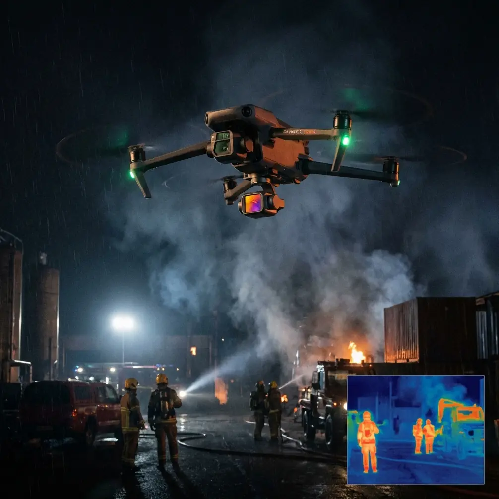
Neo 2 in Low-Light Construction Inspections: What Actually Matters on a Changing Site
META: Practical Neo 2 inspection strategies for low-light construction sites, with workflow insights grounded in UAV mapping and post-restoration survey methods from mining reclamation practice.
Construction sites rarely behave like clean demo environments. Light drops fast behind half-finished structures. Dust softens contrast. Wet ground changes texture after a weather shift. And if you are inspecting grading, drainage lines, temporary access roads, or slope work near dusk, the drone is only part of the job. The real question is whether the data still holds up when conditions stop cooperating.
That is where Neo 2 becomes interesting.
I approach this less as a gadget review and more as a field workflow question. The reference material behind this discussion comes from a UAV mapping application in bauxite mine land reclamation, where low-altitude remote sensing was used before and after restoration work. The setting was not a construction tower or a commercial real estate site, but the operational logic transfers cleanly: disturbed ground, evolving terrain, machine-shaped surfaces, drainage management, and the need to compare what was planned with what was actually built.
For anyone using Neo 2 to inspect construction sites in low light, that connection matters.
Why a mine reclamation case says something useful about Neo 2
The source describes a bauxite deposit with scattered distribution, shallow burial depth, and complex geological structure, leading to open-pit extraction. That kind of site changes quickly and unevenly. The paper notes that the land-use cycle from acquisition to stripping and mining could be as short as 2 to 3 years, after which the area was reclaimed and returned toward agricultural use. On the restoration side, the field process included leveling the base, loosening the surface, laying more than 30 cm of stripped soil as a cultivation layer, and then carrying out integrated treatment of roads, slopes, and drainage ditches.
That sequence is not just a mining detail. It tells us what inspection drones are often really documenting on active earthwork sites: elevation transitions, surface uniformity, runoff paths, edge stability, and whether the completed ground profile matches the intended design.
A Neo 2 operator inspecting a low-light construction site faces a similar challenge. You are not simply trying to get pretty footage. You are trying to preserve enough visual and spatial reliability to answer practical questions:
- Has the slope been cut and stabilized consistently?
- Do drainage channels read clearly enough to verify continuity?
- Can access roads and temporary haul routes be reviewed for rutting or obstruction?
- Is the surface preparation visually coherent across a large, irregular area?
- Can repeat flights support progress comparison after weather changes?
If your workflow cannot handle those questions after sunset edges in or clouds roll through, the aircraft’s feature list is secondary.
The low-light problem is not darkness alone
Low-light inspection is often described too casually. The issue is not only that there is less illumination. It is that reduced light magnifies every weak point in the workflow.
On a construction site, low light tends to degrade:
- edge definition on compacted surfaces,
- texture separation between wet and dry ground,
- visibility of shallow drainage features,
- confidence in obstacle spacing near steel, scaffolding, or partially enclosed structures,
- continuity in repeatable visual records.
The reclamation reference highlights a core principle from surveying practice: bad connection points must be removed before triangulation, and when errors become too large, weight values may need to be adjusted and higher-error points excluded before the aerial triangulation solution is completed. That is a highly technical mapping detail, but operationally it means something simple: weak image relationships create weak decisions.
For Neo 2 users, this has a direct lesson. In low light, the margin for sloppy capture shrinks. If the scene lacks contrast or if motion introduces ambiguity, your later review of grading lines or drainage corrections becomes less trustworthy. So the goal is not merely to finish the flight. The goal is to capture imagery that remains interpretable when you zoom in on the thing the superintendent actually cares about.
A practical Neo 2 strategy for dusk inspections
When I use a small drone like Neo 2 around a changing worksite, I think in layers.
1. Start with the surfaces that lose legibility first
Flat, disturbed ground is deceptive in low light. Once the sun drops or cloud cover thickens, subtle ruts, soft crowns, and shallow water channels disappear faster than vertical structures. That is why the mine reclamation workflow is relevant: roads, slopes, and drainage ditches were treated as distinct elements in the restoration process because each one affects whether the land performs as intended.
With Neo 2, inspect those same classes of features early in the flight window:
- drainage cuts and outfalls,
- newly graded pads,
- slope transitions,
- temporary site roads,
- stockpile edges and haul access.
Do not save them for the end when contrast is gone.
2. Use subject tracking where motion, not composition, is the issue
On a site with active machinery or moving crews, subject tracking can help maintain a consistent visual relationship without forcing aggressive pilot inputs in dim conditions. That matters when documenting rolling inspections of a haul path, perimeter check, or moving equipment corridor. A stable tracked pass can be more useful than a manually flown sequence with uneven framing and altitude drift.
The point is not cinematic polish. It is repeatability.
If a foreman wants to compare one drainage run from Tuesday to one after Thursday’s rain, consistent pathing matters. ActiveTrack-style behavior supports that consistency when used conservatively and in open sections of the site.
3. Obstacle avoidance is most valuable when weather changes your plan
The prompt here asked for a mid-flight weather change, and that is realistic. One of the trickiest inspection moments is when the light was acceptable at takeoff, then a fast-moving cloud bank or light rain shifts the site visually halfway through the mission.
I have had this happen on industrial earthwork. You launch expecting a straightforward low-angle pass over graded ground, then the wind lifts, contrast drops, and reflective puddles start appearing where there were none ten minutes earlier. In that moment, obstacle avoidance stops being a convenience feature and becomes a stress reducer. You are no longer flying the route you imagined. You are managing a site that has become visually flatter, more reflective, and less predictable.
For Neo 2 operators, obstacle sensing helps preserve safe spacing if you need to slow down, adjust your line, or back out from a structure edge when the weather shift makes depth cues less obvious. It does not replace judgment. But on cluttered construction sites, especially around partially completed framing or temporary barriers, it gives you more room to stay disciplined instead of rushing to finish before conditions worsen.
What the mapping reference teaches about usable outputs
One of the most practical details in the source is the output chain after aerial triangulation: XML results were exported to support creation of DLG, DEM, and DOM products.
Most Neo 2 users on construction sites are not building full photogrammetric deliverables every evening. Still, those output types matter conceptually:
- DLG thinking helps you focus on line features: roads, ditch edges, breaklines, boundaries.
- DEM thinking keeps your attention on surface form and elevation logic.
- DOM thinking emphasizes corrected, readable overhead imagery for comparison and annotation.
That is the real takeaway. Even if your immediate deliverable is a visual inspection set rather than a formal mapping package, you should fly with those end uses in mind. If you know the project team may later need to verify slope shape, ditch continuity, or pad regularity, capture with enough overlap, steadiness, and consistency that the imagery can support more than a quick screen review.
The reference also notes that after restoration, low-altitude UAV remote sensing was used again for post-reclamation evaluation. That repeated use is significant. Drone inspection is most powerful when it becomes a comparison method, not an isolated event.
On a construction site, Neo 2 becomes more valuable when you treat it as a repeat-observation tool:
- before grading,
- after grading,
- after rainfall,
- before handover,
- after drainage corrections,
- at dusk when machine work finishes.
That cadence gives context to each flight. A single low-light inspection may tell you what the site looks like. A series tells you whether the site is improving or drifting from plan.
Low-light image discipline: better than trying to “fix it later”
Low-light inspections tempt operators to rely on post-processing. Some of that is fair. If you are recording in D-Log, you have more flexibility to recover tonal detail and manage contrast in changing light. That can help when cloud cover arrives mid-flight and compresses the scene. Shaded cut slopes, damp access roads, and drainage channels often benefit from a flatter capture profile that can be graded later for visibility rather than drama.
But this only works if the flight itself is controlled.
The mine mapping source emphasizes cleaning bad tie points and iterating until the adjustment meets accuracy requirements. In image terms, that is a reminder that quality is built upstream. Good source material reduces downstream compromise.
For Neo 2, that means:
- smoother speed in low light,
- less abrupt yaw,
- disciplined altitude changes,
- shorter, purpose-built passes instead of long improvised wandering,
- conscious reshoots when a weather shift changes the site surface.
A brief second pass over the drainage corridor after the cloud front moves in can be more useful than trying to rescue a muddy first pass in editing.
QuickShots and Hyperlapse have a place, but only if they serve inspection logic
A lot of operators either overuse automated creative modes or dismiss them completely. Both extremes miss the point.
QuickShots can be useful for site context. A short automated reveal can show how a sediment channel relates to the larger grading area or how a temporary road connects separate work zones. Hyperlapse can document progression around a static process area, especially when crews are moving material and you want a compact visual summary of operational flow.
But neither mode should replace the slower, inspection-first passes needed for actual site review.
If I were building a Neo 2 construction workflow, I would use automated modes after the essential captures are complete, not before. The priority remains legibility of critical features: slopes, roads, ditching, and surface preparation. That priority comes straight out of the reclamation case, where those elements were integral to determining whether the restored land could function properly.
When weather turned mid-flight: the operational lesson
Here is the scenario many site teams recognize.
The inspection starts near late afternoon. The goal is to review a newly shaped runoff path and the adjacent access road while machine traffic has finally cleared. Light is already soft, but still workable. Halfway through, wind builds and a dark cloud layer moves over the site. The road surface that was textured a few minutes earlier now looks flatter. Small water patches begin reflecting the sky. Steel and temporary fencing near the compound edge become harder to judge against the background.
This is where a disciplined Neo 2 workflow earns its keep.
Instead of forcing the original route, shorten the mission. Keep obstacle avoidance active. Reprioritize the drainage line and any slope transitions that may change fastest under fresh moisture. Use subject tracking only where it stabilizes a needed pass, not as a novelty. If you are capturing in D-Log, preserve the tonal range and accept that grading later will help separate wet ground from compacted fill. Most of all, get the comparison shots that the site engineer can use tomorrow morning.
The flight is no longer about coverage. It is about evidence.
If your team is still working out how to structure that kind of field routine, one practical way to discuss workflow specifics is through a direct project chat like this: send the site details here.
Why Neo 2 fits this kind of inspection work
Neo 2 makes sense for low-light construction review not because small drones magically solve bad conditions, but because fast deployment, controlled tracking, obstacle support, and flexible capture options can align with the realities of short inspection windows.
Those windows are common on active sites:
- after equipment clears,
- before night work begins,
- right after weather changes,
- during end-of-day verification.
The mine reclamation reference is useful because it reminds us what successful UAV work really supports on disturbed land: planning, execution checks, and post-work evaluation. It also shows that outputs are only as good as the image relationships behind them. Removing erroneous connection points, adjusting weights when errors are too large, and exporting structured results for DLG, DEM, and DOM production all point to the same discipline: capture with the end decision in mind.
For Neo 2 operators on construction sites, the translation is straightforward. Do not think only like a pilot. Think like someone who will need to explain what happened to the ground surface after the weather changed, whether drainage was built as intended, and whether the visual record can stand up to a second look.
That is where low-light inspection stops being a flight and becomes a useful professional tool.
Ready for your own Neo 2? Contact our team for expert consultation.