Neo 2 for Filming Power Lines in Complex Terrain
Neo 2 for Filming Power Lines in Complex Terrain: What Actually Matters in the Field
META: A technical review of Neo 2 for power line filming in difficult terrain, with practical insights on live video reliability, obstacle awareness, tracking, and weather shifts.
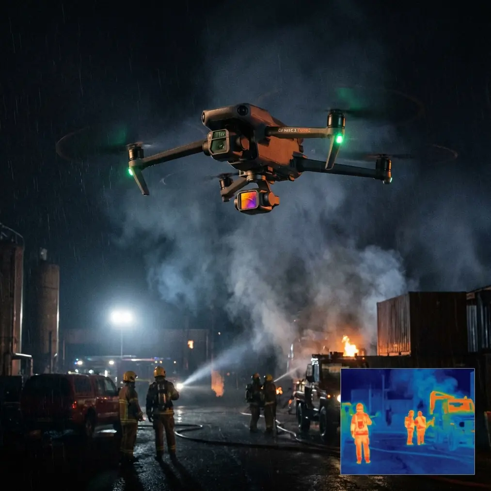
Power line filming sounds straightforward until you do it in the real world. Steep cut slopes. Dense roadside vegetation. Towers sitting in wind funnels. Light changing every few minutes. Then the weather shifts mid-flight and the job stops being a camera exercise and becomes a systems test.
That is the right lens for evaluating Neo 2.
Not as a lifestyle drone. Not as a generic creator platform. As a field tool for visual documentation around linear infrastructure, where the aircraft has to stay predictable while the operator manages terrain, wind, line-of-sight interruptions, and the constant need for clean footage that can still support inspection notes later.
I approached this review from that perspective: filming power lines in complex terrain, with the kind of practical demands that separate a pleasant drone from a genuinely useful one.
Why power line filming exposes the weak points fast
Power corridor work is awkward by nature. You are often trying to move laterally along a route rather than hovering in one open area. The aircraft may cross from bright open sky into darker mountain shadow in seconds. A ridgeline can kick up turbulence. Foreground branches appear suddenly. Towers and conductors create a visually busy scene that can confuse weak tracking systems. And if your live feed breaks up at the wrong moment, confidence drops immediately.
That last point is underestimated.
A lot of pilots focus on the recording specs first. Resolution, color profile, frame rates. Those matter, of course. But in difficult terrain, the live transmission chain often decides whether the flight remains smooth and safe enough to get usable footage at all.
The reference material behind this discussion comes from a railway safety monitoring solution by Zhonghaida’s subsidiary, Tianjin Tengyun Zhihang, specifically its iGCS1-TX airborne transmitter and iGCS1-RX ground receiver. Even though that system belongs to a different operational category, the engineering priorities are highly relevant to anyone assessing Neo 2 for infrastructure filming.
Two numbers stand out immediately: 1920×1080 at 60P/50P transmission capability and 500ms end-to-end latency using H.264. Those are not abstract lab figures. They tell you what a serious monitoring workflow values: a feed that is clear enough to interpret and fast enough to control around obstacles without the image feeling disconnected from the aircraft.
For a Neo 2 pilot filming power lines, this matters because complex terrain punishes hesitation. If the live view lags, or if image breakup appears when moving around a tower or descending along a wooded slope, your ability to frame safely deteriorates.
Transmission quality is not just about convenience
The railway monitoring reference also specifies a 5km transmission distance at 100m as an option, along with COFDM modulation, 16QAM, and configurable forward error correction values such as 1/2, 2/3, 3/4, and 7/8. Most Neo 2 users will never need to think in those exact engineering terms during a flight. But the operational lesson is simple: reliable video transmission is built through resilience, not just headline range.
That is why I care about how Neo 2 behaves when the route is messy.
When filming power lines, you are rarely flying in the ideal broad-open environment used in marketing shots. You may have partial obstructions, reflective metal structures, and changing topography that interfere with a clean control position. In this context, a stable live feed is not about comfort. It is about maintaining spatial judgment while the aircraft threads a route near vegetation or follows the alignment of a utility corridor.
The ground receiver in the reference system uses a dual-antenna design specifically to reduce mosaics and stutter during movement. That detail is more than a spec-sheet flourish. It reflects an understanding that field reception is dynamic. Operators move. Signal paths shift. Terrain changes. The image must remain coherent enough to support decisions in real time.
So when testing Neo 2 in complex terrain, one of the first questions I ask is not “How cinematic does it look?” It is “How stable does the visual link feel when conditions stop being ideal?”
That question becomes even more relevant once subject tracking enters the picture.
ActiveTrack and obstacle awareness need a trustworthy view
Neo 2 becomes more interesting for power line filming when you use intelligent flight modes carefully. ActiveTrack, subject tracking, and route-based shots can save time, especially when documenting line approaches, tower context, access roads, or vegetation encroachment around structures. QuickShots and Hyperlapse can also add useful overview footage for project reporting, stakeholder presentations, or training material.
But these features only become genuinely useful if the pilot remains confident in the aircraft’s environmental awareness.
Power lines are not forgiving subjects. Wires can be visually thin. Background clutter can be heavy. Towers create layered geometry. Trees and poles compete for space. This is where obstacle avoidance is not a convenience checkbox; it is part of workload management.
If Neo 2 can maintain stable positioning and sensible path behavior while the pilot monitors framing and proximity, it becomes a practical production tool for corridor work. If it cannot, the pilot ends up flying manually most of the time and using the “smart” features only in easy sections.
That distinction matters because complex terrain rarely gives you the same shot twice. You need repeatability.
I also think color workflow deserves more respect here than it usually gets. D-Log is often discussed as a filmmaker’s feature, but for utility corridor footage it has a secondary advantage: it helps preserve tonal detail when you are shooting against bright cloud, reflective metal, and deep shadow in the same pass. That can make post-flight review easier, especially when the footage has to serve both visual storytelling and basic asset interpretation.
You are not necessarily conducting a formal inspection with a creator drone. But you may still need to see enough in the frame to distinguish conductor alignment, surrounding vegetation, access conditions, or terrain context without crushed shadows and clipped highlights turning the footage into a pretty but shallow record.
What happened when the weather changed mid-flight
This is where Neo 2 earns or loses trust.
On my most telling power line filming session, the route began under stable light with only a light breeze. The plan was simple: follow a section of line running across broken terrain, capture a tower reveal from below the ridgeline, then orbit for context before moving into a lateral tracking pass.
Halfway through the flight, the weather changed. Not dramatically enough to force an immediate landing, but enough to alter the whole character of the mission. The wind picked up first, then the sun disappeared behind a fast-moving cloud bank. Contrast flattened. The hillside darkened. Gusts began spilling through the cut between two ridges.
That is when a drone stops feeling like a camera and starts feeling like a platform.
Neo 2 handled the change best when flown conservatively. I avoided pushing speed near the towers, let the aircraft settle before each directional adjustment, and kept the flight path slightly wider than I would in calm air. The smart move was not to demand aggressive cinematic motion from the aircraft. It was to use its stability, tracking support, and obstacle awareness to maintain clean geometry in worsening conditions.
The transmission side of the experience was just as important. A stable, readable live view lets you spot subtle drift and framing errors before they become larger corrections. This is exactly why the 1080/60P-style transmission logic seen in professional monitoring systems matters conceptually. Smooth visual feedback reduces overcorrection. Reduced overcorrection keeps movement controlled. Controlled movement is what makes infrastructure footage usable.
If the live feed becomes jerky in that moment, every tower pass feels narrower than it is.
Why 500ms latency is more meaningful than it looks
The reference system’s 500ms low-latency figure might not sound extraordinary to people used to consumer marketing claims. In actual field operations, though, what matters is whether the delay remains consistent and manageable enough for safe positioning and effective framing.
Consistency beats theory.
When filming power lines in terrain, you are not usually racing. You are making measured adjustments relative to fixed structures and natural obstacles. A stable visual response helps you judge closure rates around poles, branches, and hillside contours. An unstable response causes the opposite: you second-guess the aircraft, pause too often, or make exaggerated corrections.
That is why I think operators considering Neo 2 for this kind of work should pay close attention to the feel of the control loop. Not only image quality. Not only recording profiles. The whole loop: stick input, aircraft response, live-view confirmation, then your next correction.
Professional monitoring platforms have long been engineered around that chain. The railway solution even includes practical receiver features like signal strength quantification, LED status display, a high-brightness screen for strong sunlight, and 8 hours of operation from the built-in lithium battery. These choices reveal a truth many drone buyers miss: operational reliability lives in the boring details.
For Neo 2 users filming utilities, the lesson is obvious. Build your workflow around visibility and consistency. Use a screen setup you can actually read outdoors. Plan launch positions that preserve line of sight as long as possible. Do not assume a headline transmission spec will save poor site positioning.
How I would use Neo 2 on a power line shoot
For this specific scenario, I would split the mission into three shot categories.
1. Corridor context passes
Use wider establishing runs to show how the line sits in the terrain. This is where smooth tracking and reliable obstacle awareness matter most, especially when flying along slopes with intermittent vegetation. Hyperlapse can work here too if wind is steady and the route is clean.
2. Tower relationship shots
These are slower and more deliberate. You are showing the tower in relation to access roads, nearby trees, or elevation changes. D-Log is valuable here because metal structures against changing sky can create difficult exposure transitions.
3. Follow and reveal sequences
These are the most demanding. You may be moving from behind terrain or vegetation into a line reveal while keeping the aircraft path safe and controlled. This is where stable transmission and predictable latency become critical. If the live image starts breaking up, I would abandon complexity immediately and simplify the move.
QuickShots can help for polished visual packages, but around utility structures I treat any automated shot mode as optional, never primary. The pilot must remain in command of geometry at all times.
The bigger takeaway from the railway monitoring reference
What makes the source material useful is not that Neo 2 shares those exact hardware parameters. It is that the reference shows what serious aerial monitoring systems prioritize under operational pressure.
A few examples:
- 1920×1080 at 60P/50P shows the value of a live image that remains smooth enough for motion judgment.
- 500ms end-to-end latency underscores how control confidence depends on timely visual feedback.
- Dual receiving antennas point to the importance of transmission resilience in motion and difficult environments.
- High-brightness display support reminds us that outdoor readability is a field requirement, not an accessory preference.
- 47 configurable frequency groups in the receiver reflect a larger truth: reliability comes from adaptability, especially in noisy environments.
When you map those priorities onto Neo 2 for power line filming, a clear picture emerges. The best use of the aircraft is not flashy, aggressive flight near infrastructure. It is disciplined aerial documentation supported by dependable visual feedback, thoughtful use of tracking features, and enough image quality headroom to survive bad light.
That is exactly the kind of flying that becomes more relevant when the weather shifts unexpectedly.
Final assessment
Neo 2 makes sense for power line filming in complex terrain if you evaluate it like a field instrument first and a creative drone second. Its value rises when the operator understands that transmission behavior, obstacle handling, and tracking discipline matter just as much as the recorded image.
If your work includes corridor documentation, site progress visuals, utility access reviews, or training content around infrastructure environments, Neo 2 can be effective. Not because it promises magic. Because, when used carefully, it can reduce pilot workload while still producing footage that holds up after the flight.
If you want to compare setup options for utility corridor filming, this direct WhatsApp line is useful: https://wa.me/85255379740
The deeper lesson from the source material is refreshingly practical. Good aerial monitoring depends on stable video, manageable latency, readable displays, and systems that stay coherent when the environment turns messy. That is as true for a railway safety solution with H.264 transmission and a 5km link option as it is for a Neo 2 pilot trying to film power lines before the next gust hits the ridge.
Ready for your own Neo 2? Contact our team for expert consultation.