Neo 2 for Mountain Highway Filming: What Actually Matters
Neo 2 for Mountain Highway Filming: What Actually Matters When the Route Climbs and the Weather Turns
META: A field-focused look at using Neo 2 for filming highways in mountain terrain, with practical insight on altitude limits, obstacle handling, tracking, D-Log workflow, and why low-altitude aerial photography standards still matter.
I’ve filmed roads in places where the map looks gentle and the landscape says otherwise. Mountain highways do that. From ground level, you see curves, guardrails, and the occasional dramatic drop. From the air, the whole assignment changes. Elevation stacks up fast, light bounces unpredictably off concrete and rock, and weather can shift in the time it takes to swap batteries.
That is why filming highways in mountain terrain with a drone like the Neo 2 is not mainly a question of cinematic style. It starts as an operations problem.
The reference standard behind low-altitude digital aerial photography makes this clear in a way many casual drone discussions do not. It was written for production work, not hobby flights, and it centers on system requirements, flight planning, image quality, result organization, and acceptance criteria. That mindset is useful for any serious Neo 2 operator filming mountain roads, even if the mission is content creation rather than formal surveying.
Two details from that standard stand out immediately.
First, it defines aerial photography systems around cameras of 20 megapixels or more. Second, for work in plains and hilly areas, the flight platform should have a ceiling of at least 3,000 m above sea level, and for high mountains or plateau environments, the requirement rises to 6,000 m. Those are not abstract compliance notes. They tell you what mountain work punishes first: insufficient image detail and inadequate altitude performance.
The real problem with mountain highways isn’t the road
It’s everything around it.
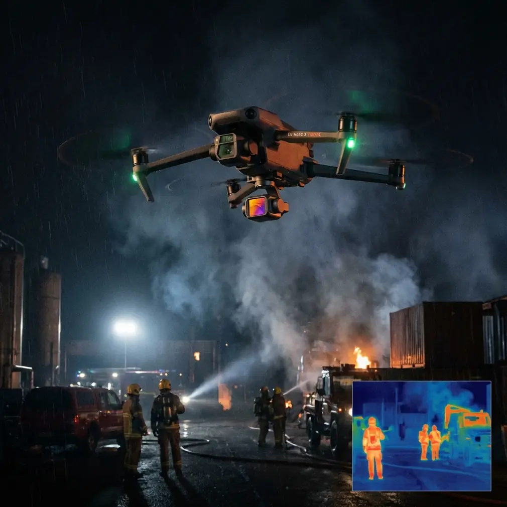
A highway in mountain terrain creates a layered shooting environment. You are not just tracking a vehicle or revealing a serpentine road. You are dealing with cut slopes, rock faces, power infrastructure, changing vertical relief, and frequent transitions between open sky and cluttered edges. If your drone loses compositional stability or struggles to read the environment, the footage stops feeling intentional very quickly.
With Neo 2, the operational goal is to make those changes survivable and repeatable.
That is where features people often mention casually, like obstacle avoidance and subject tracking, stop being convenience tools and become risk-reduction tools. On a mountain road, the difference between an open straightaway and a blind bend can be one second of flight time. A drone that can interpret nearby obstacles and maintain cleaner pathing gives the pilot more mental bandwidth to manage exposure, framing, wind, and line safety.
The same goes for ActiveTrack. On paper, tracking a moving subject sounds straightforward. In mountain road filming, it rarely is. Vehicles enter shadow, disappear briefly behind roadside structures, emerge against bright sky, then pass through terrain that narrows the available flight corridor. Good tracking matters not because it looks clever in a spec sheet, but because it preserves continuity when the background is changing harder than the subject.
Why the low-altitude imaging standard still matters for Neo 2 users
The standard’s scope is built around low-altitude digital aerial photography for mapping outputs like 1:500, 1:1000, and 1:2000. If you’re filming a highway sequence rather than producing a topographic deliverable, you might assume that has nothing to do with you.
I’d argue the opposite.
A standard built for those output scales is obsessed with consistency. It cares about flight height, imaging quality, planning discipline, and acceptance. Those same factors separate usable mountain-road footage from clips that looked fine on the controller and fall apart in post.
Take the 20-megapixel threshold mentioned in the document. Operationally, that points to one simple truth: in aerial work, detail is insurance. When filming highways in mountainous terrain, you often need flexibility later. Maybe the client wants a tighter crop on a lane merge. Maybe haze softened the distant ridge line and you need to stabilize and trim more aggressively than planned. Maybe the road geometry looked stronger in a narrower composition. More captured detail gives your footage room to survive those changes.
Then there is altitude capability. The standard’s distinction between 3,000 m for plains and hills versus 6,000 m for high mountains and plateaus reflects the fact that mountain assignments are really environment assignments. If the road is already at elevation, your aircraft is not starting from a neutral baseline. Performance margins narrow. Wind behavior gets stranger. Battery expectations become less forgiving. Even if your specific Neo 2 mission stays well below any absolute ceiling, the principle holds: you should judge suitability based on the total environment, not just the planned shot height above the road.
A flight I remember: weather changed mid-route
One highway shoot still sticks with me because it looked uncomplicated in pre-production.
We had a clean stretch of mountain road, layered switchbacks, and a window of soft morning light. The plan was simple: establish the highway line with a slow reveal, run a few tracking passes, then grab a higher-angle segment for a Hyperlapse sequence showing traffic movement through the valley.
The first part went exactly to plan. Neo 2 held the roadway cleanly, and the tracking sequence was smooth enough that I knew the edit would have options. Then the weather shifted.
Not dramatic storm conditions. The more annoying kind. A crosswind built along the exposed ridge, low cloud began to flatten the contrast, and the bright openings between clouds created alternating patches of glare and muted light across the asphalt. This is where mountain shoots become expensive in time if the drone and operator are not prepared.
Neo 2 handled the moment well for one reason above all: I stopped asking it for flashy moves and used it as a disciplined imaging platform.
Obstacle awareness mattered because wind was pushing the aircraft laterally closer to terrain edges than the original line suggested. Subject tracking still helped, but I loosened my expectations and gave the system more space to work instead of forcing a tight dramatic angle near roadside structures. I also shifted the image profile approach and prioritized footage that would grade well later. In changing mountain light, D-Log is not a buzzword. It is breathing room. When cloud cover and reflective pavement are fighting each other in the same shot, preserving tonal latitude is the difference between a usable sequence and a compromised one.
That weather change also killed one of the more ambitious transition ideas. Fine. We pivoted to shorter, more controlled passes and built the sequence in editing instead of trying to solve everything in a single flight path. That decision saved the shoot.
The lesson wasn’t that the drone performed heroically by itself. The lesson was that mountain highway filming rewards systems that let the pilot retreat into control when conditions stop cooperating.
Problem-solution: what mountain highway shoots demand from Neo 2
Problem 1: Elevation compresses your safety margin
A road in the mountains can already place you in an environment where aircraft performance feels less forgiving. The reference standard’s requirement for a platform ceiling of at least 3,000 m, and 6,000 m for higher mountain and plateau use, reminds us that terrain class changes the mission before takeoff.
Solution: treat the route as an altitude-and-weather job, not a driving-road job. On Neo 2, plan conservative passes first. Use your cleanest, most repeatable movements early, before wind and light evolve. If the highway offers multiple compositions, capture the essential geometry first: leading lines, elevation changes, and context reveals.
Problem 2: Roads move through clutter, not empty air
Mountain highways are bordered by slopes, cut faces, signs, barriers, retaining structures, and occasional vegetation intrusions. This is not the kind of environment where loose flying gets hidden by open space.
Solution: obstacle avoidance is operationally significant here because it reduces the workload during complex pathing. It should not encourage reckless proximity. It should allow more stable execution of conservative lines. In practice, that means using it to preserve smooth movement while maintaining enough stand-off distance for the system to do its job.
Problem 3: Tracking can break when the background becomes more dynamic than the subject
A car on a mountain road may be visually small compared with the surrounding terrain. Add shadows and changing contrast, and tracking consistency becomes harder than on flat open ground.
Solution: use ActiveTrack and subject tracking for continuity, not for maximum cinematic aggression. The best result often comes from giving the drone a clearer visual relationship to the subject instead of trying to squeeze dramatic side angles from every bend. In mountain work, reliable medium-strength tracking often beats unstable “epic” framing.
Problem 4: Light changes faster than your shot list
Clouds moving across ridges can alter exposure and contrast shot to shot, or within one shot.
Solution: shoot with post-production in mind. D-Log gives you latitude when the scene swings between shaded rock and bright road surface. If your concept includes timeline compression, Hyperlapse can work beautifully on highways because it emphasizes traffic rhythm and road geometry, but only if your base exposure strategy is stable. If conditions become erratic, simplify. Capture stronger anchors rather than forcing elaborate motion.
Where QuickShots fit, and where they don’t
QuickShots are useful on a mountain highway assignment when time is tight and you need efficient visual variety. A clean pull-away or reveal can quickly establish the road’s relationship to the surrounding terrain. For tourism, real estate access roads, scenic route promotion, and infrastructure storytelling, that speed is valuable.
But QuickShots are best treated as supporting footage, not the backbone of the project.
A highway in mountain terrain is fundamentally about directional flow. The most persuasive visuals usually come from controlled tracking, measured ascents, and carefully timed reveals that respect the road’s alignment. Automated patterns can add punctuation. They rarely replace intentional route-based cinematography.
Why image discipline wins over spectacle
The standard I mentioned earlier also references related documents on digital aerial camera verification and UAV operational safety requirements. Again, this is a production mindset. Verify the imaging system. Respect the operational framework. Organize results so they can be evaluated.
That mindset is exactly right for Neo 2 users working around mountain highways.
Too many operators approach these jobs as if the scenery will do all the work. Sometimes it does. More often, dramatic terrain exposes weak planning. If your camera handling is inconsistent, mountain footage looks chaotic. If your route logic is weak, the road loses visual authority. If your exposure is unstable, the atmosphere turns muddy instead of cinematic.
The best Neo 2 highway footage I’ve seen has a surveying mentality underneath it, even when the final product is purely visual. The pilot understands the corridor. The framing respects the route. The movement clarifies the geography instead of obscuring it.
A practical workflow that suits Neo 2 in this scenario
When I’m shaping a mountain highway shoot, I think in three layers:
Geographic clarity
Show where the road sits in the terrain. Wide reveals, elevated establishing passes, and careful use of horizon.Directional continuity
Use tracking and measured forward movement to make the route readable. This is where ActiveTrack earns its place.Editorial flexibility
Capture profiles and exposures that survive weather variation. D-Log helps. Higher image detail helps. Shorter backup takes help.
That approach matters more than trying to force every trendy move into one flight.
If you’re preparing a Neo 2 setup for this kind of work and need a second opinion on route planning, image settings, or mountain-road shot design, you can message a drone specialist here.
The bigger takeaway
Neo 2 can be a very capable tool for filming highways in mountain terrain, but only if you use it with the seriousness that the environment demands. The old aerial photography standard may come from a more formal mapping context, yet its priorities remain strikingly relevant: adequate imaging capability, clear flight parameters, altitude awareness, quality control, and disciplined planning.
For this kind of assignment, those priorities are not bureaucracy. They are survival mechanisms for good footage.
A mountain highway gives you only brief moments when geography, weather, traffic, and light align. Neo 2’s obstacle handling, tracking tools, QuickShots, Hyperlapse options, and D-Log workflow can all contribute. The trick is knowing which of those features solve a real problem and which simply add motion without adding meaning.
When the weather turns mid-flight, that distinction becomes obvious.
Ready for your own Neo 2? Contact our team for expert consultation.