Neo 2 Guide: Filming Remote Coastlines Without Losing
Neo 2 Guide: Filming Remote Coastlines Without Losing the Shot
META: A practical Neo 2 coastline filming guide covering obstacle avoidance, ActiveTrack, D-Log workflow, QuickShots, Hyperlapse, and why aerial capture can dramatically cut field time versus ground methods.
Remote coastlines make beautiful footage and bad plans. The light changes fast. Wind comes off the water in uneven bursts. Cliffs break line of sight. Tides erase access routes you expected to use twice in one day. If you are filming with the Neo 2 in places like that, the drone is not just a flying camera. It becomes your way to reduce wasted movement, shorten setup time, and pull usable visual data from terrain that is awkward to reach on foot.
That efficiency point deserves more attention than it usually gets.
In one heritage-survey case built around drone-based photogrammetry and Datugram3D processing, aerial mapping was estimated to cut costs by at least an order of magnitude compared with ground-only surveying. The source also notes that a total-station workflow could demand as much as 150 man-days, while the drone-centered process reduced downstream image-processing time by half and cut a comparable field schedule from 75 days to 30 days, even where some total-station work still remained. Those are surveying numbers, not filmmaking numbers. Still, the operational lesson carries over directly to remote coastline production: when the terrain is difficult, every minute saved by moving the camera into the air instead of moving the crew across rocks, dunes, and headlands compounds into a better day on location.
That is where the Neo 2 earns its place.
As a coastline tool, it sits in a sweet spot between portability and automated intelligence. Some competing small drones are easy to carry but less convincing once you ask them to track a subject along irregular shorelines, handle composition changes quickly, and produce footage flexible enough for color work. Others fly well but slow down the actual shoot because they need more intervention to get the shot you pictured in your head. For remote work, the best drone is not the one with the longest spec sheet. It is the one that helps you capture a sequence cleanly before the weather turns.
Start by treating the coastline like a survey problem
That may sound odd coming from a photographer, but it is the right mindset.
Before launching the Neo 2, divide the location into three visual layers:
The broad geography
Headlands, beaches, tidal flats, sea stacks, and access lines.The moving subject layer
A walker on a ridge, a vehicle on a coastal road, a surfer returning to shore, or even just wave rhythm if there is no human subject.The hazard layer
Spray, gust funnels near rock faces, birds, masts, cables near harbors, and blind spots created by terrain.
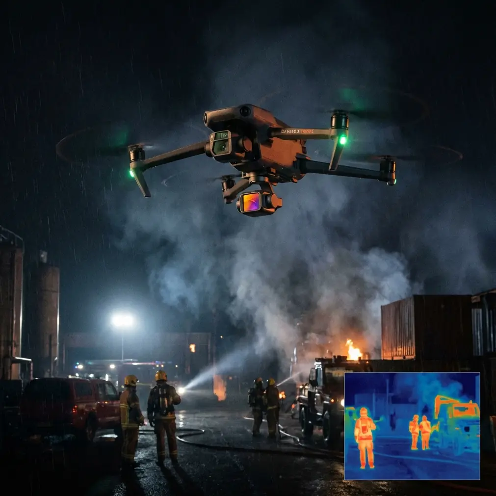
This is where obstacle avoidance and ActiveTrack stop being marketing terms and become practical tools. On a remote coastline, you rarely get wide open “perfect conditions” airspace. You get uneven topography, changing elevations, and moments where the subject moves from bright reflective sand into dark rock shadow. If the Neo 2’s obstacle avoidance is active and your route planning is conservative, you can focus more attention on framing and less on last-second corrections.
Competitor drones often claim similar intelligence, but many pilots know the difference between having obstacle sensing and trusting it enough to use it while flying a real subject route near terrain. Confidence matters. On a coastline, hesitation costs shots.
Build the first shot for safety, not style
My first launch in a new coastal location is rarely the dramatic reveal. It is a diagnostic pass.
Take off from the most stable launch zone you can find, not necessarily the most scenic one. Clifftop grass may look cinematic, but a flatter inland patch with less rotor wash disruption often gives a cleaner departure. Fly a medium-height out-and-back route parallel to the shoreline. During this pass, check four things:
- Wind consistency over land versus over water
- GPS stability and signal behavior near cliffs
- Visual glare off the sea at your planned camera angle
- How the Neo 2 responds when changing direction across gust lines
This pass is your equivalent of a location scout compressed into minutes.
In old ground-based workflows, difficult terrain can devour labor. The heritage reference is a perfect example: a conventional total-station approach could reach 150 man-days. For a filmmaker, the coastline version of that problem is not “man-days” on a bid sheet. It is repeated hikes to recover angles you should have captured in one flight. A drone that lets you read the whole coastline early saves more than battery life. It saves your creative energy.
Use ActiveTrack where the shoreline already gives you composition
ActiveTrack is one of the most misused features in coastal filming. Pilots switch it on and expect the drone to invent good framing. That is not its job.
The strongest use case is when the landform already creates a directional line. Think of:
- a narrow trail tracing a cliff edge
- a person walking along the wet-sand line at low tide
- a van moving on a coast road with the sea on one side
- a kayak hugging an inlet curve
In those situations, ActiveTrack gives you consistency while you make finer decisions about altitude, lateral offset, and reveal timing. The Neo 2 stands out here because it turns a technically demanding shot into a repeatable one. On remote coastlines, repeatability is gold. If the light opens for ninety seconds, you do not want to be manually rebuilding the same tracking pass from scratch.
A smart way to work is this:
- Run the first pass higher and wider than you think you need.
- Check whether the background separation is strong enough.
- Then lower altitude gradually on the second or third pass if terrain clearance allows.
That sequence sounds basic, but it prevents the classic coastal mistake: starting too low over uneven ground and spending the whole shot thinking about safety instead of framing.
QuickShots are not just for casual clips
A lot of experienced operators dismiss QuickShots too quickly. On a remote coastline, that is a mistake.
QuickShots are useful because they help you secure transitional footage fast when conditions are unstable. If cloud movement is changing your contrast every few minutes, or if you are hiking between points with limited battery reserve, a reliable automated move can fill critical gaps in your edit.
Good coastal uses include:
- a short reveal rising above a rock shelf
- a pullback from a solitary figure at the surf line
- a curved orbit around a lookout point
- a compact dronie move from dune vegetation to open water
The key is restraint. Use QuickShots as structural footage, not the entire visual language of the piece.
This is another area where the Neo 2 can outperform competitors in practical terms. The best automated move is the one you actually keep in the final cut. If a drone’s automated path feels stiff, or if obstacle handling makes you nervous near terrain, you stop using the feature. When the execution is dependable, QuickShots become a speed tool. And speed, especially in remote environments, is often what separates a polished sequence from an incomplete one.
Shoot D-Log when the coast gives you contrast extremes
Coastlines are brutal on dynamic range. Bright foam, reflective water, pale sky, black rock, and shaded vegetation can all sit in the same frame. If you are serious about preserving options in post, D-Log matters.
I would not use it blindly for every single flight. If the goal is a quick social cut with minimal grading, a standard profile may be enough. But when you are filming in hard midday conditions or capturing scenes where sea haze and cliff shadow coexist, D-Log gives you room to rebalance the image later without breaking it apart.
Operationally, this means three things:
- protect highlights on water before anything else
- avoid overexposing cloud detail just to lift dark cliffs
- keep your white balance consistent across sequences
Consistency is what makes coastal edits feel expensive. Not gear alone. Not dramatic scenery alone. Consistency.
And there is a useful parallel with the reference case. Datugram3D’s value in that project was not just that it processed images. It produced outputs directly usable in CAD, including terrain maps, cross-sections, roof plans, façade plans with orthographic imagery, and 3D vector models in AutoCAD. In other words, the aerial capture translated cleanly into downstream deliverables. That same principle applies to D-Log footage from the Neo 2. The image you record should be captured in a way that supports the next stage of work. A flat profile is not about looking cinematic on the controller screen. It is about producing footage that grades cleanly when the scene is visually difficult.
Hyperlapse works best when the landscape is doing the motion
Hyperlapse on the coast can go wrong fast. The mistake is trying to force it into scenes where nothing meaningful changes except your battery percentage.
Use Hyperlapse when the environment already contains moving systems:
- cloud bands sliding over cliffs
- waves crossing repeating rock patterns
- tide lines shifting around a cove
- vehicles or walkers moving through a static coastal frame
The Neo 2 becomes especially useful here because you can establish a stable aerial perspective that would be impossible or exhausting to repeat from a ground position. If you have ever scrambled over uneven shoreline with a tripod, trying to maintain composition while wind rattles everything, you understand the benefit immediately.
Again, the heritage-survey numbers are instructive even outside surveying. Cutting fieldwork from 75 days to 30 days in a partially hybrid workflow shows what aerial efficiency looks like when terrain complexity is real. For filmmakers, Hyperlapse is one expression of that same advantage. You are extracting time-based visual information from a place without physically inhabiting every inch of it.
Plan batteries around access, not just airtime
Remote coastlines punish optimistic battery planning.
Do not think in terms of “how many minutes can I stay airborne?” Think in terms of “how many complete shot cycles can I safely execute from this access point before the retrieval hike starts to affect my judgment?” A shot cycle includes launch, positioning, one or two committed takes, a recovery buffer, and landing.
That matters more than the marketing flight-time number.
If the location demands a steep descent to the launch spot or a long walk back over exposed rock, preserve margin. Tired pilots make bad calls. Salt air also has a way of making routine handling feel less routine by the end of the session.
A practical coastline sequence with the Neo 2
If I were building a 60- to 90-second coastal film, I would structure it like this:
1. Establishing pass
A broad, slightly elevated run parallel to the coast. Let viewers understand geography first.
2. Subject introduction
Use ActiveTrack on a walker or vehicle moving through a natural line in the landscape.
3. Terrain detail transition
Insert a QuickShot reveal from rock texture or dune grass to the ocean.
4. Hero motion shot
A lower, more committed follow or angled side track where the subject and coastline relationship feels strongest.
5. Environmental pause
A Hyperlapse showing cloud or tide movement from a stable aerial position.
6. Final pullaway
Climb and recede, leaving the subject small within the larger coastline.
That sequence works because it uses the Neo 2’s automation selectively. You are not handing the film over to the aircraft. You are using the aircraft to remove friction from difficult shots.
Why the Neo 2 fits remote coastline creators particularly well
The real advantage is not one isolated feature. It is how the features reduce operational drag in a location where drag multiplies fast.
- Obstacle avoidance helps near irregular terrain.
- ActiveTrack makes moving-subject coverage more repeatable.
- QuickShots capture transition footage quickly when conditions are unstable.
- Hyperlapse turns slow environmental change into usable storytelling.
- D-Log protects footage when sky, sea, and rock all fight for exposure at once.
Some drones compete strongly on paper. Fewer feel equally cooperative when you are cold, standing in wind, judging tide timing, and trying to leave with a complete sequence instead of a folder full of almost-shots. That is where the Neo 2 excels.
If you are planning a real coastline project and want to talk through setup, workflow, or location strategy, you can message a drone specialist here.
The smartest way to film a remote coast is to stop thinking only like a pilot. Think like a field operator managing terrain, time, and outputs. The reference heritage case shows exactly why aerial systems keep winning that equation: less physical effort over difficult ground, faster processing, and deliverables that arrive in forms people can actually use. For a filmmaker, the deliverable is not a CAD section or a 3D vector model. It is a sequence that feels intentional, stable, and hard-earned without looking hard-won.
That is the promise of a good coastal drone workflow. Less scrambling. More seeing.
Ready for your own Neo 2? Contact our team for expert consultation.