Filming Coastlines with Neo 2: A Field Report on Mapping
Filming Coastlines with Neo 2: A Field Report on Mapping Discipline, Safer Recoveries, and Cleaner Post Workflow
META: A field-tested Neo 2 coastline workflow built from orthomosaic mission practices: landing control at 1 meter, DTM-assisted processing, manual sensor pixel size entry, and file-path discipline for reliable results.
Coastlines punish sloppy drone habits.
They expose weak planning in the air, and they punish weak data discipline on the ground. Light changes fast. Wind shifts sideways off the water. Sand, rock, foam, vegetation, and reflective surfaces all end up in the same frame. If you are using Neo 2 along the coast—whether for cinematic passes, inspection visuals, environmental documentation, tourism media, or training flights—the difference between a good session and a wasted one often has less to do with flight bravado than with how well you borrow from structured mapping practice.
That may sound strange if your first thought about Neo 2 is QuickShots, subject tracking, ActiveTrack, or compact shoreline content capture. But one of the most useful lessons for coastline work comes from an orthomosaic workflow built around DJI GS Pro and Envi OneButton. The reference material is not flashy. It is procedural. That is exactly why it matters.
I have seen plenty of pilots obsess over D-Log profiles and Hyperlapse timing while overlooking the things that actually protect a field session: controlled recovery, terrain-aware processing, and correct camera metadata. Those details are where coastline reliability lives.
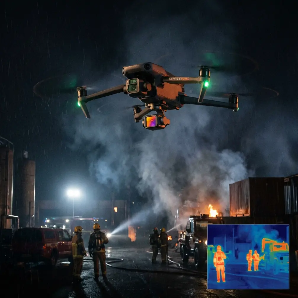
The 1-meter hover rule changes the way you recover over coastal terrain
One practical detail from the source stands out immediately: during landing, the aircraft can hover at about 1 meter above the ground and wait for pilot instruction, allowing the operator to take over and complete the descent manually.
For coastline filming, that is more than a convenience. It is an operational safety buffer.
Beaches and rocky edges are rarely uniform landing zones. A drone descending onto dry sand behaves differently from one settling near damp packed shoreline, driftwood, or uneven stone. Add crosswind from the sea and you have a common problem: the final meter is the least predictable part of the whole mission. If Neo 2 operators adopt this same mindset—treating the last meter as a deliberate handover point rather than an automatic afterthought—they reduce the chance of a messy touchdown, prop wash debris, or a bad catch decision.
This is especially relevant when filming coastlines for repeatable commercial work. Maybe you are documenting erosion over time, collecting content for a resort, or creating progress visuals for a marine-adjacent construction site. In those settings, the landing is part of the workflow, not just the ending. A stable hover near ground level gives you a moment to assess gusts, surface texture, and obstacles before committing.
That ties directly into obstacle avoidance habits. Even if Neo 2 offers strong automated support, coastal operators should think beyond obstacle sensors. Reeds, fence lines, mooring ropes, beach signage, and irregular rock formations do not always present themselves cleanly in a low-angle return. Automation helps, but judgment still finishes the job.
My own rule for shoreline work is simple: if the landing zone changed while I was in the air—more people moved in, a tide line crept closer, wind shifted, or loose debris became active—I do not trust the final descent to routine behavior. I want the drone settled, stable, and waiting for me before the last drop.
Antenna positioning matters more at the coast than many pilots admit
The coastline is one of those environments where people routinely misread range issues. They blame the drone, the battery, or local interference. Often the real culprit is body position and antenna orientation.
When I am flying Neo 2 along a beach or cliff edge, I keep the controller antennas broadside to the aircraft rather than pointed directly at it. That matters because the strongest signal pattern is usually off the sides, not the tip. I also avoid standing too low behind dune grass, concrete barriers, parked vehicles, or metal railings that can interrupt a clean path to the aircraft. If I am tracking a moving subject with ActiveTrack along the shoreline, I will reposition myself early rather than waiting for signal quality to degrade.
Over water, the visual openness can fool you into thinking the link will always be perfect. Yet coastal zones often stack multiple complications at once: reflective surfaces, tourist infrastructure, boats, Wi‑Fi congestion near promenades, and terrain breaks if you are operating near bluffs or harbor walls. Good antenna positioning is free performance. It costs nothing and solves a surprising number of “range” complaints.
That matters operationally because subject tracking and QuickShots only work well when the command link and video feed remain consistent. If your Neo 2 is following a runner beside breaking surf or pacing a cyclist on a coastal road, smooth link quality helps preserve framing discipline. It also reduces the temptation to overcorrect with abrupt stick inputs when the feed stutters.
Why a mapping workflow belongs in a coastline filming conversation
The reference document centers on processing flight outputs with Envi OneButton. For many Neo 2 users, that sounds like a world away from everyday content capture. It is not.
Coastline work often overlaps with documentation. A creator might shoot cinematic reveal shots in the morning, then collect overlapping imagery for a stitched site overview in the afternoon. A marina operator may want marketing footage one week and shoreline condition records the next. Environmental teams frequently need visuals that are attractive enough for public communication and structured enough for analysis.
That is where the source material becomes valuable. It highlights a processing step that uses a DTM folder—a digital terrain model input—to support computation. If the operator does not have a more accurate local DTM, the software can download one automatically for the mapped area.
Here is why that matters in plain field terms: coastal terrain is deceptive. A beach berm, seawall, dune face, raised path, or sloped access road can introduce vertical variation that affects how image geometry is interpreted during stitching. Terrain-aware processing improves the chance that your final orthographic output is usable rather than merely interesting.
For Neo 2 operators, the lesson is broader than one software package. If you are capturing coastline imagery that may later be stitched, measured, compared over time, or integrated into planning documents, terrain context matters. Flat-Earth assumptions fail quickly in mixed coastal topography. Even modest elevation changes near the shore can distort a result if your workflow ignores them.
This is one reason I encourage creators to think in two layers during coastal shoots. First layer: the hero footage—tracking, Hyperlapse, low-elevation reveals, maybe D-Log for grading latitude. Second layer: the disciplined overlap set captured with future processing in mind. If those images may support an orthomosaic or change record later, terrain support is not a luxury.
The tiny camera number that can quietly ruin an entire deliverable
The most technical detail in the source is also one of the most useful: when a new drone model is not yet included in the software’s lens library, the sensor pixel size may not populate automatically. In the example given for Mavic imagery, the value must be entered manually as 0.00158173 mm.
That one number deserves attention because it reveals a common industry problem. New aircraft reach the field before every downstream software package fully recognizes them. Pilots assume compatibility. Processors assume metadata is complete. Then a stitched product comes out wrong, alignment drifts, scale behaves oddly, or internal calculations are less reliable than expected.
For Neo 2 users, the practical lesson is not that this exact value belongs to your aircraft. It is that if your platform is new—or if your processing software has not fully caught up—you cannot assume the camera model is correctly interpreted. You need to verify lens and sensor parameters before trusting output quality.
Operationally, this matters a lot for coastline projects because repeatability is often the point. If a local council, resort manager, environmental consultant, or infrastructure owner wants imagery from the same stretch of coast across multiple dates, even small metadata problems can undermine comparison value. A beautiful stitched map that is geometrically weak is still weak.
This is where creator culture and technical discipline often part ways. In creator circles, if the image looks good, the job feels done. In professional coastal documentation, “looks good” is not enough. If the software misses a camera parameter and no one catches it, your output may be attractive but unreliable.
If you are unsure how to validate a Neo 2 post pipeline for coastal deliverables, you can message a workflow specialist here before building a repeat-flight template around bad assumptions.
File naming sounds boring until it breaks your export
Another source detail that deserves more respect than it gets: after exporting flight results to a computer, the directory path should not contain Chinese characters.
This is not a language issue so much as a compatibility issue. Some processing tools, plugins, or legacy dependencies behave unpredictably when project paths include unsupported characters. And when they fail, they often fail in unhelpful ways—missing files, stalled imports, incomplete outputs, or unexplained errors halfway through a job.
For a Neo 2 coastline operator, this translates into one simple rule: make your folder structure boring on purpose.
Use short, clean, Latin-character file paths. Keep project names consistent. Separate raw video, stills, proxy media, exports, and mapping imagery. If you are combining cinematic footage with structured capture from the same site, label folders clearly enough that you never feed the wrong image set into a stitching workflow.
Why is this especially useful at the coast? Because shoreline jobs generate mixed media quickly. One battery may produce tracking clips, low passes, and D-Log scenic shots. Another may produce high-overlap stills for site context. If your files are disorganized, post-production becomes a guessing game. If your file paths introduce compatibility trouble, that guesswork turns into delay.
The best coastline teams I know are not just good pilots. They are clean archivists.
A smarter way to use Neo 2 features at the shore
Neo 2’s appeal for coastline work is obvious: compact deployment, automated shot modes, subject tracking, and creative profiles that let a small aircraft produce polished visual storytelling. But the source material points toward a better way to think about those features.
Use automation for capture, not for thinking.
ActiveTrack can help follow a jogger, paddleboard launch, or shoreline inspector moving along a predictable route. QuickShots can establish scale around a cove or coastal path. Hyperlapse can show tide movement, surf patterns, or changing foot traffic near a waterfront site. D-Log can preserve highlight and shadow information when bright sea reflections compete with darker land textures.
None of that replaces mission structure.
Before takeoff, I want a recovery plan. During flight, I want a line of sight that supports both obstacle awareness and antenna efficiency. After flight, I want metadata and folder hygiene that support future processing. If the mission also includes overlapping stills for stitched outputs, I want terrain-aware post options and verified camera parameters.
That is the real lesson hidden inside the GS Pro and OneButton references. Sophisticated coastal results do not come from treating drone work as either “creative” or “technical.” The strongest field practice merges both.
What this means for repeatable coastal operations
If you are serious about using Neo 2 along the coast, whether as a creator or a commercial operator, here is the operational hierarchy I would follow:
First, secure the link. Stand where your antennas have a clean relationship to the aircraft and where local obstructions do not sabotage you.
Second, protect the recovery. Treat the final meter of descent as an active decision zone, not dead time.
Third, separate visual capture from data capture, even if the same aircraft does both.
Fourth, verify post assumptions. Terrain support, sensor metadata, and software compatibility all matter more than most pilots realize.
Fifth, keep your archive clean. Organized files are not administration; they are production insurance.
Coastlines reward people who respect process. The waves, wind, and scenery may be what the audience notices. The real craft is in the quiet details they never see.
Ready for your own Neo 2? Contact our team for expert consultation.