Neo 2 in Complex Terrain: A Practical Flight Routine
Neo 2 in Complex Terrain: A Practical Flight Routine for Safer Field Delivery Missions
META: A field-tested Neo 2 tutorial for delivery work in complex terrain, covering pre-flight cleaning, obstacle avoidance, subject tracking, camera setup, and safer route planning.
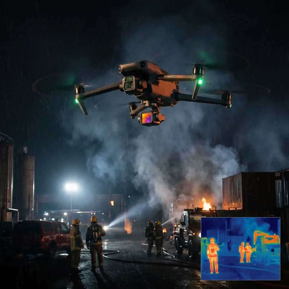
Complex terrain exposes every weakness in a drone workflow. Ridgelines compress GPS confidence. Tree lines interrupt sight paths. Dust, pollen, and moisture collect where pilots forget to look. If you are using a Neo 2 for field delivery work, the difference between a smooth sortie and a forced abort often comes down to routine rather than raw flight skill.
That is the real value of a disciplined pre-flight process. Not just battery checks and prop inspection, but the less glamorous step that many operators rush past: cleaning the sensors and camera surfaces that feed the aircraft’s safety and tracking systems.
For Neo 2 missions in uneven ground, wooded edges, terraces, quarry roads, ravines, utility corridors, or agricultural cut paths, this step matters more than most pilots admit. Obstacle avoidance, ActiveTrack, subject tracking, QuickShots, and even how useful your D-Log footage becomes after the flight all depend on the drone seeing clearly before it ever leaves the ground.
This tutorial is built around that one operational truth.
Why cleaning is not cosmetic on a Neo 2
Pilots sometimes treat lens cleaning as a content concern. Wipe the camera if you want cleaner footage. Leave it alone if the flight is functional. That mindset breaks down fast in delivery scenarios.
On a Neo 2, the aircraft’s situational awareness depends on optical surfaces and sensor windows remaining readable in bad field conditions. Fine dust from dry access roads, mist from creek crossings, residue from fertilizer zones, and even a single fingerprint can degrade how the drone interprets nearby space. In open sky, you may never notice. In complex terrain, you will.
A branch overhang that should be identified earlier may be recognized later. Ground texture used for stable positioning can appear less distinct. Subject tracking can become less reliable when the aircraft is trying to hold visual lock on a moving person receiving or guiding a delivery path. The system is not simply “on” or “off.” It performs on a spectrum, and contamination pushes it the wrong way.
That is why the cleaning step belongs with flight safety, not just image quality.
The 3-minute pre-flight cleaning routine
Before any delivery run, especially in sloped or obstructed terrain, I recommend a simple three-minute sequence.
First, power the aircraft down and move away from blowing dust or vehicle exhaust. There is no point cleaning in the same environment that is coating the drone.
Second, inspect the front camera, any obstacle sensing windows, and downward-facing surfaces under angled light. Smudges hide in flat light. Turn the drone slightly and let the glare reveal what your eye misses.
Third, use a clean microfiber cloth and remove dust before applying pressure. Rubbing grit across a lens window does not clean it; it grinds contamination into the surface. If the residue is sticky, use a lens-safe cleaning method appropriate for field optics. Keep it minimal. The goal is clarity, not a wet housing.
Fourth, inspect the propellers and motor vents right after cleaning the visual system. These areas often collect the same debris, and this is the right moment to catch both.
Fifth, once powered on, verify that the live feed looks clean and that the aircraft is not reporting any sensing or vision-related issue before launch.
Three minutes is enough. In return, you reduce the risk of false confidence from a drone that technically arms but is no longer interpreting the environment at full fidelity.
Why this matters more in complex terrain than open ground
A Neo 2 flying over a clear field has room to absorb small errors. A Neo 2 descending into a narrow delivery window beside rock walls, orchard rows, or slope-side structures does not.
Complex terrain creates three compounding pressures:
- The route often changes elevation quickly.
- Obstacles appear from multiple angles, not just straight ahead.
- Visual contrast can shift dramatically from shade to sun.
That combination stresses obstacle avoidance and tracking logic. If the aircraft’s optical surfaces are dirty before takeoff, your safety margin narrows before the mission even starts.
Consider a basic field handoff on uneven terrain. The receiver walks uphill to a visible clearing while the drone approaches from a lower contour. ActiveTrack or subject tracking may help maintain awareness of the person on the ground, but those systems rely on a usable visual signature. If the drone’s camera window is smeared, the aircraft may still fly, but the track quality can degrade just when the subject moves from bright sunlight into patchy shade near trees.
Operationally, that means more manual correction, more attention diverted to flight management, and less reserve for handling wind or route changes.
Build the route after the cleaning check, not before
Many pilots open the app and start thinking about path geometry first. I prefer the opposite order for delivery work in difficult terrain. Clean the aircraft. Confirm visual clarity. Then design the route with confidence that the drone’s sensing is giving you honest input.
With the Neo 2, I would structure the route in four layers:
1. Entry corridor
Choose the cleanest line with the fewest lateral surprises. In complex terrain, the shortest path is rarely the safest. A route that adds 20 or 30 seconds but avoids tree encroachment or rock outcrops is usually the better mission profile.
2. Decision point
Pick a location where you can still abort cleanly. This should be before the aircraft commits to a narrow area, drop zone, or final handoff path. If the live view or aircraft behavior suggests any sensing inconsistency, this is where you back out.
3. Delivery zone
Treat the destination as a volume, not a point. In rough terrain, the usable airspace around a handoff location may be smaller than it looks from a map. Watch for overhead branches, rising ground, wire risk, and moving people entering the approach lane.
4. Exit route
Do not improvise the departure. Terrain traps pilots on the way out because the stressful part feels “done.” Plan the exit while you are still calm.
The reason this sequence works is simple: route planning is only as reliable as the aircraft’s ability to perceive what it meets. Cleaning first improves the trustworthiness of every decision after it.
Using obstacle avoidance without overestimating it
Obstacle avoidance is one of the most misunderstood features in field operations. Pilots either lean on it too heavily or ignore it out of habit. Neither approach is smart.
With a Neo 2 in complex terrain, obstacle avoidance should be treated as a risk reduction layer, not permission to fly casually into cluttered spaces. It helps identify threats you might miss. It does not remove the need for angle discipline, speed control, and conservative spacing.
A dirty sensing surface makes overreliance even more dangerous because the pilot thinks the system is fully available when, in practice, it may be working with degraded visual input.
That is why the pre-flight wipe-down has direct operational significance. It improves the conditions under which obstacle avoidance does its job. Not perfectly. Not magically. Just materially better.
In real field delivery work, “materially better” is often enough to prevent a bad day.
When subject tracking and ActiveTrack actually help
For delivery missions, subject tracking and ActiveTrack are useful in a narrower set of situations than marketing materials suggest. They are not there to replace piloting. They are there to reduce workload when a moving recipient, spotter, or field technician needs to remain visually referenced during a controlled segment of the mission.
Used well, these features help in two cases:
- A recipient is walking to a safer handoff area across uneven ground.
- A spotter is guiding the aircraft around terrain features while maintaining movement.
In those situations, maintaining a stable visual relationship with the person can reduce pilot workload. But again, the entire benefit depends on the drone’s camera and sensing surfaces being clean enough to preserve tracking confidence.
A single overlooked smudge can turn a helpful automation layer into something inconsistent and distracting. The operator then wastes attention deciding whether the feature is trustworthy mid-flight. That is the wrong time to discover a preventable issue.
If your crew wants a tighter field workflow for that handoff stage, you can share mission details with our team here: https://wa.me/example
QuickShots and Hyperlapse are not just “content modes”
For a delivery reader, QuickShots and Hyperlapse may sound secondary. They are not central to the mission, but they can still provide operational value when used intentionally.
QuickShots can help during site familiarization or post-mission review by generating fast, repeatable visual context around a location. If you are scouting a handoff area surrounded by terrain complexity, a controlled automated capture can reveal approach constraints that were not obvious from a static hover.
Hyperlapse is not a delivery tool in the direct sense, but it can document environmental change across a route corridor. Wind movement in trees, shifting ground traffic, livestock patterns, water crossing activity, and changing light in narrow valleys all influence repeat missions. A concise time-compressed view can make those patterns easier to study.
Neither mode should distract from the task. But both become more valuable when your visual system is clean and the image is trustworthy from the start.
Why D-Log matters even for utility-style missions
Some operators assume D-Log belongs only to cinematic flying. That misses the point. In field work, D-Log can preserve more usable image information in mixed lighting, which is common in complex terrain.
Think about a delivery route that moves from bright exposed ground into shadow under trees or near a cut bank. Standard-looking footage may clip highlights or crush detail right where you need visual evidence for review. D-Log gives you more flexibility later to examine what the aircraft actually saw.
That makes it useful for debriefing. If a route felt tighter than expected, if the receiver moved unpredictably, or if obstacle spacing looked different on final approach than during planning, richer recorded footage gives you more to work with afterward.
Once again, none of that helps if the optical path is compromised before takeoff. Clean lenses and sensor windows first. Then the recording mode becomes worth something.
A practical field workflow for Neo 2 delivery teams
If I were standardizing a Neo 2 routine for complex-terrain delivery crews, I would keep it simple and repeatable:
- Secure a clean setup area away from dust and rotor wash.
- Inspect and clean the camera and sensing surfaces.
- Check props, motors, frame, and landing condition.
- Power on and confirm a clean live image and no vision warnings.
- Build the route with a defined entry, decision point, delivery zone, and exit.
- Use obstacle avoidance as support, not as your primary safety plan.
- Use subject tracking or ActiveTrack only where it reduces workload in a controlled segment.
- Record in D-Log when lighting contrast may complicate later review.
- Debrief immediately after landing while the route is fresh in memory.
This is not flashy. It is effective.
The bigger lesson
Complex terrain punishes loose habits. That is the real story behind Neo 2 field delivery work. The technology can do a lot, but it still depends on the operator respecting the chain of small decisions that shape every mission.
The pre-flight cleaning step sounds minor until you connect it to everything downstream: obstacle avoidance reliability, subject tracking confidence, ActiveTrack usefulness, route interpretation, and post-flight footage quality. Then it stops looking minor.
A Neo 2 does not need a dramatic new feature to become safer in the field. Often it needs a better routine. Three careful minutes on the ground can protect the next 15 or 20 minutes in the air, especially where terrain removes your margin for error.
If you fly deliveries in orchards, ridgelines, hillside access roads, quarry cuts, or broken agricultural land, make sensor cleaning part of the launch standard. Not optional. Standard.
That one habit earns its place every time the aircraft threads through a difficult approach with fewer surprises and more honest situational awareness.
Ready for your own Neo 2? Contact our team for expert consultation.