Neo 2 on Remote Construction Deliveries: A Field Case Study
Neo 2 on Remote Construction Deliveries: A Field Case Study That Goes Beyond Footage
META: A practical Neo 2 case study for remote construction delivery support, covering obstacle avoidance, subject tracking, QuickShots, Hyperlapse, D-Log, ActiveTrack, and accessory-based field workflow gains.
Remote construction projects have a habit of exposing weak equipment fast. Roads wash out. Cellular coverage drops. Site layouts change by the hour. Crews split across ridgelines, temporary staging zones, and half-finished access routes. In that setting, a small drone is only useful if it does more than capture pretty clips. It needs to reduce friction.
That is the lens I used when evaluating the Neo 2 for a remote construction delivery scenario.
This is not about replacing trucks, cranes, or trained site logistics teams. It is about the layer in between: the constant need to verify access conditions, confirm delivery points, monitor route changes, brief incoming contractors, and produce visual records without sending people on repeated back-and-forth drives. On remote jobs, those small inefficiencies pile up into lost daylight and delayed handoffs.
The Neo 2 makes the most sense when you treat it as a compact aerial field assistant rather than a flying camera.
The job: supporting deliveries where the map is already out of date
The project that shaped this assessment involved a remote construction site with difficult access and uneven terrain. Deliveries were arriving in phases. Some loads were straightforward. Others needed rerouting because temporary storage areas had shifted after weather events and earthmoving activity. The drone’s role was simple on paper: help the site team see what had changed before dispatching vehicles deeper into the job area.
What mattered was not raw flight endurance alone. The key was how quickly the aircraft could be launched, how reliably it could navigate around clutter, and whether the output was usable by both site supervisors and off-site stakeholders.
That is where a Neo 2-style workflow begins to earn its place.
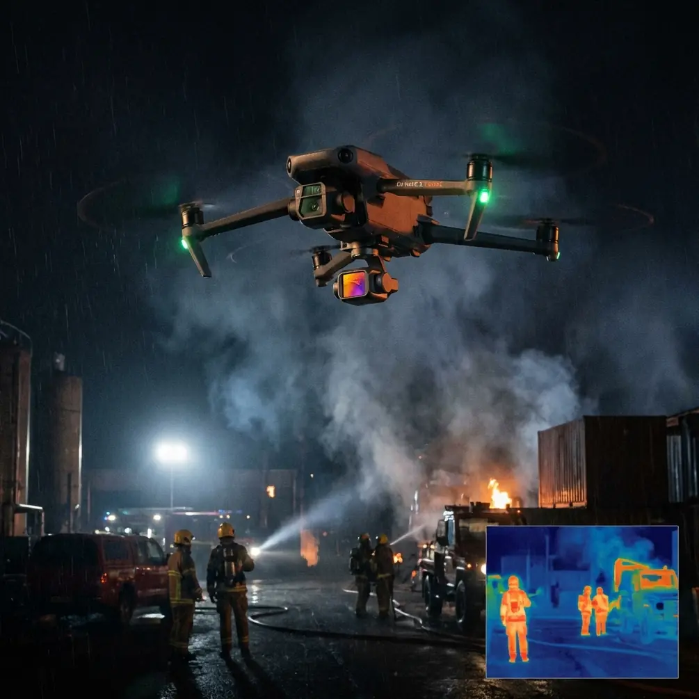
Why obstacle avoidance matters more on construction sites than in open landscapes
A lot of drone discussions flatten “obstacle avoidance” into a checklist feature. On remote construction sites, it has operational weight.
These environments are rarely clean open spaces. You have temporary fencing, material stacks, utility poles, cables, containers, scaffolding, half-completed steelwork, and moving equipment. Add dust, glare, and changing shadows, and even a short recon flight becomes more demanding than a casual pass over farmland.
With obstacle avoidance in the mix, the Neo 2 can support lower-stress close-range route verification around work zones where a pilot needs to inspect approach corridors or document a newly established unloading area. That does not eliminate the need for careful piloting. It does reduce the chances that a quick “just check that corner” mission turns into a recovery problem.
For remote delivery support, this matters because the drone is often being launched for short, practical tasks. A pilot might need to confirm whether a narrow access lane is still passable or whether temporary barriers have been moved before a truck commits to the last section of road. If the aircraft can handle cluttered space more confidently, those micro-missions become realistic parts of daily operations instead of exceptional events.
Subject tracking is not just for creators
One of the more misunderstood tools in compact drones is subject tracking. People hear “subject tracking” or “ActiveTrack” and immediately think of action sports or social media clips. On a construction site, that is far too narrow.
In this use case, subject tracking became useful for following a moving utility vehicle transporting small materials from the main staging point to a remote work face. Instead of manually fighting every minor course correction, the pilot could focus on framing and airspace awareness while the aircraft maintained attention on the moving subject.
That had two practical benefits.
First, it created a cleaner visual record for supervisors reviewing delivery flow. They could see how long the route actually took, where bottlenecks formed, and which sections forced vehicles into awkward detours. Second, it improved communication with subcontractors arriving later. A tracked overhead clip of the actual route often explained site conditions better than a marked-up screenshot ever could.
ActiveTrack and subject tracking are especially useful when the terrain has poor visual continuity from the ground. On remote projects, you may not have a single vantage point that reveals the entire movement path. An aerial follow shot fills that gap.
QuickShots and Hyperlapse have a job here too
At first glance, QuickShots and Hyperlapse sound cosmetic compared to inspection or route planning. They are not.
QuickShots can create fast, repeatable overview sequences that help teams document progress from consistent vantage patterns. When a site manager needs a brief visual update without spending time on manual cinematic flying, a structured automated shot is efficient. It is one of those features that looks lightweight until a project asks for updates three times a week.
Hyperlapse is even more useful than many site teams expect. Construction logistics are not static. Weather shifts traffic patterns. Equipment arrives late. Temporary roads evolve. A Hyperlapse sequence from a known position can show how a staging yard changes over several hours, or how delivery activity builds and clears through a workday.
That kind of time-compressed view is valuable because remote projects often suffer from fragmented visibility. One team sees the excavation area. Another sees the materials laydown zone. Another is waiting on incoming loads from town. A Hyperlapse can connect those moving parts into a single visual timeline.
Used well, these tools do not decorate the project. They shorten explanation cycles.
D-Log is not just for colorists
D-Log tends to get filed under “advanced video settings,” as if it only matters to post-production specialists. In real-world construction documentation, it has a more grounded advantage: preserving flexibility in challenging light.
Remote sites often produce harsh contrast. Bright sky, reflective metal, shaded trenches, pale aggregate, and dark machinery can all land in the same frame. If you are shooting for documentation that may later be used in reporting, stakeholder review, or claims support, having a flatter capture profile with more grading latitude can matter.
D-Log gives editors more room to recover detail and create a consistent look across multiple flights, especially when footage is gathered at different times of day. That consistency becomes operationally useful when site updates are compared over time. It is easier to evaluate change when exposure and color do not swing wildly from one session to the next.
No, every construction team needs D-Log in the hands of a disciplined operator helps transform “we have drone footage” into “we have usable visual records.”
The third-party accessory that made the Neo 2 more practical
The most meaningful improvement in this case did not come from the airframe alone. It came from a third-party high-brightness monitor hood and mounting bracket setup attached to the pilot’s mobile device.
That sounds modest. It was not.
Remote construction sites are full of viewing problems: noon glare, dust, reflective surfaces, and awkward standing positions near vehicles or stockpiles. Even when the drone itself is performing well, poor screen visibility slows decision-making. Pilots hesitate. Supervisors crowd around the display and still cannot see what matters. Framing errors increase because the operator is judging exposure and composition on a washed-out screen.
Adding a rigid hooded mount made the Neo 2 easier to use under direct sun and windblown dust. The pilot could hold a steadier viewing angle, supervisors could check the feed more quickly, and short flights became more decisive. That accessory did not change the aircraft’s flight characteristics, but it changed the workflow enough that the drone was launched more often for practical checks.
That is usually the real test of field value. Not whether a feature looks impressive in isolation, but whether the team actually uses it when pressure is on.
A sample remote-delivery workflow with Neo 2
Here is how the Neo 2 fit into a repeatable site routine.
1. Morning access verification
Before a scheduled delivery window, the pilot launched from the main compound and used a short reconnaissance flight to assess the current route into the remote work zone. Obstacle avoidance helped during low-to-medium altitude passes near temporary structures and stacked materials. The goal was not artistic footage. It was a fast answer to a simple question: can vehicles still use the planned path?
2. Delivery-point confirmation
The aircraft then captured a brief overhead sequence of the intended unload zone. QuickShots were useful here because they produced a clear, structured site view with minimal setup. That clip could be shared internally so the incoming driver and site lead were aligned on the exact drop area.
3. Movement tracking
When a support vehicle or small material run headed into the work face, ActiveTrack or subject tracking helped document the real route and identify delays. This was especially helpful on stretches where sightlines from the ground were poor.
4. Progress compression
During days with multiple deliveries, a Hyperlapse from a fixed vantage point created an efficient record of yard turnover, staging pressure, and traffic flow. Instead of dozens of disconnected snapshots, the site team got a readable time-based overview.
5. Archival capture
When conditions were visually challenging, D-Log footage was retained for better post-flight balancing. That meant the material could serve both immediate decision-making and later reporting with less compromise.
This layered use is why the Neo 2 works better as a site operations tool than many people expect.
What the Neo 2 does well in remote construction support
Its real advantage is speed-to-use.
Large enterprise platforms have their place. So do fixed cameras, ground crews, and conventional site surveying workflows. But remote projects often need something faster and lighter for the countless small checks that do not justify a major deployment.
The Neo 2’s feature set aligns with that reality. Obstacle avoidance supports flights around temporary site complexity. Subject tracking and ActiveTrack turn moving route documentation into a manageable task. QuickShots make repeatable overviews easy. Hyperlapse gives a way to explain site change over time. D-Log protects footage quality when light is ugly and inconsistent.
None of these tools alone solves remote delivery friction. Together, they reduce ambiguity.
That reduction in ambiguity is where the savings usually hide. Fewer wasted trips. Better handoff communication. Faster route confirmation. Cleaner evidence of what the site looked like at a specific moment.
Where operators still need discipline
A compact drone can create a false sense of simplicity. Remote sites are exactly where discipline matters most.
Obstacle avoidance is assistance, not immunity. Subject tracking is helpful, but it should never distract from changing site hazards. Hyperlapse and QuickShots are only useful when their outputs tie back to a real communication need. D-Log only pays off if someone in the workflow knows how to process it properly.
The strongest Neo 2 operators in construction settings are not the ones chasing the fanciest footage. They are the ones who build repeatable visual procedures around site decisions.
That might mean capturing the same access route every morning from the same altitude. Or recording the unloading zone from the same angle after each weather event. Or creating a standard tracked route clip for contractor orientation. Once the pattern is established, the drone stops being a novelty and starts functioning as infrastructure.
The bigger takeaway
Remote construction delivery support is often treated as a ground logistics problem. In reality, it is also a visibility problem. Teams lose time because they cannot see current conditions quickly enough, clearly enough, or in a format that everyone understands.
The Neo 2 is well suited to that gap.
Not because it turns a project into a film set. Because it helps convert changing site conditions into actionable visual information with less delay. Features like obstacle avoidance, ActiveTrack, QuickShots, Hyperlapse, and D-Log matter here only when tied to that purpose. In a remote construction environment, they are not isolated specs. They are workflow accelerators.
And if you are trying to build a practical field setup rather than just buy an aircraft, it helps to discuss the accessory side too. For operators comparing mounts, sun hoods, and mobile viewing options for rough-site use, you can message Chris directly here.
The Neo 2 will not replace core logistics planning. It does something narrower and, on difficult jobs, extremely valuable. It helps teams confirm reality before reality turns into delay.
Ready for your own Neo 2? Contact our team for expert consultation.