Neo 2 for Coastlines: What Actually Matters When
Neo 2 for Coastlines: What Actually Matters When the Terrain Gets Difficult
META: Expert analysis of Neo 2 for coastline drone filming, covering wind handling, stable flight paths, visual tracking, and why industrial-grade control logic matters in complex terrain.
Coastlines punish weak drones.
That sounds dramatic until you try to film one properly. Cliffs create abrupt updrafts. Sea spray hangs in the air. Wind direction shifts as soon as you move from open water to a rocky inlet. Then the shot itself adds pressure: a subject moving along a shoreline, waves breaking on one side, uneven terrain on the other, and only a short window before light changes.
That is exactly where a drone like Neo 2 has to prove itself. Not in calm promotional footage over a flat field, but in mixed coastal terrain where flight stability, tracking confidence, and platform design directly affect whether you bring home usable footage.
The source material behind this discussion comes from a film and aerial imaging solution deck built around professional UAV cinematography. Even though the presentation focuses on another platform family, the operational lessons map neatly onto what serious Neo 2 users should care about. The references emphasize two things that deserve more attention than glossy feature lists usually get: stable route control under changing dynamics, and a physical airframe built for real environmental stress. Those are not side notes. For coastline work, they are the foundation.
The coastline problem is not just wind
Most people reduce coastal flying to one issue: strong wind. Wind is only part of it.
The harder problem is variability. A drone may face open gusts over water, then a sudden lull near a bluff, then rotor wash-like turbulence as air curls around rock formations. Add moving subjects and a need for repeatable framing, and the challenge becomes much more technical than “can it fly in breezy weather?”
The reference slides make a sharp comparison between advanced navigation control and typical aircraft systems. One of the most useful details is the claim that the superior system can rapidly adapt to dynamic changes, while conventional alternatives struggle with weather and payload variation, leading to unstable performance. That matters because coastal shooting is a constant sequence of changing aerodynamic conditions. A drone that only behaves well in a narrow envelope will force the pilot to back off the shot, increase safety margins, and accept flatter, less immersive compositions.
For Neo 2 users, this should shift the buying and setup conversation. The real question is not whether the aircraft can technically lift off by the sea. The question is whether its control intelligence can preserve smooth motion when the environment keeps changing beneath it.
Why route stability matters more than headline camera specs
There is a line in the source that deserves to be unpacked: route stability, tied to a high-performance autopilot and visual tracking recognition, is presented as a breakthrough for control, tracking, and imaging.
That is a big claim, but the underlying point is sound. In coastline production, route stability governs almost everything downstream:
- Whether a tracking shot feels cinematic or nervous
- Whether a reveal along a cliff edge stays spatially coherent
- Whether repeated passes match closely enough for editing
- Whether the operator can focus on composition instead of constant correction
The presentation cites a route error of 1 meter versus 2 meters for more typical aircraft. On paper, that may not sound dramatic. Near a coastline, it can be the difference between a confident repeat pass and a visibly drifting line that ruins continuity. If you are trying to skim parallel to a beach path, hold a safe offset from jagged rock, or maintain a clean relation to a moving subject, one meter matters.
For Neo 2 creators, this ties directly into the usefulness of subject tracking modes like ActiveTrack, as well as automated moves such as QuickShots and Hyperlapse. These features are only as good as the flight platform beneath them. If the aircraft cannot maintain a reliable path, the move will look synthetic at best and unstable at worst. People often judge these features by menu design. They should judge them by control authority and positional confidence.
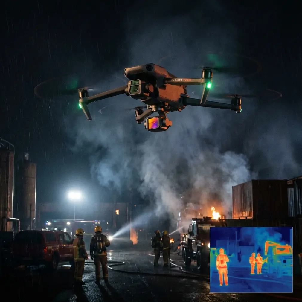
A wildlife encounter reveals what sensors are really for
On one shoreline shoot, the most revealing moment came from a wildlife interruption rather than the planned route. A cormorant lifted unexpectedly from a ledge below the takeoff point and cut across the planned line just as the drone was transitioning from a lateral tracking move into a slight climb over a tide-carved rock shelf.
That is the kind of event that exposes the difference between brochure features and practical value.
Obstacle sensing and intelligent avoidance are often marketed as beginner safeguards. In coastal work, they are production tools. The point is not to make reckless flying acceptable. The point is to give the pilot and aircraft enough environmental awareness to manage the unscripted. Birds, protruding stone, scrub-covered ridges, and irregular cliff faces create a visual environment that changes by the second. When the drone can interpret that space quickly, the operator has a much better chance of preserving both safety and shot continuity.
This is where the contextual hints around obstacle avoidance and subject tracking become meaningful. If Neo 2 is being used for coastlines, those capabilities should not be treated as convenience extras. They are part of the flight envelope. They help the aircraft remain useful when the terrain stops behaving like a simple open landscape.
The wildlife encounter also says something else: good sensors are not there to encourage aggressive flying close to hazards. They are there to help a disciplined operator survive unpredictable moments without ending the mission.
Airframe design is not glamorous, but it affects every flight
One of the strongest technical details in the source deck is the airframe comparison. The featured aircraft uses a honeycomb composite integrated body design described as lightweight, high-strength, and resistant to dust and rain, in contrast to more open, panel-assembled structures.
This matters a lot for shorelines.
Salt-laden moisture is brutal. Fine particulates settle into exposed areas. Wind-driven spray can reach the aircraft even when the operator thinks there is enough distance from the surf. A more enclosed, integrated body is not just a durability talking point. It reduces the number of ways the environment can interfere with the aircraft during a demanding shoot.
Neo 2 users should read that lesson broadly. Even if the product architecture differs, the principle remains: coastlines favor aircraft that combine structural rigidity, low weight, and some degree of environmental resilience. A body that stays composed under gust load and resists intrusion from dust and moisture will support steadier imaging and reduce operational anxiety.
There is a second operational benefit here. A stiffer, more integrated platform tends to help the whole imaging chain. Less flex and less vibration mean fewer subtle disturbances passed into stabilization and camera movement. Along a coastline, where long lateral passes often reveal every micro-correction, that can have a visible effect on footage quality.
Endurance changes what stories you can tell
The source compares roughly 30 minutes of endurance against alternatives with less than 20 minutes. Even after real-world deductions for wind, conservative reserves, and return planning, that spread is significant.
Coastal filming is rarely efficient. You often lose time repositioning around terrain rather than flying directly through it. A headland blocks one angle. A tidal shelf looks better from the opposite direction. A tracking pass fails because the subject disappears under shadow. Then light opens up for ninety seconds and you need to try again immediately.
Extra endurance gives you options. It lets you scout from the air, rehearse one line, execute another, and still leave room for a final pass when the ocean texture improves. For mapping-style documentation of shoreline assets, promenades, reservoirs, or coastal infrastructure, longer flight time also means fewer interruptions and more consistent capture conditions.
This is especially relevant if you plan to use modes like Hyperlapse or D-Log-based workflows. Hyperlapse needs time and positional confidence. D-Log rewards careful exposure planning and often benefits from multiple takes in changing light. Endurance is not just about staying airborne longer. It expands the creative and technical margin.
Wind resistance is only useful if the rest of the system keeps up
The source cites level 6 wind resistance compared with level 5 for other typical aircraft. Again, the raw number is less interesting than its implications.
A drone that can tolerate stronger wind but suffers from overheating electronics, sluggish response, or inconsistent control logic still creates weak footage. That is why another source detail matters: the presentation highlights a self-developed electronic speed control system with strong dynamic performance and no overheating issues, contrasted with systems that respond slowly, handle wind poorly, and overheat easily.
Put simply, coastline work requires a complete chain:
- responsive motors and ESC behavior
- stable control algorithms
- strong positional confidence
- resilient airframe construction
- effective sensing and tracking
If one element lags, the whole aircraft feels less trustworthy.
For Neo 2, this is the correct evaluation lens. Don’t isolate ActiveTrack from wind handling. Don’t isolate obstacle avoidance from route stability. Don’t isolate camera profiles like D-Log from the aircraft’s ability to hold an elegant line over broken terrain. A coastline sequence only looks effortless when the entire system is working together.
Why automated modes still need an expert mindset
QuickShots, ActiveTrack, and Hyperlapse can be genuinely useful on a coastal production day. They speed up repeatable moves and help solo operators secure polished sequences without building everything manually from scratch.
But complex shorelines punish overconfidence in automation.
A cliff edge may be visually legible to the pilot while remaining ambiguous to the drone’s detection system at certain angles or lighting conditions. Reflections from water can complicate perception. A tracked subject may move from bright sand into dark rock shadow and challenge recognition consistency. If the aircraft’s route stability is poor, even a smart mode can produce twitchy footage.
The best use of automation in this environment is selective. Let Neo 2 handle the parts it is good at: maintaining a clean relation to a subject, preserving a repeatable arc, or automating a time-based movement when the air is stable enough. Keep manual authority and conservative spacing whenever terrain, wildlife, or gust behavior starts changing quickly.
That hybrid approach reflects the strongest lesson from the source material. Advanced UAV cinematography is not about replacing pilot judgment. It is about giving judgment a more capable machine to work with.
The larger shift: from flying camera to intelligent imaging platform
One subtle but valuable point in the source deck is that UAV aerial imaging is presented as a fusion of multiple technical layers: microcontroller systems, imaging sensors, GPS navigation, communications, flight control, and programming. That framing is exactly right.
Neo 2 should not be evaluated as a camera with propellers. For coastline work, it is an integrated imaging platform. The success of the mission depends on how these layers cooperate under stress.
That is why route precision, adaptive control, visual tracking, and enclosed structural design deserve more attention than they usually get in casual reviews. They determine whether the drone can convert difficult geography into stable, editable footage.
If you are planning to shoot shorelines, marinas, reservoir edges, river mouths, or long coastal roads, start there. Ask how the aircraft behaves when wind shifts around landforms. Ask how well it repeats a line. Ask whether tracking remains convincing when the background is visually chaotic. Ask how much reserve you still have after a false start and a return reposition. Those questions lead to better drone choices than feature-checking alone.
If you want to compare real coastline setups or discuss how to configure Neo 2 for this kind of terrain, you can message our flight team directly here.
The smartest coastline footage rarely comes from the boldest flying. It comes from a drone that stays composed when the environment is not. The reference material makes that clear through hard operational details: around 30 minutes of endurance, 1 meter route accuracy, stronger wind tolerance, adaptive control behavior, and a sealed integrated body built for harsher conditions. Applied to Neo 2, those are not abstract specs. They are the difference between chasing a shot and actually capturing it.
Ready for your own Neo 2? Contact our team for expert consultation.