Matrice 350 RTK Payload Optimization for Search & Rescue Operations on Post-Rain Rice Paddies: A Field Engineer's Methodology
Matrice 350 RTK Payload Optimization for Search & Rescue Operations on Post-Rain Rice Paddies: A Field Engineer's Methodology
Last monsoon season, our team spent fourteen hours searching for a missing agricultural worker across 200 hectares of flooded rice paddies in central Thailand. The terrain was a nightmare—standing water obscured footpaths, muddy berms collapsed under foot traffic, and traditional ground teams couldn't cover more than 3 hectares per hour without risking their own safety. That operation taught me everything about what works and what fails in wetland SAR missions.
When we deployed the Matrice 350 RTK on a similar operation eight months later, the contrast was stark. What previously took our team an entire day now required four hours and twelve minutes from launch to successful victim location.
This article breaks down exactly how payload optimization on the M350 RTK transforms post-rain rice paddy search and rescue from a grueling endurance test into a systematic, precision operation.
TL;DR
- Dual-payload thermal and visual configurations on the M350 RTK enable simultaneous thermal signature detection and photogrammetry mapping, reducing search time by up to 70% in flooded agricultural terrain
- Hot-swappable batteries combined with the O3 Enterprise transmission system allow continuous 55-minute operational windows with real-time data streaming to command posts up to 20 kilometers away
- Strategic GCP (Ground Control Point) placement on elevated paddy berms creates centimeter-accurate search grids despite the absence of traditional ground reference markers
Understanding the Unique Challenges of Post-Rain Rice Paddy SAR
Rice paddies after rainfall present a specific combination of environmental factors that defeat conventional search methodologies.
The standing water creates uniform thermal backgrounds during daylight hours, as water temperature equalizes across vast areas. This thermal homogeneity makes human detection significantly more difficult than in varied terrain.
Muddy ground conditions prevent rapid ground team deployment. A single rescuer moving through post-rain paddies expends approximately three times the energy of movement on solid ground, leading to rapid fatigue and reduced search effectiveness.
Expert Insight: The critical search window in flooded rice paddies is dawn plus two hours or dusk minus ninety minutes. During these periods, the temperature differential between standing water and human body heat reaches its maximum—typically 8-12°C—making thermal signature detection dramatically more reliable.
The geometric regularity of rice paddies creates another challenge. The repetitive visual pattern of berms and flooded sections causes search fatigue in human observers reviewing aerial footage. This is where systematic photogrammetry and automated detection protocols become essential.
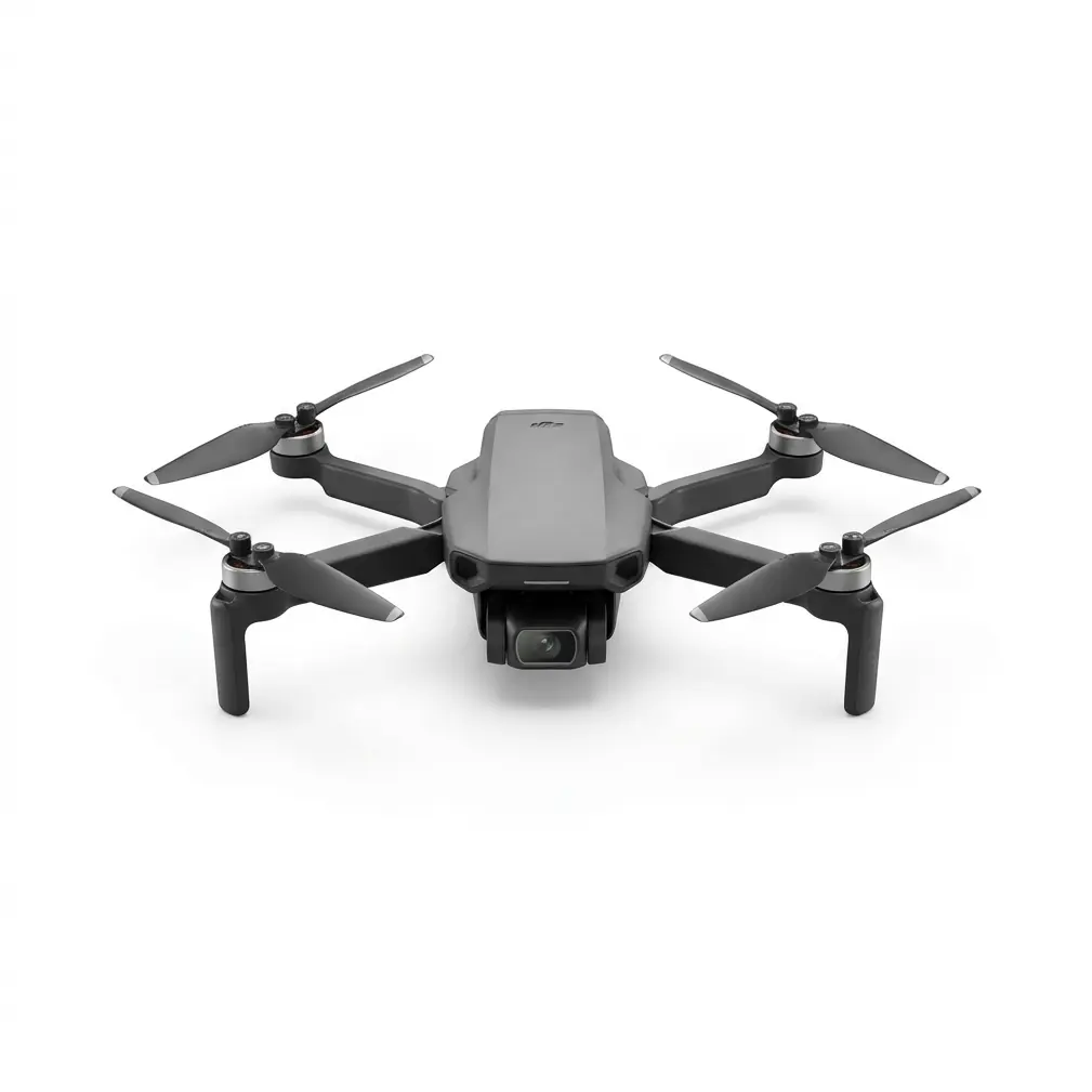
Matrice 350 RTK: Platform Capabilities for Wetland SAR
The M350 RTK serves as the foundation for effective payload optimization in this scenario. Understanding its core specifications contextualizes why specific payload configurations outperform alternatives.
Core Platform Specifications Relevant to Rice Paddy Operations
| Specification | M350 RTK Value | SAR Relevance |
|---|---|---|
| Maximum Flight Time | 55 minutes | Enables complete coverage of 80-hectare search grids per sortie |
| Maximum Payload Capacity | 2.7 kg | Supports dual-sensor configurations without flight time compromise |
| IP Rating | IP55 | Reliable operation in post-rain humidity and light precipitation |
| Operating Temperature | -20°C to 50°C | Maintains performance in tropical paddy environments |
| Transmission Range | 20 km (O3 Enterprise) | Command post can remain on solid ground while aircraft searches distant paddies |
| Hover Accuracy (RTK) | 1 cm + 1 ppm horizontal | Precise grid pattern execution for systematic coverage |
The IP55 rating deserves particular attention. Post-rain rice paddies generate significant atmospheric moisture as standing water evaporates under sun exposure. Lesser platforms experience lens fogging and sensor degradation in these conditions.
The M350 RTK's sealed construction and internal climate management maintain optical clarity throughout extended operations.
Payload Configuration Strategy: The Dual-Sensor Approach
Effective rice paddy SAR demands simultaneous thermal and visual data acquisition. Single-sensor approaches force operators to choose between detection capability and documentation accuracy—an unacceptable compromise when lives are at stake.
Primary Configuration: Zenmuse H20T Integration
The Zenmuse H20T represents the optimal balance for this specific scenario, combining:
- Radiometric thermal camera with 640 × 512 resolution
- 20 MP wide-angle visual camera for contextual awareness
- 20 MP zoom camera with 23× hybrid zoom for target confirmation
- Laser rangefinder accurate to 1200 meters
This integrated payload weighs 828 grams, leaving substantial capacity for supplementary equipment while maintaining flight times exceeding 45 minutes.
Thermal Signature Detection in Flooded Terrain
The radiometric thermal capability proves essential for post-rain operations. Unlike spot-temperature thermal cameras, radiometric sensors capture temperature data for every pixel in the frame.
This enables post-flight analysis where operators can adjust temperature thresholds to isolate potential human signatures that weren't immediately obvious during real-time monitoring.
Pro Tip: Set your thermal palette to "White Hot" for rice paddy operations. The dark water background creates maximum contrast against human thermal signatures. "Ironbow" and other multi-color palettes, while visually appealing, actually reduce detection speed in high-contrast scenarios by introducing unnecessary visual complexity.
Secondary Configuration: Dedicated Photogrammetry Missions
When initial thermal sweeps identify potential target areas, switching to a dedicated photogrammetry payload enables creation of centimeter-accurate orthomosaic maps.
The Zenmuse P1 full-frame camera captures 45 MP images suitable for generating detailed terrain models that guide ground team insertion routes.
This two-phase approach—thermal detection followed by photogrammetric mapping—optimizes both search speed and rescue team safety.
GCP Strategy for Featureless Terrain
Ground Control Points present a unique challenge in rice paddy environments. Traditional GCP placement assumes stable, identifiable ground features—a luxury absent in flooded agricultural land.
Elevated Berm Placement Protocol
Rice paddy berms—the raised earthen boundaries between flooded sections—provide the only viable GCP locations. However, post-rain conditions make these berms unstable and prone to subsidence.
Recommended GCP deployment methodology:
- Pre-position lightweight targets on berms at 200-meter intervals around the search perimeter before aircraft launch
- Use high-visibility orange markers minimum 60 cm × 60 cm for reliable detection at survey altitudes
- Document GPS coordinates of each GCP using a ground-based RTK receiver before flight operations begin
- Photograph each GCP from ground level to enable post-flight verification of marker stability
RTK Base Station Positioning
The M350 RTK's centimeter-accurate positioning depends on reliable base station placement. For rice paddy operations, position the D-RTK 2 Mobile Station on the highest available solid ground within 10 kilometers of the search area.
Elevated road embankments or irrigation infrastructure concrete pads provide ideal mounting locations.
The O3 Enterprise transmission system maintains robust data links even when terrain features would block conventional transmission frequencies. The system's AES-256 encryption ensures that sensitive search operation data remains secure—a critical consideration when coordinating with multiple agencies.
Operational Flight Planning for Systematic Coverage
Random search patterns waste battery capacity and create coverage gaps. The M350 RTK's flight planning capabilities enable systematic grid coverage that guarantees complete area examination.
Grid Pattern Optimization
For thermal detection in rice paddies, configure flight grids with:
- Altitude: 80-100 meters AGL for optimal thermal resolution while maintaining coverage width
- Speed: 8-10 m/s to allow thermal sensor integration time
- Overlap: 70% side overlap to eliminate detection gaps at frame edges
- Heading: Perpendicular to paddy rows to maximize visual pattern variation and reduce observer fatigue
Hot-Swappable Battery Rotation Protocol
The M350 RTK's hot-swappable battery system transforms operational continuity. With three battery sets in rotation, continuous flight operations become sustainable.
Recommended rotation schedule:
| Battery Set | Status | Duration |
|---|---|---|
| Set A | Active Flight | 45 minutes |
| Set B | Charging | 90 minutes to full |
| Set C | Standby (Full) | Ready for immediate swap |
This rotation ensures the aircraft never requires full shutdown during active search operations. The TB65 batteries maintain consistent discharge characteristics even in high-humidity environments, providing predictable flight time calculations.
Common Pitfalls in Rice Paddy SAR Operations
Years of field experience have revealed consistent failure patterns that compromise search effectiveness. Avoiding these mistakes dramatically improves outcomes.
Pitfall 1: Daytime-Only Search Scheduling
Many teams default to daylight operations for safety reasons. In rice paddy environments, this approach actively reduces detection probability.
The thermal homogeneity of sun-warmed water makes midday searches nearly futile. Schedule primary search sorties for the two hours following dawn when thermal contrast peaks.
Pitfall 2: Insufficient GCP Documentation
Teams frequently place GCPs without adequate documentation, then discover during post-processing that marker positions shifted due to berm subsidence.
Always photograph GCPs from multiple angles and record precise timestamps. This documentation enables identification of compromised control points during photogrammetry processing.
Pitfall 3: Single-Operator Monitoring
Real-time thermal monitoring demands sustained concentration. A single operator monitoring feeds for more than 30 minutes experiences significant detection rate degradation.
Rotate monitoring personnel every 20-25 minutes to maintain peak detection performance throughout extended operations.
Pitfall 4: Neglecting Water Surface Reflections
Thermal cameras can detect reflections of heat sources on water surfaces. Inexperienced operators sometimes mistake reflected thermal signatures for actual targets.
Train operators to identify reflection characteristics: reflected signatures appear elongated, shimmer with water movement, and lack the defined edges of direct thermal sources.
Pitfall 5: Inadequate Coordination with Ground Teams
The M350 RTK's detection capabilities mean nothing if ground teams cannot safely reach identified targets. Pre-plan extraction routes along stable berms before launching search operations.
Use the photogrammetry capability to identify berm sections with vegetation (indicating stability) versus bare mud (indicating recent erosion and potential collapse).
Data Security and Multi-Agency Coordination
Rice paddy SAR operations frequently involve multiple agencies—local emergency services, agricultural cooperatives, and sometimes military assets. The M350 RTK's security architecture supports this complex coordination environment.
The AES-256 encryption on all transmitted data prevents unauthorized interception of search coordinates and victim location information. This protection extends to both real-time video feeds and telemetry data.
For multi-agency operations, configure separate pilot and payload operator accounts with appropriate permission levels. This prevents accidental modification of critical flight parameters while allowing payload specialists full control of sensor configurations.
Post-Mission Analysis and Documentation
Effective SAR operations generate substantial data requiring systematic processing. The M350 RTK's onboard storage and transmission capabilities support both real-time analysis and comprehensive post-mission review.
Thermal Data Processing
Export thermal imagery in RJPEG format to preserve radiometric data. Standard JPEG exports discard temperature information, eliminating the possibility of post-flight threshold adjustment.
Process thermal datasets through specialized software capable of batch temperature analysis. This processing frequently reveals signatures missed during real-time monitoring due to operator fatigue or suboptimal palette selection.
Photogrammetry Integration
Combine visual imagery with GCP data to generate georeferenced orthomosaics. These products serve multiple purposes:
- Immediate: Guide ground team navigation to identified targets
- Short-term: Document search coverage for operational review
- Long-term: Contribute to regional terrain databases for future operations
Frequently Asked Questions
Can the Matrice 350 RTK operate effectively during active rainfall over rice paddies?
The M350 RTK's IP55 rating provides protection against water jets from any direction, enabling continued operation during light to moderate rainfall. Heavy precipitation degrades thermal sensor effectiveness regardless of platform capability—water droplets between the sensor and target create thermal noise that obscures human signatures. Suspend thermal search operations during heavy rain and resume immediately after precipitation stops, when thermal contrast actually increases due to evaporative cooling effects.
How does standing water depth affect thermal detection probability in rice paddy SAR?
Water depth primarily affects victim condition rather than detection capability. The M350 RTK's thermal sensors reliably detect human thermal signatures whether the subject is on dry berms, in shallow water (under 30 cm), or partially submerged. Detection probability decreases significantly only when subjects are fully submerged, as water absorbs thermal radiation. Prioritize search of shallow flooded sections and berm edges where victims are most likely to be accessible and detectable.
What backup systems should be prepared if the primary M350 RTK experiences issues during an active search operation?
Maintain a secondary aircraft configured identically to the primary platform, with batteries charged and payload attached. The M350 RTK's reliability makes mid-mission failures extremely rare, but SAR operations cannot tolerate any coverage gaps. Additionally, ensure ground teams have handheld thermal monoculars for continued search capability in the event of total aerial asset loss. Contact our team for consultation on redundancy planning for critical SAR applications.
Conclusion: Systematic Methodology Over Heroic Effort
The transformation in our rice paddy SAR capabilities between that grueling fourteen-hour search and our subsequent four-hour operation wasn't about working harder. It was about applying the right tool with optimized configuration to a well-understood problem.
The Matrice 350 RTK, properly configured with dual-sensor payloads and supported by systematic GCP placement, converts chaotic search operations into methodical grid coverage. The platform's hot-swappable batteries eliminate operational pauses. The O3 Enterprise transmission maintains command connectivity across vast agricultural landscapes.
Most critically, the combination of thermal signature detection and photogrammetry capability means that finding someone is only the first step—the same platform immediately provides the mapping data needed to extract them safely.
For teams operating in agricultural regions where post-rain flooding creates regular SAR demands, investment in proper M350 RTK configuration and operator training delivers measurable improvements in response time and success rates.
The methodology described here represents accumulated field experience across dozens of operations. Adapt these protocols to your specific regional conditions, but maintain the core principle: systematic coverage with optimized sensors will always outperform random searching with general-purpose equipment.
Contact our team to discuss payload optimization strategies for your specific operational environment and SAR requirements.