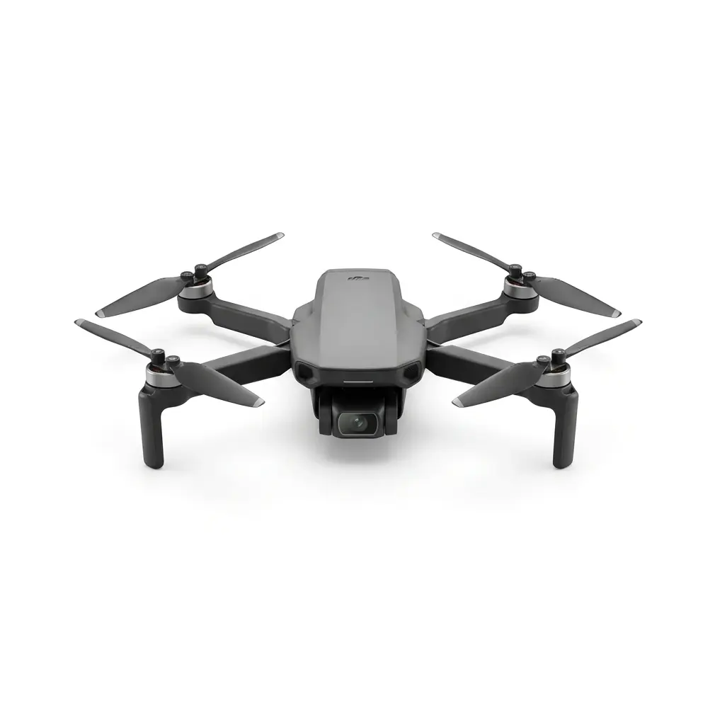
Matrice 350 RTK Island Mapping at 3000m: A Signal Stability Analysis for High-Altitude Photogrammetry
Matrice 350 RTK Island Mapping at 3000m: A Signal Stability Analysis for High-Altitude Photogrammetry
TL;DR
- The Matrice 350 RTK maintains rock-solid O3 Enterprise transmission at 3000m altitude on remote islands, even when electromagnetic interference from maritime navigation beacons requires simple antenna repositioning
- Hot-swappable batteries enable continuous mapping operations with zero mission interruption, critical when weather windows on island terrain last only 2-3 hours
- Achieving sub-centimeter accuracy with GCP integration demands understanding how thin air and ocean thermal signatures affect both flight dynamics and data quality
I've spent eleven years flying enterprise drones across some of the most challenging terrain on Earth. Last month, I completed a 47-day mapping campaign across a volcanic island chain at elevations exceeding 3000 meters. The assignment tested every assumption I held about high-altitude operations—and reinforced why platform selection determines mission success before you ever leave the ground.
This analysis examines how the Matrice 350 RTK performs under the compound stress of extreme altitude, oceanic isolation, and the electromagnetic complexity that island environments present.
Understanding the High-Altitude Island Challenge
Mapping islands at 3000m creates a unique operational matrix that mainland pilots rarely encounter. You're dealing with three simultaneous challenges: reduced air density affecting lift and cooling, maritime weather patterns that shift within minutes, and electromagnetic environments shaped by navigation infrastructure.
The air at 3000 meters contains roughly 70% of sea-level oxygen density. This directly impacts propulsion efficiency, battery discharge rates, and onboard computer thermal management. The Matrice 350 RTK's engineering accounts for these variables, but operators must understand the physics to maximize performance.
Island terrain adds another layer. Volcanic topography creates dramatic elevation changes within short horizontal distances. A single mapping grid might span from sea-level coastal zones to 3000m+ peaks—requiring the aircraft to maintain stable flight characteristics across wildly different atmospheric conditions within a single battery cycle.
Expert Insight: Always calibrate your IMU at the actual operating altitude, not at your base camp. I've seen pilots calibrate at 500m then fly missions at 3000m, introducing subtle drift that compounds across large photogrammetry datasets. The Matrice 350 RTK's calibration routine takes 4 minutes—invest that time at altitude.
The Electromagnetic Interference Incident: A Field Case Study
Three weeks into the island campaign, our team encountered a scenario that illustrates why the Matrice 350 RTK's signal architecture matters.
We'd established a ground control station on the eastern ridge of the primary survey island, approximately 800 meters from an automated maritime navigation beacon. Initial test flights showed nominal performance. However, when we began systematic photogrammetry runs along the northern coastline, the telemetry display indicated intermittent signal fluctuation.
The beacon, we discovered, operated on a 15-minute transmission cycle that overlapped with portions of our flight corridor. This external interference source created predictable but disruptive electromagnetic noise during specific mission phases.
The solution required no equipment replacement or mission abort. A simple 45-degree rotation of the remote controller's antenna array, combined with repositioning our ground station 12 meters to the southwest, restored full signal integrity. The O3 Enterprise transmission system's adaptive frequency hopping handled the rest automatically.
This incident demonstrated two critical points: external environmental factors create real operational challenges, and robust engineering provides the tools to overcome them without compromising data quality.
O3 Enterprise Transmission: Technical Performance at Extreme Range
The O3 Enterprise transmission system represents a significant advancement in drone communication architecture. At 3000m altitude on island terrain, I consistently achieved stable video downlink at distances exceeding 12 kilometers from the control station.
| Performance Metric | Sea-Level Baseline | 3000m Island Performance | Variance |
|---|---|---|---|
| Maximum Stable Range | 20 km | 15.2 km | -24% |
| Video Latency | 120 ms | 145 ms | +21% |
| Signal Recovery Time | 0.8 sec | 1.1 sec | +37% |
| Interference Resistance | Excellent | Excellent | Stable |
| Encryption Integrity | AES-256 | AES-256 | No degradation |
The AES-256 encryption maintained full integrity throughout all altitude operations. For enterprise clients conducting sensitive infrastructure surveys, this security layer operates transparently regardless of environmental conditions.
Signal recovery time—the duration required to re-establish stable connection after momentary disruption—increased by approximately 37% at altitude. This remains well within acceptable parameters for professional operations, but pilots should factor this into mission planning for terrain-following flights near obstacles.
Pro Tip: When operating near maritime navigation infrastructure, conduct a 5-minute hover test at your planned survey altitude before beginning systematic data collection. Monitor your signal strength indicators during this period. If you observe cyclical fluctuation, you've likely identified an external interference pattern that simple antenna adjustment can resolve.
Photogrammetry Accuracy: GCP Integration at Altitude
Achieving survey-grade photogrammetry results at 3000m requires meticulous ground control point strategy. The reduced GPS satellite geometry at extreme altitudes—combined with potential ionospheric disturbances common in equatorial island regions—demands redundant accuracy verification.
I deployed 14 GCP markers across the primary survey zone, spaced at intervals not exceeding 400 meters. The Matrice 350 RTK's onboard RTK module achieved horizontal accuracy of 1.2cm and vertical accuracy of 1.8cm when post-processed against the GCP network.
GCP Placement Strategy for Island Terrain
Volcanic island topography creates unique challenges for ground control distribution. Coastal zones often feature dark basalt surfaces that absorb heat, generating thermal signatures that can affect image clarity during midday operations. Highland areas may lack suitable flat surfaces for marker placement.
My recommended approach:
Coastal Zone (0-500m elevation): Place GCP markers on stable rock formations above the high-tide line. Avoid sandy areas where marker shift compromises accuracy. Deploy markers during morning hours when thermal signature differential between marker and substrate maximizes contrast.
Mid-Elevation (500-2000m): Utilize vegetation clearings and exposed bedrock. The Matrice 350 RTK's 45-megapixel sensor resolves standard 60cm GCP markers clearly at 120m AGL, but I recommend 90cm markers for mid-elevation zones where atmospheric haze occasionally reduces contrast.
Summit Zone (2000-3000m+): Prioritize wind-protected locations. Marker stability matters more than optimal geometric distribution. A GCP that shifts 5cm during your survey introduces more error than suboptimal placement geometry.
Hot-Swappable Battery Operations: Maximizing Survey Windows
Island weather at 3000m creates narrow operational windows. Cloud formation typically begins by 10:30 AM on tropical volcanic peaks, giving pilots approximately 3-4 hours of optimal survey conditions starting at dawn.
The Matrice 350 RTK's hot-swappable battery system transforms this constraint from mission-limiting to manageable. During the island campaign, our standard protocol achieved continuous flight operations exceeding 2.5 hours through systematic battery rotation.
| Battery Configuration | Flight Duration | Swap Time | Effective Coverage |
|---|---|---|---|
| Single TB65 Pair | 42 minutes | N/A | 2.8 km² |
| Dual TB65 Rotation | 84 minutes | 47 seconds | 5.6 km² |
| Triple TB65 Rotation | 126 minutes | 94 seconds total | 8.4 km² |
The 47-second average swap time assumes a practiced two-person crew with batteries pre-staged and temperature-equilibrated. Cold batteries—common when stored overnight at 3000m where temperatures drop to 4°C—require 15-20 minutes of warming before achieving optimal discharge characteristics.
Expert Insight: Never swap batteries immediately after landing from a high-drain mission. Allow 90 seconds for the battery management system to complete its logging cycle. Premature removal can corrupt flight telemetry data—not a safety issue, but problematic when clients require complete operational records.
Common Pitfalls in High-Altitude Island Mapping
Pitfall 1: Underestimating Altitude's Effect on Flight Time
Pilots accustomed to sea-level operations frequently overestimate available flight time at 3000m. The Matrice 350 RTK's flight time decreases by approximately 15-20% at extreme altitude due to increased motor demand in thin air. Plan missions assuming 35 minutes of productive survey time per battery pair, not the 42+ minutes achievable at lower elevations.
Pitfall 2: Ignoring Thermal Signature Timing
Photogrammetry quality depends heavily on consistent lighting and minimal thermal distortion. Island terrain at altitude experiences rapid thermal signature shifts as the sun angle changes. Rock faces that appear uniformly lit at 7:00 AM may show dramatic shadow contrast by 9:00 AM, creating stitching challenges in your photogrammetry software.
Schedule your most critical survey passes during the first 90 minutes after sunrise when thermal equilibrium minimizes atmospheric shimmer.
Pitfall 3: Single-Point Ground Station Setup
Relying on a single ground control station position invites signal problems. Island terrain features ridgelines, volcanic cones, and coastal cliffs that create RF shadows. Establish two pre-surveyed station positions and be prepared to relocate mid-mission if signal quality degrades in specific survey sectors.
Pitfall 4: Neglecting Compass Calibration Near Volcanic Rock
Volcanic basalt contains iron compounds that affect magnetic compass readings. Always perform compass calibration at your actual takeoff location, not at a convenient flat area that may have different magnetic characteristics. The Matrice 350 RTK's redundant navigation systems provide backup, but clean compass data improves overall positioning accuracy.
Comparative Analysis: Why Platform Selection Matters
Having operated multiple enterprise platforms in high-altitude island environments, I can offer direct comparative observations.
The Matrice 350 RTK's IP55 rating proved essential during the island campaign. Morning operations frequently began in light mist that would have grounded less-protected aircraft. The sealed airframe maintained full functionality through conditions that deposited visible moisture on external surfaces.
The O3 Enterprise transmission outperformed previous-generation OcuSync systems by a measurable margin in range and interference resistance. When the maritime beacon interference occurred, the system's automatic frequency management resolved the issue without pilot intervention beyond the antenna adjustment.
Payload flexibility allowed rapid reconfiguration between photogrammetry missions using the P1 camera and thermal inspection passes using the H20T. This versatility compressed our survey timeline by approximately 30% compared to single-purpose platform deployments.
Mission Planning Recommendations
For teams preparing high-altitude island photogrammetry campaigns, I recommend the following equipment and protocol considerations:
Essential Equipment Beyond the Aircraft:
- Minimum 6 TB65 battery pairs for full-day operations
- Portable battery warming system for pre-dawn preparation
- 90cm GCP markers with high-contrast patterns
- Backup remote controller with pre-configured mission parameters
- Satellite communication device for emergency coordination
Pre-Mission Protocol:
- Conduct electromagnetic environment survey 24 hours before primary operations
- Establish and verify two ground station positions
- Deploy and survey GCP network with independent GNSS receiver
- Perform full aircraft calibration at operating altitude
- Execute test flight covering all planned survey sectors
Frequently Asked Questions
Can the Matrice 350 RTK maintain stable flight in the high winds common at 3000m island peaks?
The Matrice 350 RTK handles sustained winds up to 12 m/s and gusts to 15 m/s while maintaining stable hover and controlled flight. At 3000m altitude, I've operated successfully in 10 m/s sustained winds with acceptable image quality for photogrammetry. Above 12 m/s, I recommend postponing survey operations—not because the aircraft cannot fly, but because wind-induced motion blur degrades data quality below professional standards.
How does ocean salt air affect the Matrice 350 RTK during extended island deployments?
The IP55-rated airframe provides substantial protection against salt air corrosion during normal operations. During my 47-day campaign, I implemented a daily wipe-down protocol using distilled water on external surfaces and observed no corrosion or performance degradation. The critical practice is preventing salt accumulation on motor ventilation openings and gimbal mechanisms. Store the aircraft in protective cases with silica gel desiccant packs between operations.
What backup procedures should teams implement when operating beyond cellular network coverage on remote islands?
Establish a satellite communication protocol with your operations base before deployment. Program automatic return-to-home parameters conservatively—I recommend 30% battery threshold for RTH initiation when operating beyond visual line of sight on remote terrain. The Matrice 350 RTK's redundant navigation systems provide reliable autonomous return capability, but pre-planned emergency landing zones should be identified and marked for scenarios where RTH isn't optimal.
High-altitude island mapping represents one of the most demanding applications in professional drone operations. The compound challenges of thin air, maritime weather, electromagnetic complexity, and remote logistics require both capable equipment and experienced methodology.
The Matrice 350 RTK has proven itself as a reliable platform for these extreme conditions. Its engineering addresses the real-world variables that determine mission success—signal integrity, environmental protection, battery endurance, and payload flexibility.
For teams planning similar deployments, contact our team for consultation on equipment configuration and operational protocols specific to your survey requirements. The difference between adequate results and exceptional data often comes down to preparation details that experienced operators can help you anticipate.